Mid-Atlantic and Northeast Brace for Hermine With its 70 mph Winds
Hermine has turned into a post-tropical cyclone.

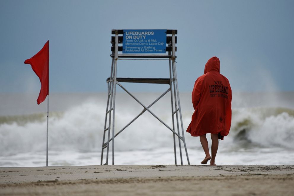
— -- New Jersey, Delaware and other mid-Atlantic and northeastern states are bracing for a severe storm as Hermine, which has turned into a post-tropical cyclone with winds up to 70 mph, moves up the coast after battering Florida, Georgia and the Carolinas.
"This storm continues to be a major concern for coastal areas along much of the East Coast," said ABC News meteorologist Dan Peck.
As of 8 p.m. Saturday, Hermine was moving east-northeast at 12 mph, with the center of the storm more than 150 miles east-southeast of Norfolk, Virginia.
New Jersey Gov. Chris Christie on Saturday declared a state of emergency in three coastal counties ahead of severe weather conditions expected later in the day and throughout the Labor Day weekend. And in Delaware, Gov. Jack Markell issued a limited state of emergency for Sussex County beginning at 5 p.m. local time Saturday.
Hermine is forecast to bring "bringing tropical storm force winds, very heavy and sustained rain, as well as moderate to major coastal flooding with heavy surf and beach erosion," the New Jersey governor's office said in a statement.
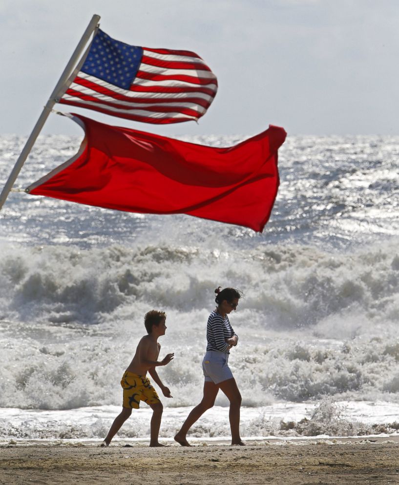
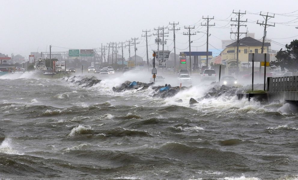
A tropical storm warning was in effect Saturday afternoon from Surf City, North Carolina, to Sandy Hook, New Jersey, and a tropical storm watch from north of Sandy Hook, New Jersey, to west of Watch Hill, Rhode Island, the Federal Emergency Management Agency said in a statement.
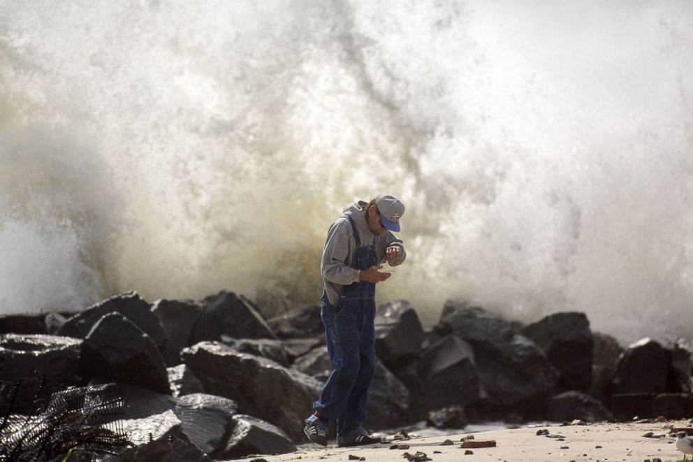
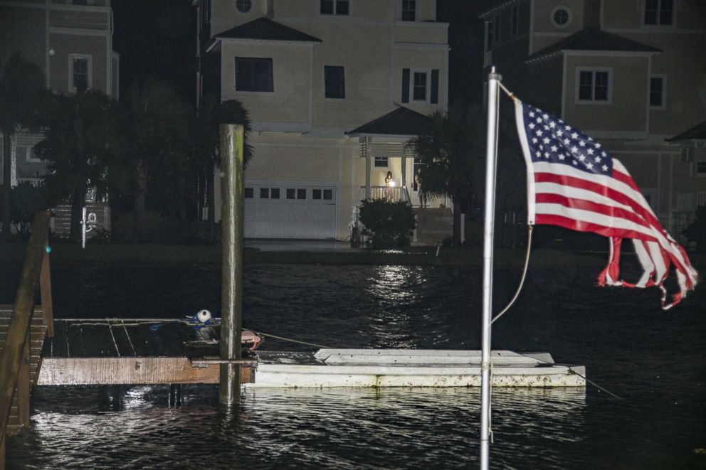
"There is danger for life-threatening storm surge in the next 48 hours for coastal locations between the North Carolina and Virginia border and Bridgeport, Connecticut," the federal emergency agency said.
The tropical storm warning was extended on Saturday afternoon to include Long Island and New York City.
Hermine Makes Landfall

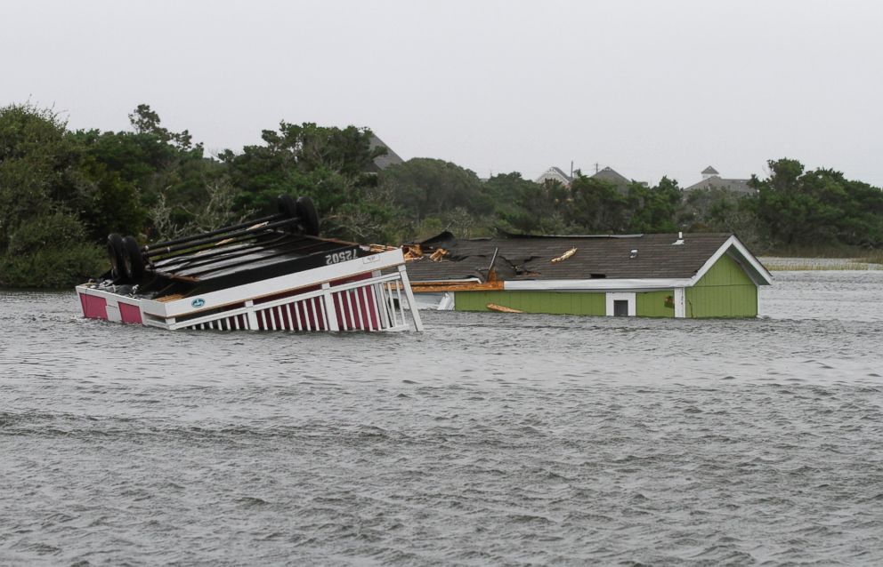
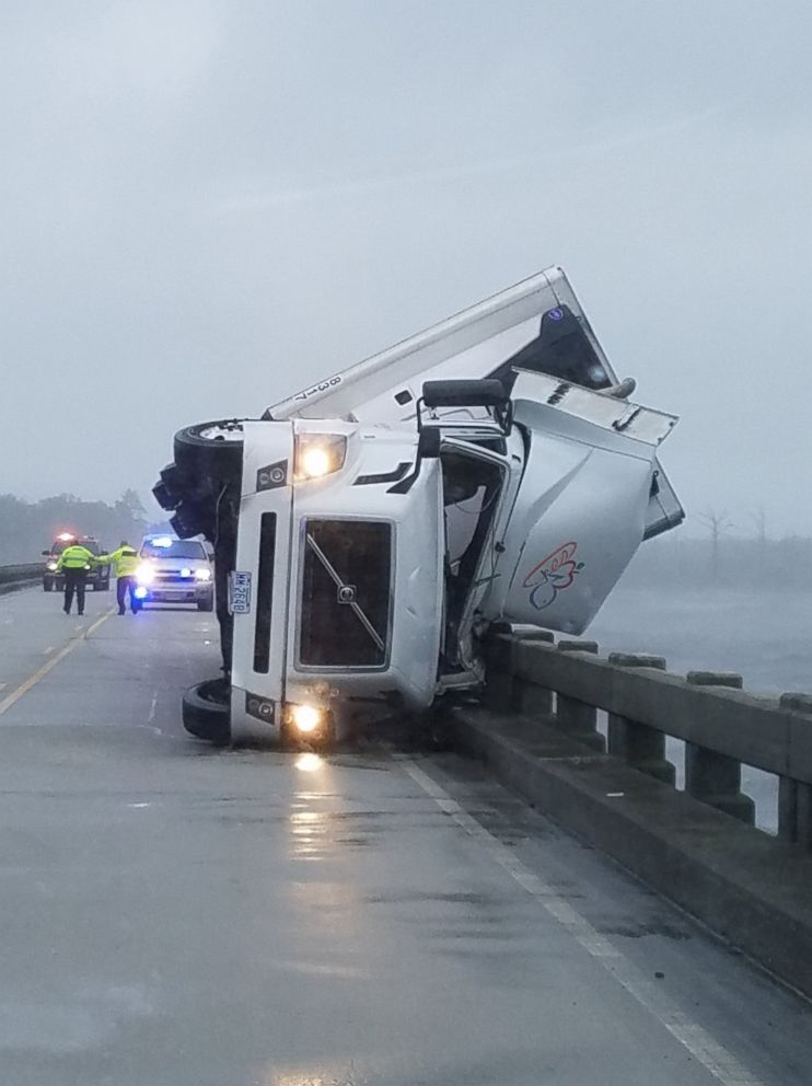
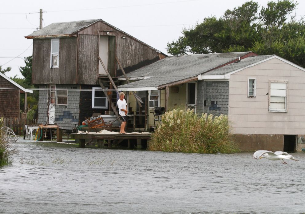
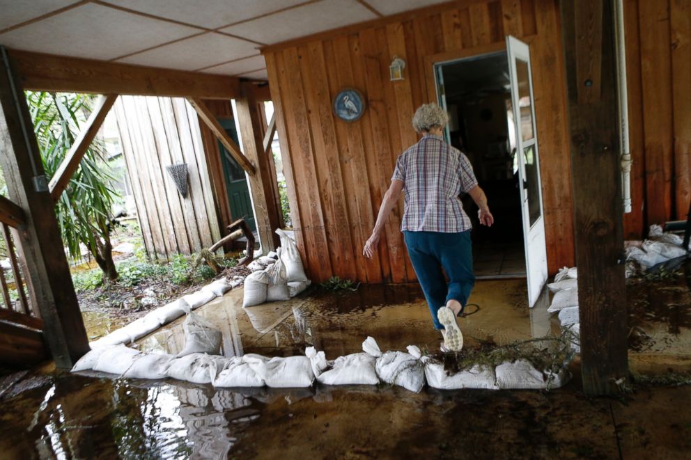

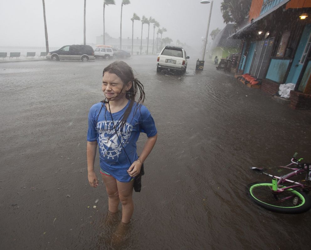

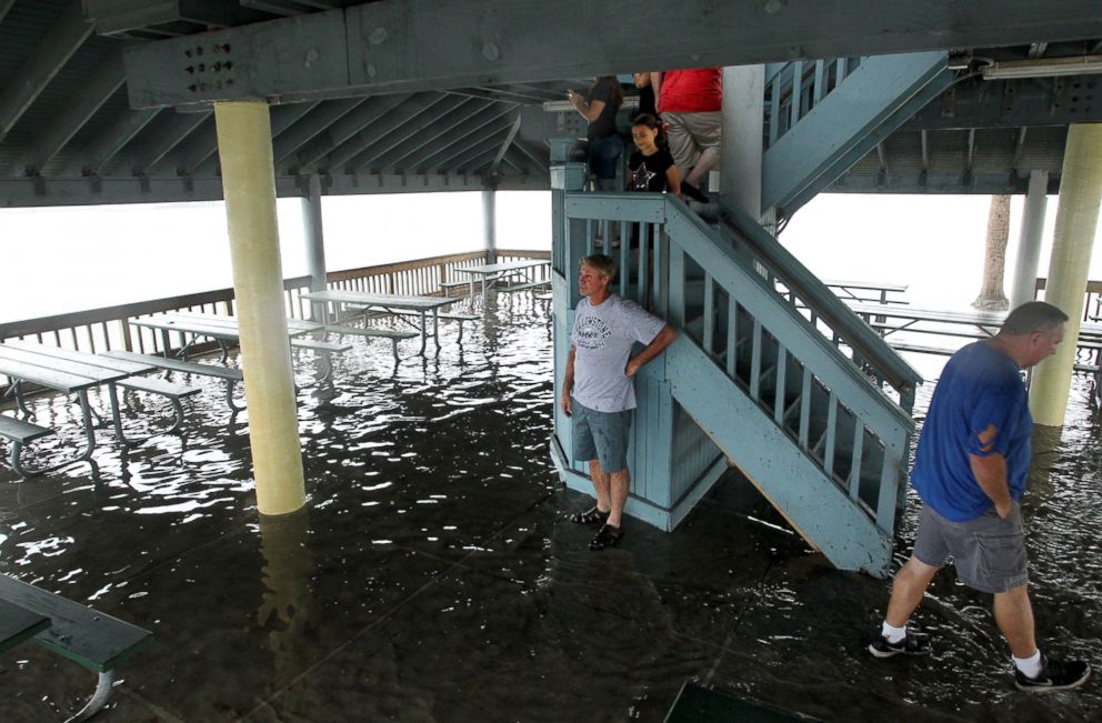
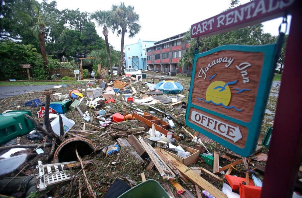
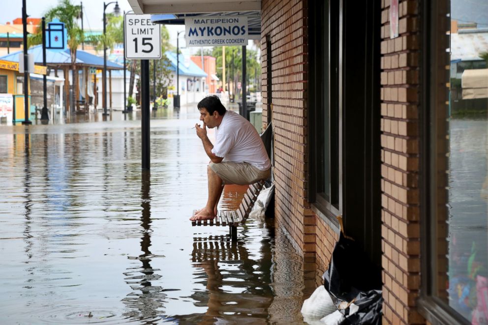
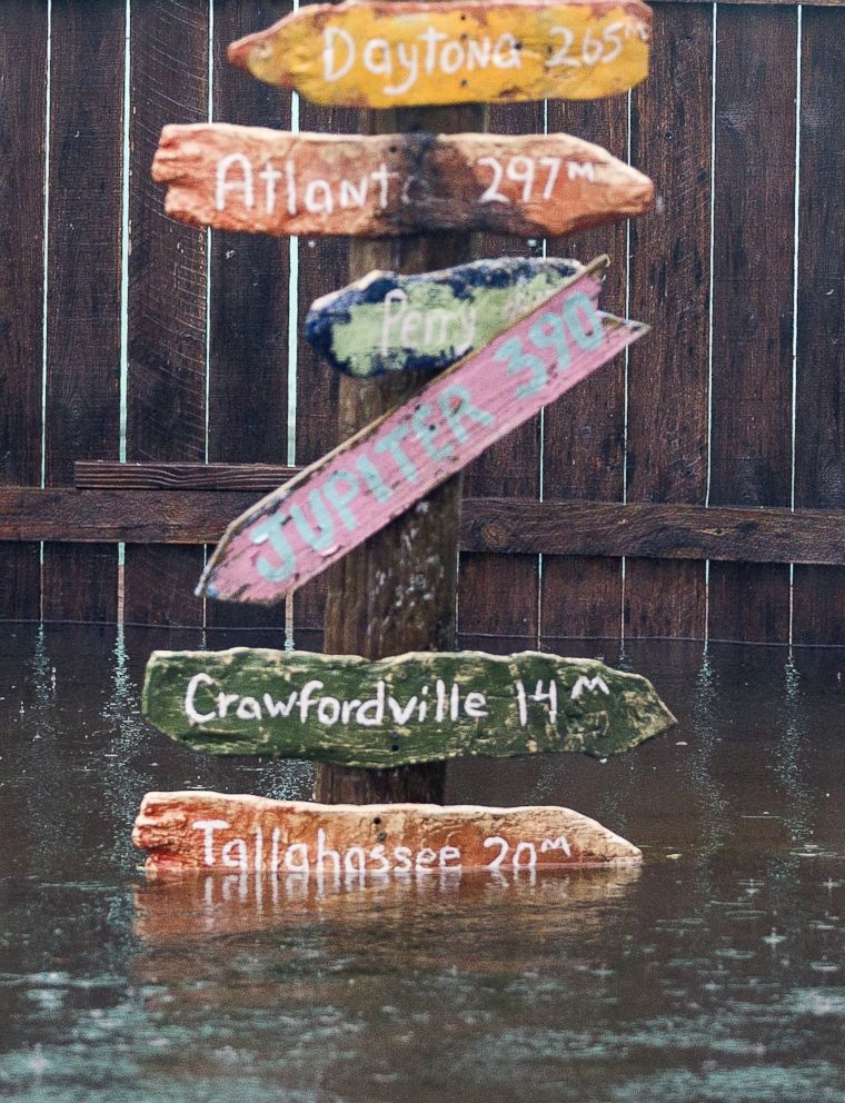

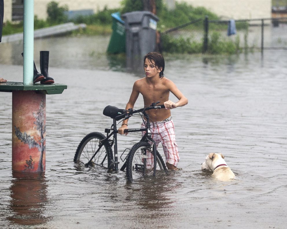
Hermine slammed into North Carolina late Friday night, unleashing heavy rain and gusty winds, creating flooding in many areas, knocking down trees, and leaving thousands of residents without power in both inland and coastal areas. The tropical storm turned into a post-tropical cyclone on Saturday, with sustained winds strengthening to 70 mph.
Duke Energy reported 2,432 outages across the state after midnight Saturday -- down from a high of 18,000 at 9:40 p.m. Friday -- while Dominion North Carolina reported 11,201 outages. The state has other utility companies, but those figures were so far unknown.
The video below taken in Topsail Island, North Carolina, showed gusting winds and rising water as the storm hit:
Despite reports of a tornado in North Carolina, there has been no confirmation from the National Weather Service. But the Dare County Emergency Medical Services told ABC News that four people were injured by debris from the purported tornado. They were transported to a local hospital with minor injuries. There was also some damage to structures at the Hatteras Sands Campground.
North Carolina Gov. Pat McCrory had declared a state of emergency for the 33 eastern counties ahead of the storm "to facilitate the movement of any resources that may be needed to respond to and recover from the storm."
Below, a video taken in Lake Waccamaw in North Carolina's Columbus County shows the rising sea.
Hermine is expected to head northeast toward the Atlantic Ocean on Saturday, according to ABC News meteorologist Dan Manzo.
The next state to feel the wrath of Hermine? Virginia.
Manzo said Hermine is threatening a storm surge into southeast Virginia.
"The most pressing issue this morning will become the possibly dangerous storm surge in the Hampton Bays area of Virginia," he said. "Additional rainfall of 3 to 4 inches still remains forecasted for the eastern portions of Virginia and North Carolina, which could set off flash flooding."
According to ABC News' Manzo, winds in eastern North Carolina and Eastern Virginia are expected to gust as high as 40-plus miles per hour on Saturday. Flash flooding in the region will continue to be a concern with three to five inches of additional rainfall in the forecast Saturday morning.
Hermine is expected to strengthen once it moves offshore late Saturday, and there is the possibility that it could reach hurricane intensity by Sunday, Manzo said.
Maryland has already declared a state of emergency ahead of Hermine, which will bring tropical storm conditions into the mid-Atlantic region Saturday, then into coastal areas of New Jersey and New York on Sunday, Manzo said.
Before hitting North Carolina, Hermine lashed the coastline areas of South Carolina and Georgia. As of midnight Saturday, there were 64,796 power outages across South Carolina, according to the state's Emergency Management Division. And in Georgia, there were 107,000 power outages. Georgia declared a state of emergency, but South Carolina did not.
The video below shot on Pawleys Island, South Carolina, shows waves rushing onto shore.
In South Carolina, multiple cars were pulled out of flood waters in the Garden City area last night, and many homes there were also flooded. Officials are also looking for a missing swimmer near Murrells Inlet.
The strength of the gusting winds is evident in the video below, taken on Hilton Head Island, South Carolina.
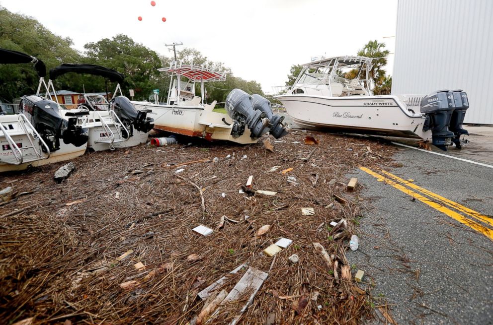
And before being downgraded to a tropical storm, Hermine hit Florida early Friday morning as a category 1 hurricane, the first to slam into the state in eleven years. An estimated 325,000 people were without power statewide.
ABC News' Rex Sakamoto and Brendan Rand contributed to this report.
Related Topics

Trending Reader Picks
ABC News Live