New major storm will bring flooding, severe weather to central US
The storm will stretch across the country from Texas to Pennsylvania.
— -- A stalled frontal system continues to plague much of the central U.S. with heavy rain in the south and snow and ice in parts of the Northern Plains and upper Midwest.
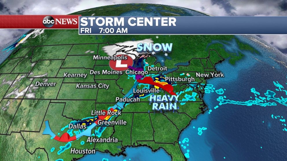
A line of strong storms remains situated Friday morning over the south-central U.S. from northeast Texas all the way to southern Ohio. Heavy rain is accompanying these storms with rainfall rates of half an inch to three-quarters of an inch per hour. The threat for flash flooding is increasing in parts of Kentucky, Illinois, Indiana, Ohio, Tennessee and Arkansas this morning.
This stalled storm system is also bringing some snow to the upper Midwest this morning with locally 1 to 2 inch per hour snowfall rates.
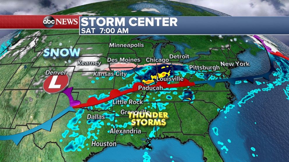
While the system moves to the north and east on Friday, another storm is developing right behind it that will bring a significant flood risk from Texas to Pennsylvania this weekend.
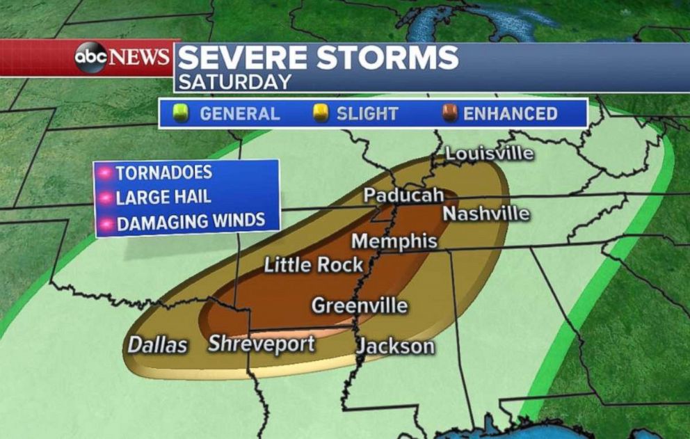
Severe weather -- including tornadoes -- across the lower Mississippi River Valley and significant snow from Nebraska to Wisconsin are possible.
By Saturday morning, heavy rain will be falling on parts of the Ohio River Valley and new thunderstorms will develop across parts of Texas. Meanwhile snow and ice will begin to cover parts of the Central Plains across Nebraska and Iowa. This slow-moving storm will move across the central U.S. this weekend.
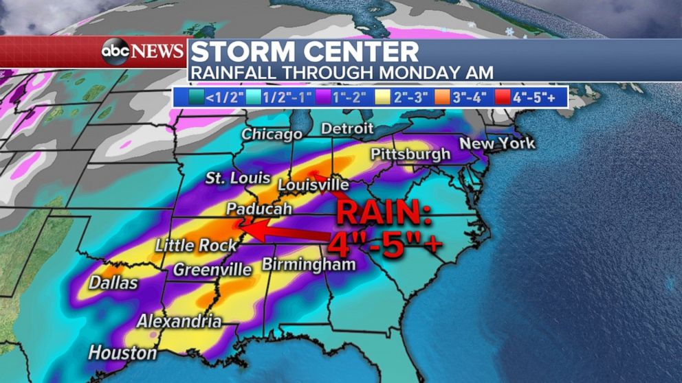
The primary concern will be the next round of very heavy rainfall from Texas to Pennsylvania. These areas have already been hard hit this week. Nearly 4 to 5 inches of additional rainfall is possible through Monday morning, especially from Arkansas to Ohio. Significant flash flooding and river flooding could happen in the region. Rainfall rates during some of these storms, especially on Saturday, could exceed 1 to 2 inches per hour.
The only good news is that the heaviest rain will miss most of central Illinois and central Michigan -- an area that was hard hit with river flooding this week already.
Snow develops across northern US
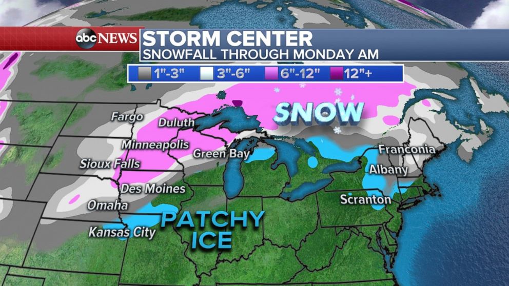
On the colder side of this system additional snow is on the way for the Central Plains and Upper Midwest. An additional 6 to 10 inches of snow is expected from northern Iowa to Wisconsin and Minnesota -- including Minneapolis. The snow will reach peak intensity on Saturday afternoon and evening with blowing snow likely in the cities of Minneapolis and Eau Claire, Wisconsin.
Patchy ice will also be possible once again in parts of the Kansas City region.
Related Topics

Popular Reads

ABC News Live