Major winter storm takes aim at Rockies and Midwest, above average temps headed for Eastern U.S.
The Eastern U.S. will experience above average temperatures this weekend.
— -- The Southwest is getting walloped with winter conditions this weekend.
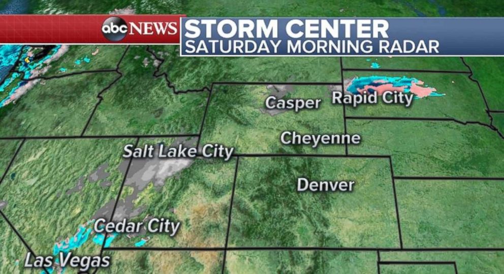
A disturbance is moving through the region Saturday morning bringing snow to parts of Nevada and Utah, including Salt Lake City. This disturbance will move further east Saturday expanding snow into the Colorado and Wyoming Rockies. Significant impacts are expected through much of Saturday on I-15, I-70 and I-80 in Utah.
This disturbance will develop into a more significant and organized storm with impacts arriving in the Colorado and Wyoming later on Saturday and lasting into Sunday. The storm will then bring significant snow to parts of the Plains and upper Midwest on Sunday and Monday. Winter storm Watches, Warnings and Advisories have been posted for parts of the Rockies, central Plains and upper Midwest.
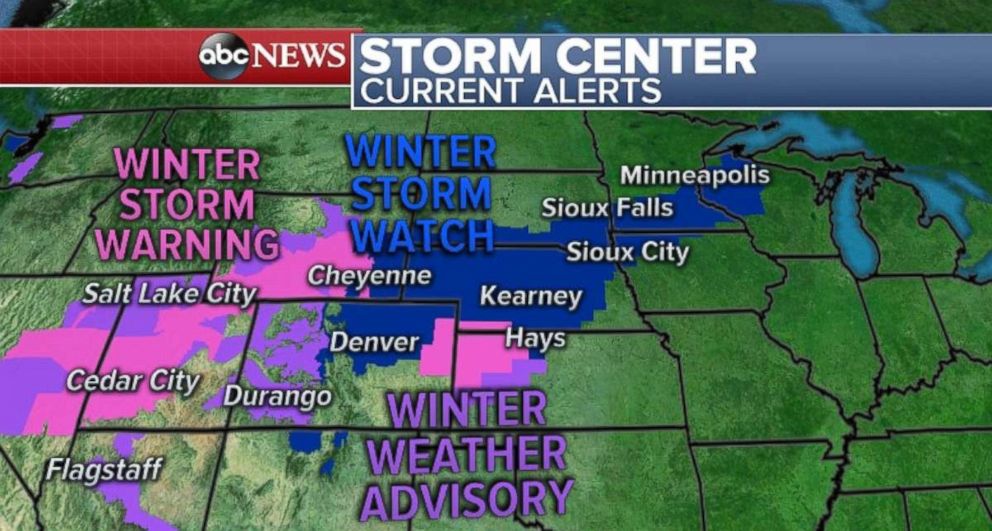
Impacts from the storm will arrive in Denver and the high Plains early Sunday morning. Denver will see locally 4 to 8 inches of snow. Some locations outside of the city could see locally one foot of snow. Winds will be a concern as well, with gusts up to 40 mph likely. This storm arrives in Denver after the region saw temperatures in the 60s and 70s on Friday.
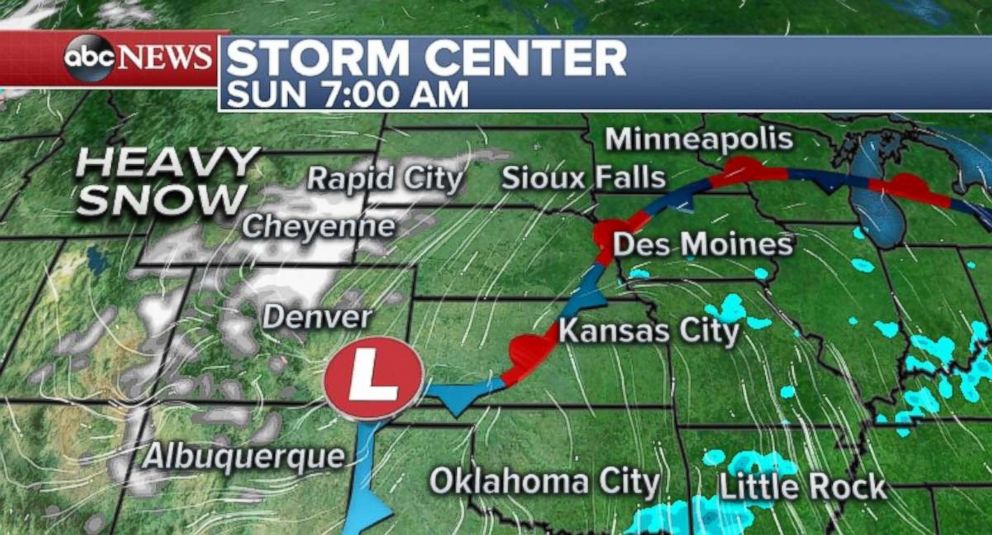
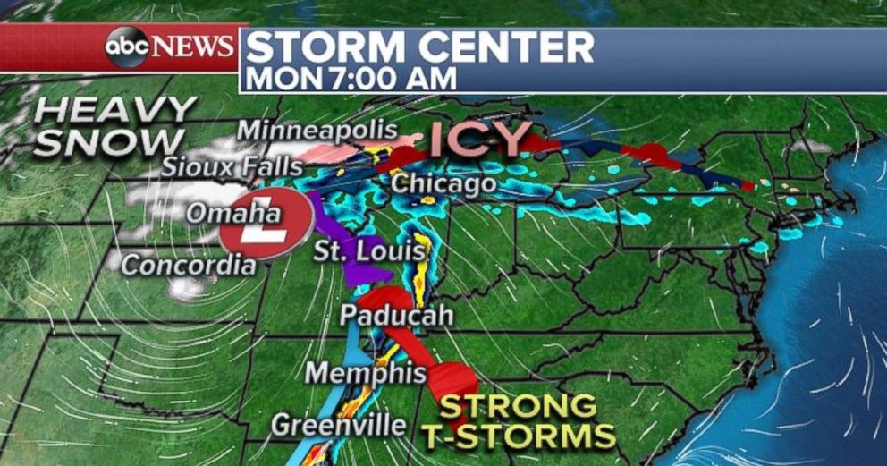
On Sunday afternoon and evening the storm will track towards the Central Plains and upper Midwest including Sioux City and Sioux Falls. Heavy snow will hamper any Sunday afternoon and evening travel in the region. The heavy snow will last through the early hours of Monday in this region. On the warmer side of the storm, in the southern Plains, strong thunderstorms are expected to develop on Sunday evening and early Monday. Isolated severe storms will be likely with locally damaging winds and large hail. The risk for these strong storms include parts of Arkansas, Louisiana, Tennessee, and Mississippi.
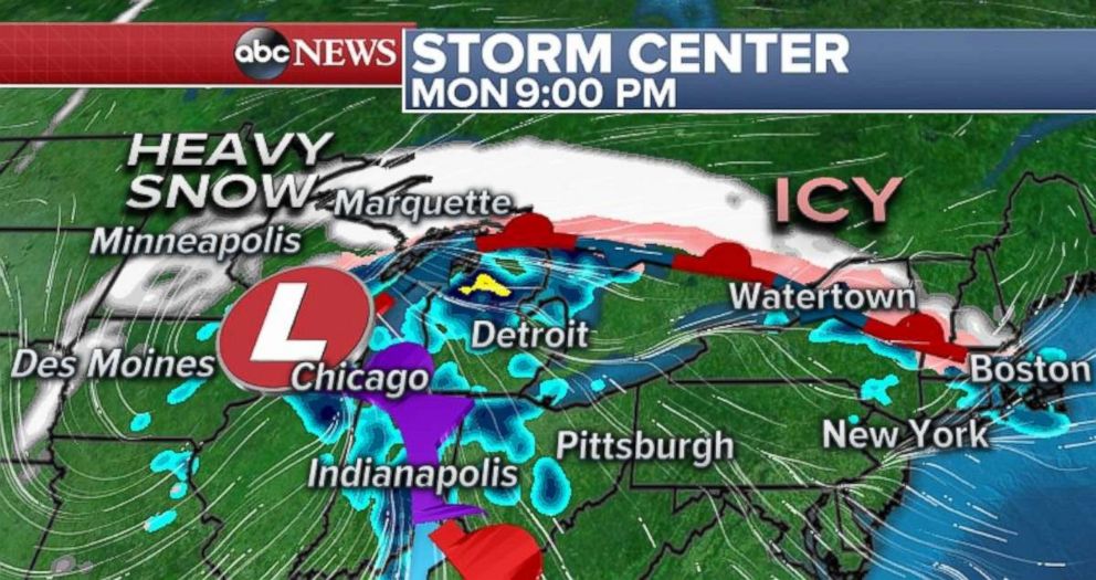
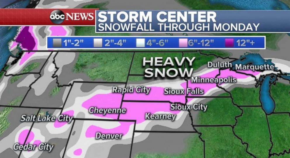
As the low pressure system tracks towards Minnesota and Wisconsin late Sunday and Monday, bands of heavier snow will dump locally 6 to 12 inches across parts of eastern Minnesota and Northwest Wisconsin. A large swath of 6 to 12 inches of snow from Denver to Duluth is currently forecast for the region, with locally higher amounts in Minnesota and Wisconsin.
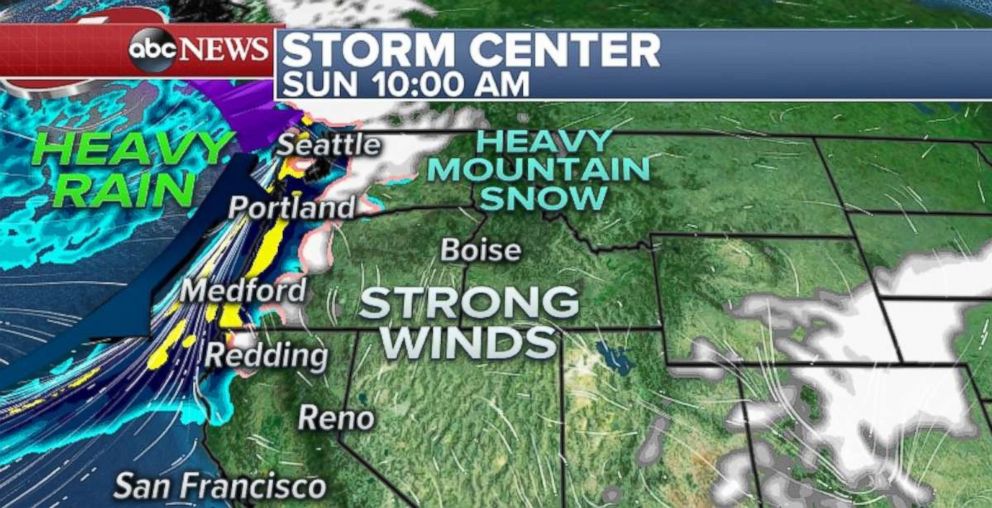
Meanwhile, another disturbance is heading for the Pacific Northwest on Saturday night. Heavy rain, strong winds and mountain snow will all be likely. Winds will peak during Sunday morning across parts of Washington and Oregon with gusts locally to 45 mph. Landslides will be possible.
Above average temperatures are forecasted for much of the eastern U.S. Temperatures in much of this region are forecasted to be 10 to 20 degrees above average.
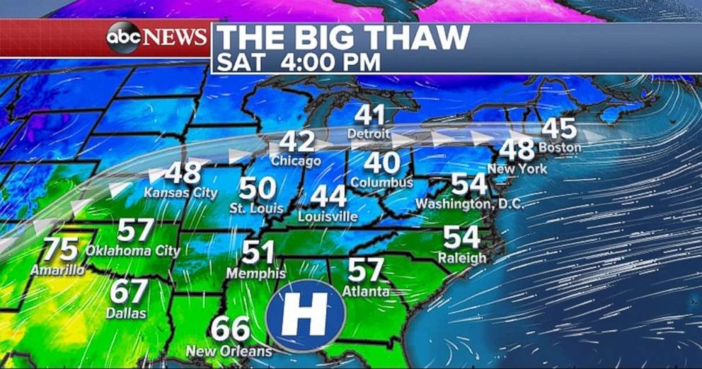
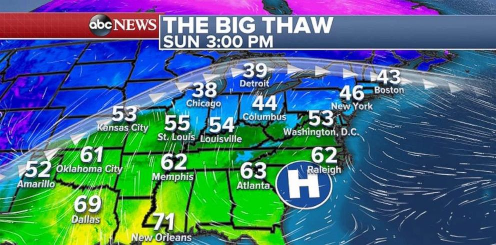
With temperatures forecasted to be near 50 Saturday in New York, it will be nearly 25 degrees warmer Saturday in New York than it was this past Sunday. Chicago is expected to be near the low 50s. Washington will be in the mid-50s. This is pretty comfortable weather for the middle of winter.
Like last weekend, with the milder temperatures, the threat for localized ice jams, and thin ice remain a concern across parts of the Northeast.
For those who enjoy this milder winter weather, there is good news: The chances for above-average temperatures will remain likely through the next several weeks for much of the eastern U.S.


