Storm that ripped through heartland heading east
A storm system that tore through the heartland is making its way east.
A major storm that brought more than 350 reports of damaging storms from Texas to Ohio Tuesday is now starting to weaken as it moves off the East Coast.
Thunderstorms and showers are still possible today for eastern states before the storm system completely moves offshore.
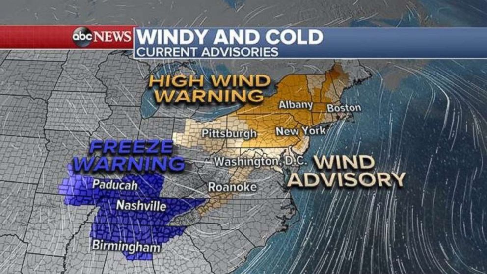
The system leaves behind arctic air and heavy winds, with advisories for freezing temperatures and high winds currently in effect for 23 states from Alabama to Maine.
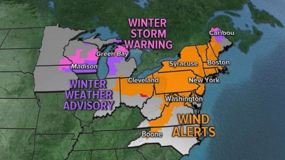
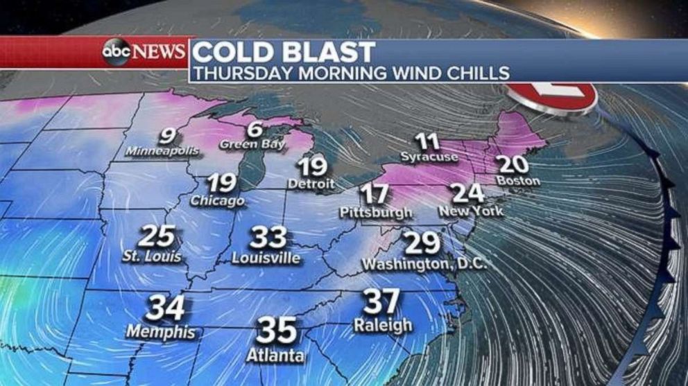
Wind alerts are in effect across the Northeast for gusts reaching up to 50 to 60 mph, while much of the South will experience a freeze Thursday morning. It will feel like it's in the 30s as far south as Memphis and Atlanta.
The most severe storms will be found in the southern mid-Atlantic and Carolinas, which could see winds of up to 60 mph, hail and even isolated tornadoes.
Further north, temperatures will feel like the 20s from Washington, D.C., to Boston and in the single digits from Minneapolis to Green Bay.
After Tuesday's storm, eight tornados were reported in Ohio, Illinois, Missouri, Ohio and Kentucky and flooding rains hit the Ohio Valley.
Indianapolis had its wettest April day on record, seeing 3.9 inches of rain, as winds at the Houston airport gusted up to 60 mph.
A heavy swath of snow, between 6 and 11 inches, fell in the Dakotas, Iowa, Minnesota, Wisconsin and Michigan. Minneapolis saw 9 inches, the most the city's seen in April since 1984.


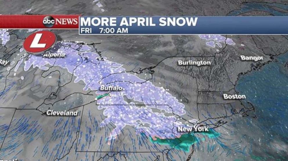
Snow is in the forecast later in the week, with a quick-moving storm bringing snow from the Plains to the Northeast Thursday night into Friday morning. New York City can expect another snowy morning for Friday's commute before the precipitation changes to rain.
A larger system will follow, bringing snow to the Midwest Friday and then to the Northeast on Saturday.
Related Topics

Popular Reads
ABC News Live