9 Tornadoes Reported in Louisiana, Mississippi, at Least 31 Injured and 9,400 Residents Without Power
Large tornadoes have caused damage and injuries from Baton Rouge to New Orleans.
— -- Nine tornadoes were reported Tuesday in Louisiana and Mississippi -- four of which have been confirmed -- damaging property, injuring at least 31 people and prompting Louisiana Governor John Bel Edwards to declare a state of emergency in the state.
In addition to New Orleans, which also declared a state of emergency, tornadoes were reported in Baton Rouge, Donaldsonville, Ponchatoula and Killian, according to ABC News meteorologist Melissa Griffin.
Tornado watches were in effect for parts of Louisiana, Mississippi, Alabama and the Florida Panhandle. The tornado watch in Louisiana and Mississippi expired after 2 p.m., when the storms moved east, Griffin said. The tornado watch in Alabama and Florida is set to expire at 6 p.m. Severe storms are expected in cities such as Gulfport, Biloxi, Mobile and Pensacola.
New Orleans Mayor Mitch Landrieu said a serious tornado hit Chef Menteur Highway and traveled there for about two miles. Landrieu described the damage it caused as "devastating" and that it looked "like an elephant stomping on your house."
Approximately 9,400 Orleans Parish residents are currently without power, the mayor said. Crews are working around the clock and expect to have all power restored in three to five days.
No deaths have been reported, but of the 31 injuries reported in New Orleans, at least six were considered moderate to severe according to Landrieu. Authorities will continue to survey the damage in the next several days.
NASA's Michoud Assembly Facility in New Orleans was impacted by a tornado, the agency said Tuesday. All 3,500 employees at the facility were accounted for, with five sustaining minor injuries. The facility will remain closed on Wednesday, as emergency personnel continue damage assessments on multiple buildings which were damaged, including the main manufacturing building, which sustained roof damage.
NASA posted the following video to YouTube of the tornado near the facility.
President Donald Trump tweeted Tuesday night, "Our thoughts and prayers are with everyone in southeastern Louisiana affected by today's severe tornadoes."
There could still be isolated severe storms in North and South Carolina.
As of Tuesday morning, at least 23 U.S. states were under winter weather alerts, and a tornado watch has been issued for parts of the Southeast as most of the country braces for severe weather this week.
“We are in a very active weather pattern all across the country, from California to New York,” ABC News senior meteorologist Max Golembo said.
An atmospheric river, which draws massive amounts of water vapor from the Pacific Ocean, has taken aim at California, where the National Weather Service has issued flash flood and flood watches through Friday.
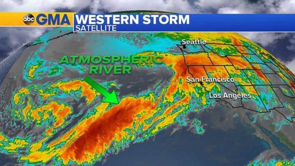
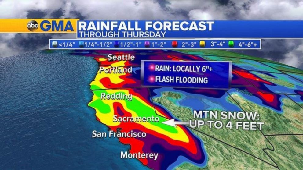
Copious rainfall is in the forecast for the West Coast until the end of the week, potentially bringing floods, mudslides and debris flows. ABC News’ weather team predicts more than a half a foot of rain in Central to Northern California over the next several days. Additional rain is expected for Portland, Oregon, and Seattle.
“California will see waves of moisture on and off through Friday,” Golembo said.
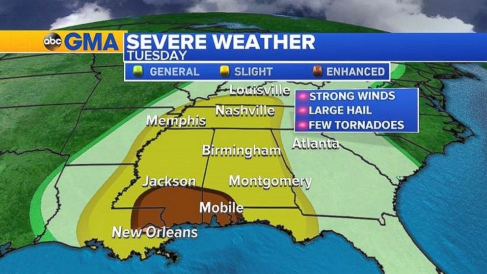
Meanwhile, thunderstorms and damaging winds are expected to rattle Southern states, from the Gulf Coast to the Ohio Valley. The National Weather System has issued a tornado watch for portions of southern Louisiana, southern Mississippi and other parts of the region’s coast until 2 p.m. local time.
“Severe storms are firing up already in Louisiana and Mississippi,” Golembo said. “Damaging winds are the biggest threat this morning.”
Northeastern states can expect to see rain, snow and ice this week, according to ABC News meteorologists. The first of two storms arrives today, bringing rain and ice for much of the region, with potential snowfall in Boston and other parts of New England.
The icy weather moved through the Hudson Valley into southern New England this morning. By this afternoon, the snow and ice in Boston will transition to heavy rain, with some snow and ice lingering in New England and the upper Hudson Valley near Albany, New York.
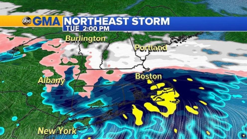
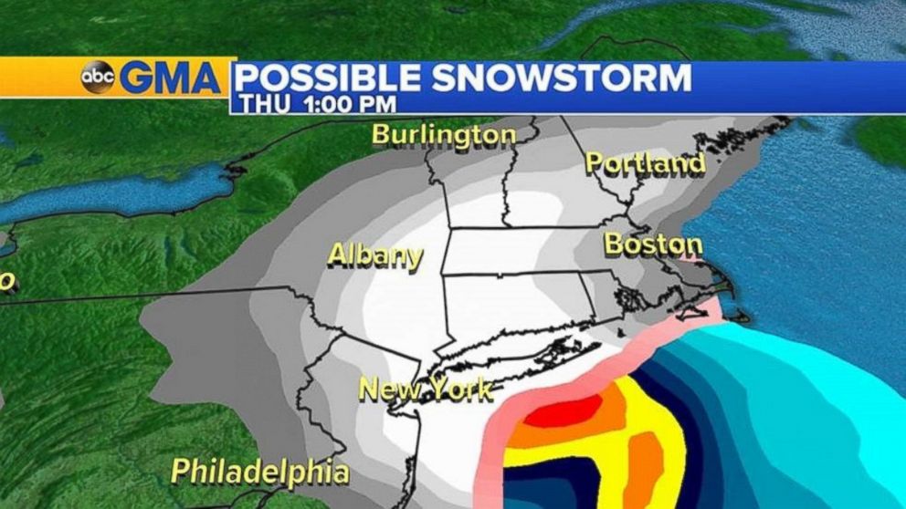
ABC News meteorologists said a second storm will move into the Northeast on Thursday morning, bringing mostly snow to New York City and Boston. Heavy snowfall is in the forecast until Thursday afternoon. Some weather models are showing snow farther south in Philadelphia and Washington, D.C.
“This could be a plowed event for major Northeast cities,” Golembo said. “Stay tuned. This is a changing forecast.”
