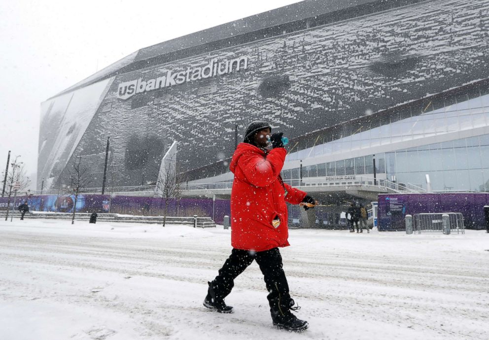
Snow wreaking havoc on roadways; more snow, ice, heavy rain bearing down
This afternoon brought snow to Nebraska, Iowa and northern Illinois.
— -- Snow and ice are wreaking havoc on roadways today as the eastern half of the country braces for more snow, ice and heavy rain.
A quick-moving clipper system is sweeping across parts of the Midwest this afternoon, bringing snow to Nebraska, Iowa and northern Illinois.
Today, the snowfall rate reached 1 inch per hour in some places, leading to lower visibility and quickly disappearing roadways.
In Nebraska, multiple semi-trucks were stranded in median and ditches, the Nebraska State Patrol said. State police say one person died in an accident in the Omaha area.
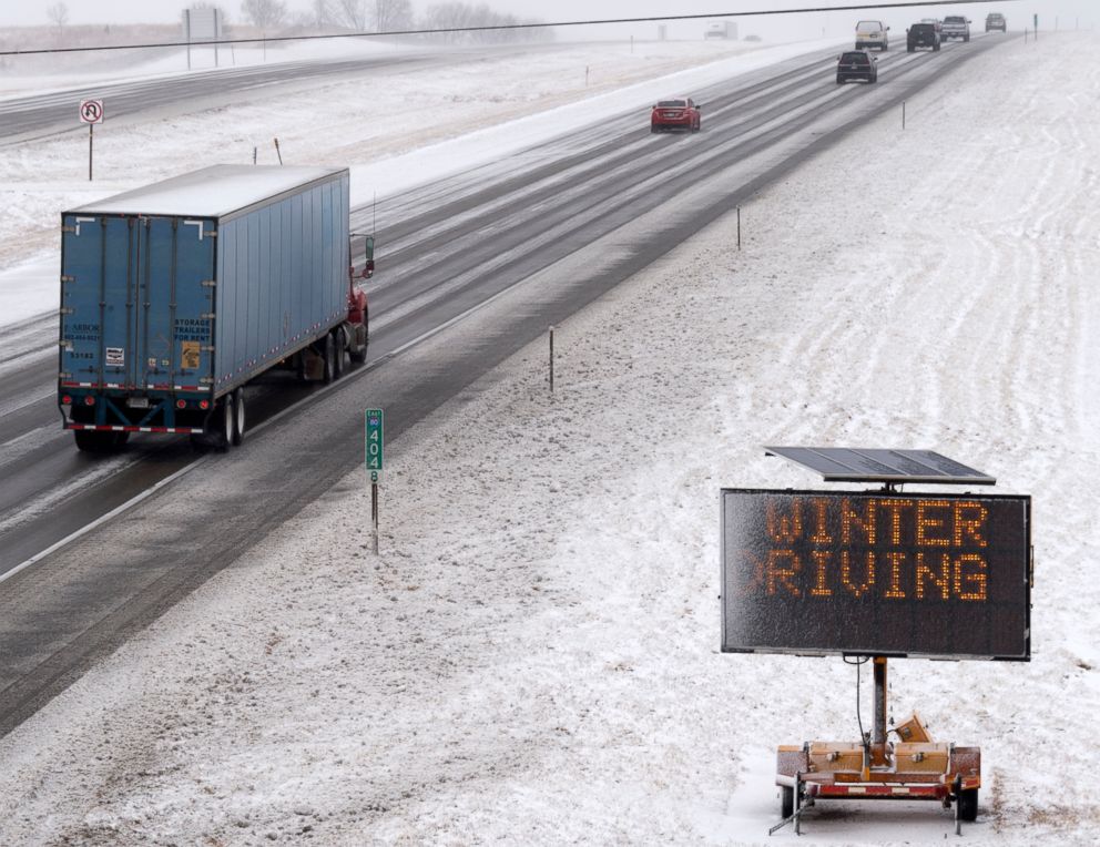
Serious crashes were also reported in Iowa. At least seven people died in weather-related accidents across the state today, authorities said.
Iowa State Patrol Sgt. Nathan Ludwig said they handled four of the fatalities: one on Interstate-80 between Des Moines and Iowa City; a 17-year-old boy and his 14-year-old sister, who died in the northeast part of the state; and on Interstate-35 in Ames after a 50-car pileup.
The other three deaths were handled by local authorities, including two on Interstate-380, where weather played a part in two deaths.
In Missouri, five people died in weather-related traffic deaths. The victims ranged in age from 26 to 63 years old.
The snow will begin to fall in the Chicago area this afternoon, where it could potentially be heavy at times, creating a treacherous evening commute.
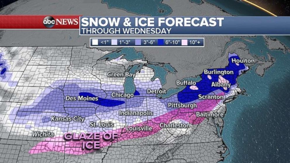
On Tuesday, a winter storm will take shape over the southern Plains, and on Wednesday it will bring snow, ice and heavy rain to the Northeast.
By Wednesday morning, snow will be falling from the Great Lakes into Pennsylvania and western New York.
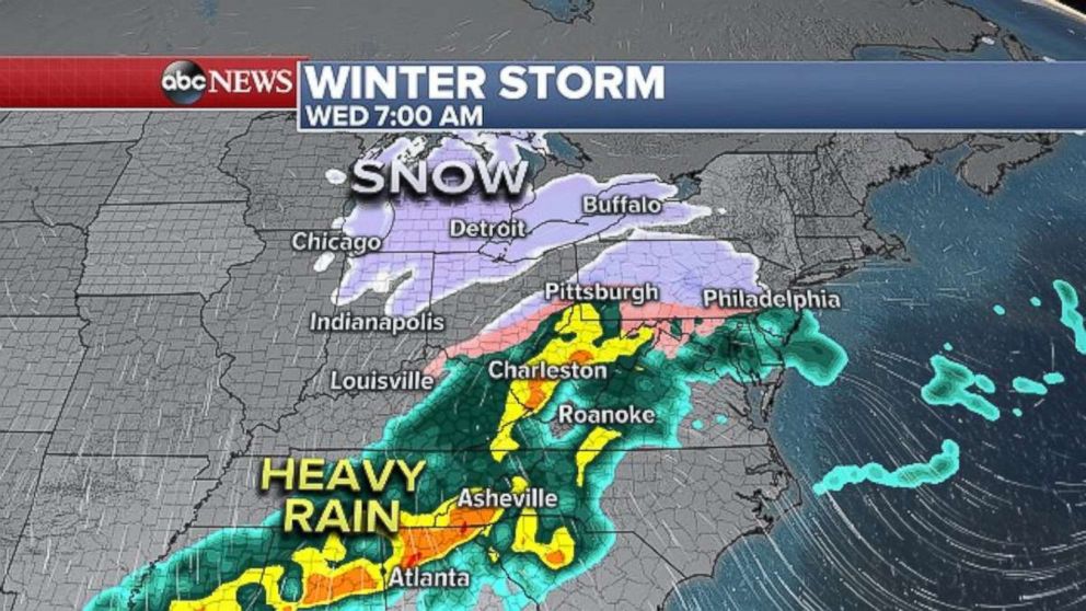
The precipitation will move into Washington, D.C., and Baltimore early Wednesday morning and could briefly mix with snow and ice before warming up to rain. Philadelphia, New York and Boston may also see snow in the morning before the precipitation changes over to rain.
Areas of heavy rain is expected in parts of the South as well, potentially causing isolated flash flooding.
By Wednesday afternoon, heavy rain will be falling along the Northeast coast and along much of the Interstate 95 corridor. It's expected to wrap up Wednesday night.
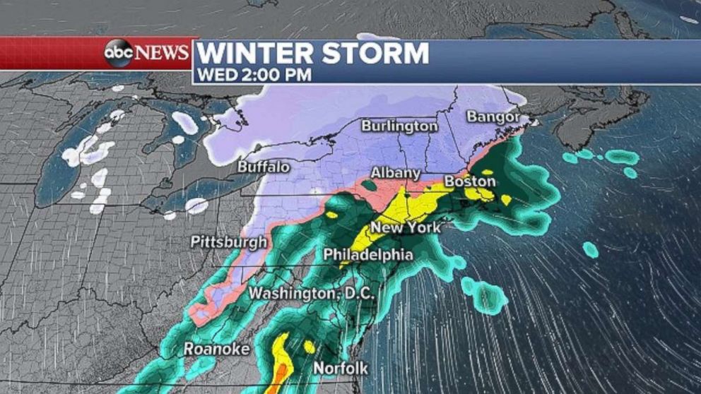
Through Wednesday night, accumulating snow is forecast from the Midwest to New England.
The biggest snowfall totals will occur across interior parts of the Northeast, where 6 to 10 inches is expected.
Isolated snowfall amounts topping 6 inches could also occur in parts of Iowa and Illinois, south of Chicago.
In Washington, D.C., New York City and Boston this will be a mainly rain event once again, but the precipitation could briefly start off as snow or a wintry mix. These areas could also see a light glaze on the roadways.
While the frigid air will stay focused over the upper Midwest, it will be a bitter cold start to Tuesday from the Midwest to Northeast. Wind chills will be below zero from Minneapolis to Chicago. It will feel like the teens from St. Louis to Indianapolis and Boston.
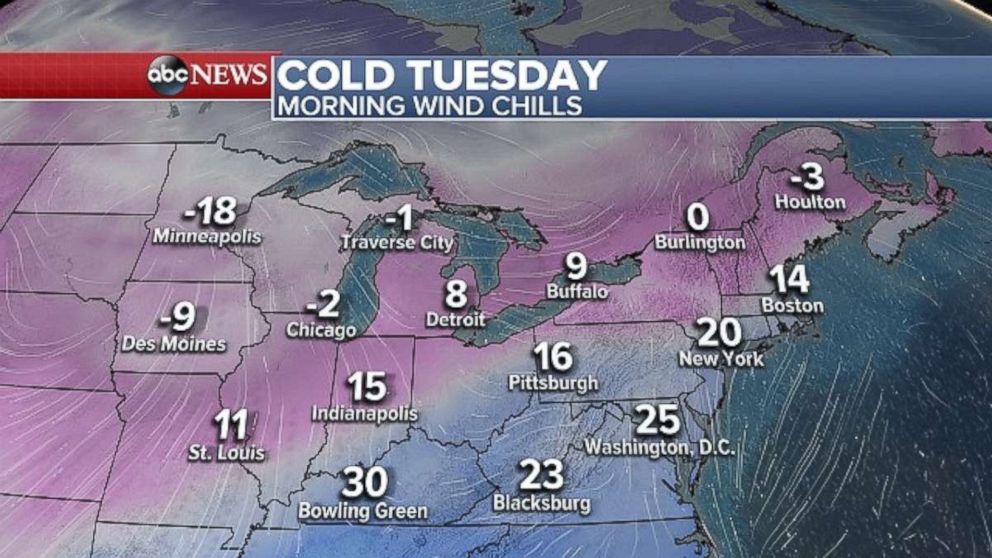
On Tuesday afternoon, temperatures will rebound into the 30s across much of the Northeast with some lower 40s along the I-95 corridor from Washington, D.C., to New York City. It will remain well below freezing across much of the Midwest throughout the day on Tuesday.
ABC News' Rachel Katz contributed to this report.
Related Topics

Popular Reads
ABC News Live