Wintry mix moves into Northeast with temperature drop to follow
A line of storms is moving into the eastern U.S. on Friday.
— -- A storm which caused blizzard conditions in Kansas and the Dakotas on Thursday moves east today with dozens of states from Texas to Maine under wind, snow and flood alerts.
Up to 9 inches of snow fell in parts of the Great Plains and western Great Lakes yesterday as the large storm system moved east. Visibility was close to zero at times in some parts of the region.
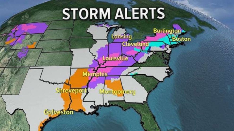
The rain is changing to ice and snow Friday morning from northern Louisiana to Memphis, and Indianapolis to Detroit. Major issues are expected on the fast-freezing roads. Schools already announced they will be closed in the city of Memphis on Friday.
By rush hour on Friday afternoon, the storm system will be moving into the I-95 corridor with very heavy rain -- including 1 to 3 inches possible locally. This could create flooding on roadways, creeks and ponds.
Behind the storm, snow and ice will stretch from Nashville to Cincinnati and into western Pennsylvania and New York state.
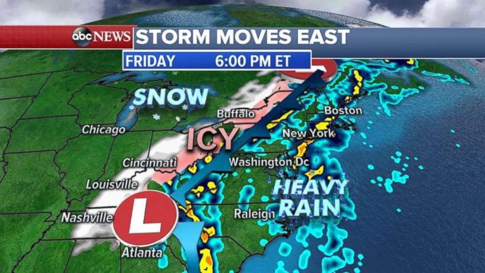
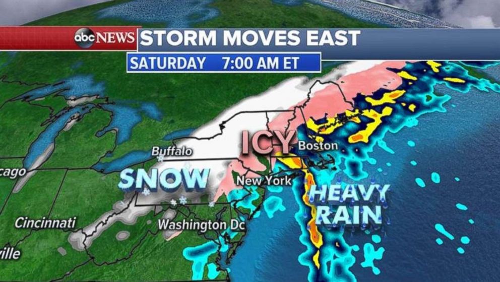
The rain will begin to change to snow and ice by Saturday morning as the colder air wraps around the storm further east, getting close to the more-populated I-95 corridor. Some icy roads are possible close to New York City and Boston.
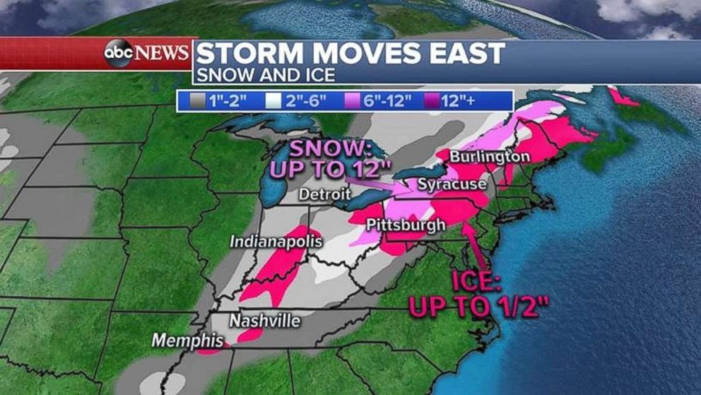
Ice and snow accumulations for the eastern U.S. could include as much as a foot of snow for western New York and New England. Icy accumulations will be up to half an inch from Pennsylvania into New England.
Locally 2 to 4 inches of snow is possible for the Ohio Valley with a glaze of ice possible as well.
Temperatures tumble
A major temperature tumble is forecast following the storm system.
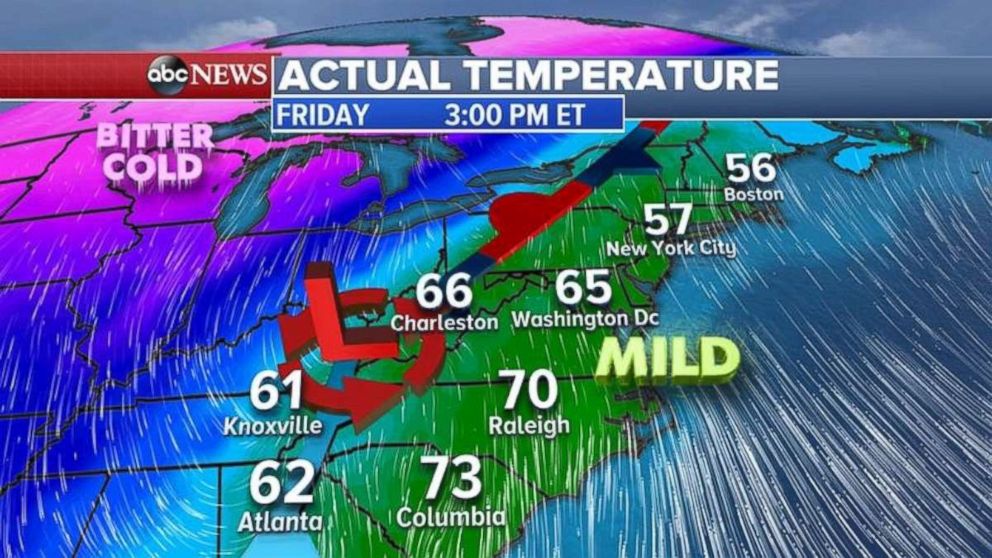
Ahead of the storm, temperatures will be near record highs on the East Coast -- in the 50s and close to 60 degrees from Washington, D.C. to Boston.
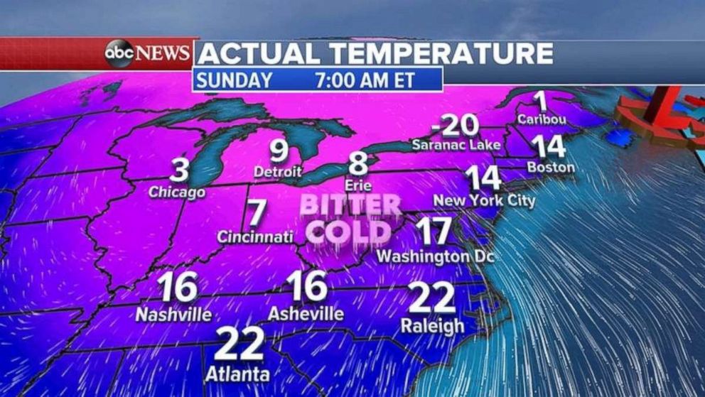
Behind the storm, temperatures will drop 30 degrees into the teens and single digits in the Northeast with wind chills below zero by Saturday night into Sunday morning.
Related Topics

Popular Reads
ABC News Live