Satellite Photos Show Horrific Damage From Boko Haram Attack
Amnesty International released the images to show how a town was razed.

— -- New satellite images released today by Amnesty International show the extent of the damage from an alleged attack by Boko Haram in northeast Nigeria.
The attack on Baga and the small twin town of Doro Baga has been a source of confusion because the estimated death toll varies widely, from as few as 150 to as many as 2,000.
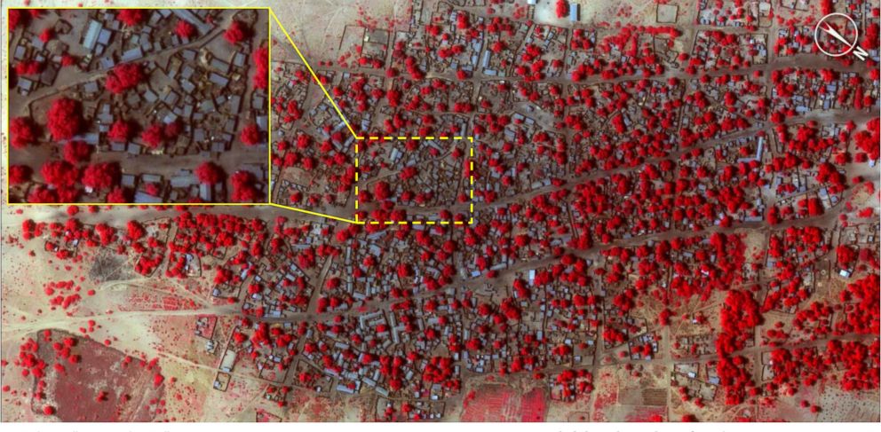
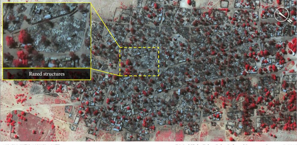
These photos show how significant the damage was to the town, according to Amnesty International. The False Color Infrared Image used the bright red color to show healthy vegetation.
The “before” photos, taken Jan. 2, show vegetation scattered throughout the small city, with trees or shrubs seen throughout.
Reliable information from both Baga and other rural towns in remote northeastern Nigeria is hard to come by for multiple reasons. The dangers of the fighting have kept reporters and international aid groups away, with the United Nations collecting its data from interviews with refugees after they flee to neighboring countries.
Adotei Akwei, the managing director for government relations at Amnesty International, told ABC News the photos directly contradict the government's reported death toll of 150 people. Outside watchdog groups, including Amnesty, estimate the actual death toll is closer to 2,000.
"They confirm the Nigerian government's continuing policy of underreporting the attacks of Boko Haram and the civilian casualties," Akwei said.
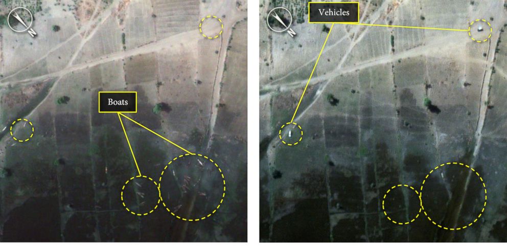
Another before-and-after photo pairing shows there were a number of boats and canoes at the edge of the village and Lake Chad. On Jan. 7, those boats are no longer at the water's edge, which Amnesty says confirms reports that villagers tried to cross the lake to escape.
"When we were reporting on the numbers and Baga was so isolated, it was hard to keep the human element, but these photos do show exactly what happened … ," Akwei said.

Popular Reads
ABC News Live