80 mph winds rock Northeast as tropical threats brew
More than 100 reports of severe weather came in on Wednesday.
More than 100 severe weather reports came in on Wednesday, mostly in the Northeast.
A 73 mph gust was reported at Logan Airport in Boston, and an apparent microburst with winds of up to 80 mph was reported in Winthrop, Massachusetts, where it capsized boats at a yacht club.
In New Jersey and Pennsylvania, storms with gusts as high as 60 mph downed trees. Elsewhere in the region, heavy local rainfalls of 2 inches and flash flooding were reported, including in parts of New York City.
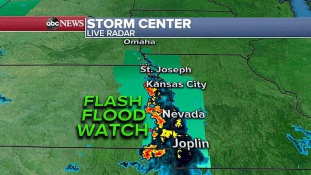
There's a small risk of severe weather in northwest Kansas and eastern Colorado, but the main concern Thursday morning is potential flash flooding along the Kansas-Missouri border, where 4 inches of rain has been reported locally.
Some nearby rainfall rates appear to be in excess of 2 inches per hour, meaning flash flooding is possible. The risk of flash flooding declines later in the morning before additional storms appear later in the day, potentially delivering more rain. A pattern of thunderstorms is expected to continue through Saturday, and rainfall totals in some parts could surpass half a foot.
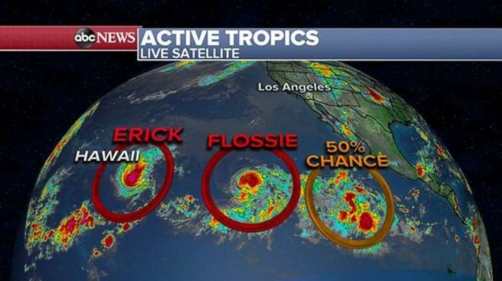
Hurricane Erick, a Category 1 with winds of about 90 mph, still should pass south of Hawaii and is likely to weaken significantly over the next few days. No significant impact is expected in Hawaii.
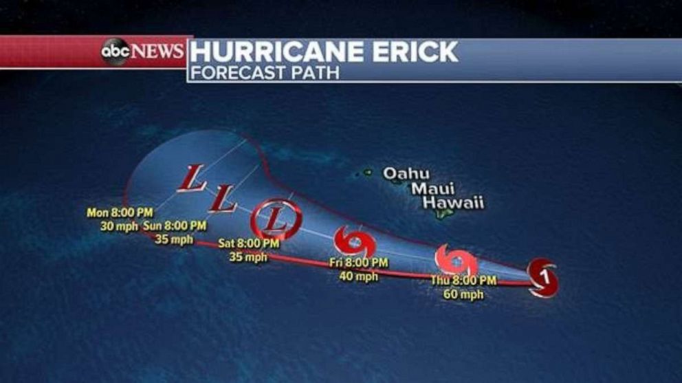
Swells are being seen in Hawaii, and dangerous surf is expected along the state's eastern coast.
Locally, 4 to 6 inches of rain is possible through Saturday related to moisture from Erick. A flash flood watch has been issued for parts of the state.
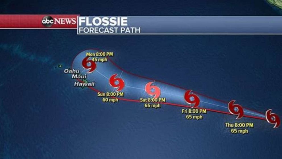
Tropical Storm Flossie, with winds of 65 mph, is moving west-northwest at about 16 mph. As of early Thursday, it still was about 1,700 miles away from Hawaii. The storm's intensity probably will change dramatically over the next few days.
Flossie is tracking toward Hawaii, but it's unclear how close it will get and likely make its nearest approach late in the weekend or early next week.
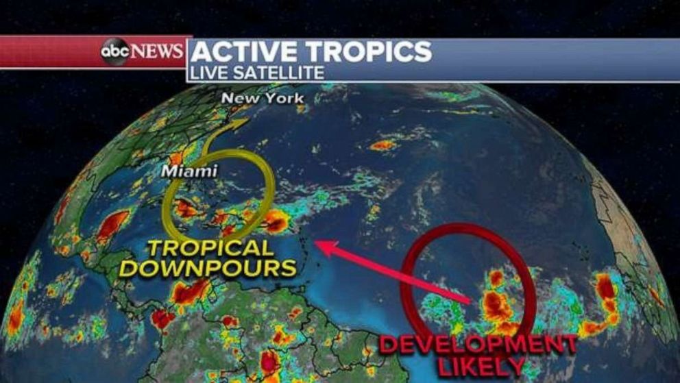
There are two areas of concern in the Atlantic Basin -- a broad cluster of thunderstorms nearing Cuba and an area of much greater concern in the middle of the ocean. This second cluster of storms is drifting westward and could organize gradually over the next few days. A tropical depression may form early next week.


