Dangerous cold hitting Midwest expected to get worse next week
Temperatures will be dangerously low in the central U.S.
A large storm that brought 2 inches of rain to the Northeast has moved out, and cold air is spilling into the central U.S. behind it on Friday.
There is now increasing confidence and concern that a major long-duration cold blast will target the central U.S. with the potential to be the coldest weather the lower 48 states have seen in years.
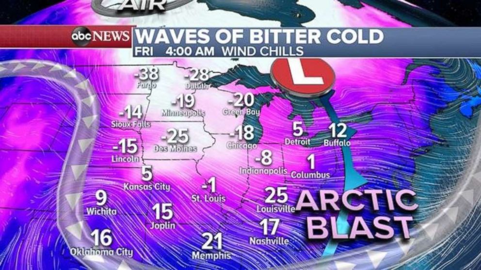
Wind chill alerts have been issued for a large part of the Midwest for this first round of arctic cold. Wind chills on Friday morning in parts of the Midwest are as low as minus 20 to minus 30 degrees. In Chicago it feels like minus 18, while it feels like minus 38 in Fargo, North Dakota. Wind chills in the teens stretch all the way down to the Mississippi and Tennessee valleys this morning.
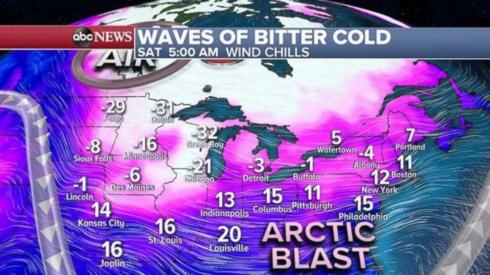
The arctic blast will expand into the Northeast overnight and into Saturday, with wind chills in the teens for major Interstate 95 cities including Philadelphia, New York and Boston. Wind chills will be a little bit worse in Chicago and Green Bay, dipping into the minus 20s and, near the suburbs, minus 30s.
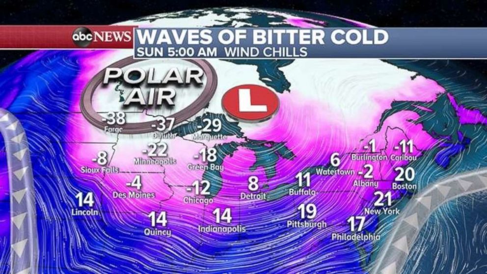
On Sunday, the forecast includes some minor relief from that brutal cold, but more polar air will descend on the northern Plains and upper Midwest, putting wind chills back in the minus 30s and minus 20s. In the northeast, wind chills will still be in the teens to 20s, closer to January norms.
Unfortunately, after Sunday, the cold weather situation will worsen into next week. A quickly developing storm will slide into the Midwest by Monday, bringing a round of snow to the upper Midwest and Great Lakes. Heavy precipitation isn't expected, but it'll be so cold snowfalls in and around Chicago could be significant -- local accumulations could near half a foot.
A very sharp cold front will bring another round of rain, changing into mixed precipitation, to parts of the central plains and Mississippi River Valley. The storm will slide off to the east on Tuesday and Wednesday, likely affecting the Northeast although significant snowfall there isn't likely.
The most significant weather from this pattern is the high likelihood of the storm finally dragging polar air into parts of the central U.S.
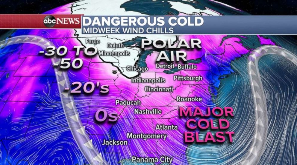
This could be the most intense Midwest cold blast in years, surpassing that of five years ago, when in Chicago on Jan. 16, 2014, the high was minus 2.
Wind chills next week in cities including Chicago and Minneapolis could be minus 30 to minus 50 -- or even lower.
Related Topics

Popular Reads
ABC News Live