Flash flooding, mudslides threat for California; Unseasonably warm on East Coast
Several storm systems continue to march across the country this morning.
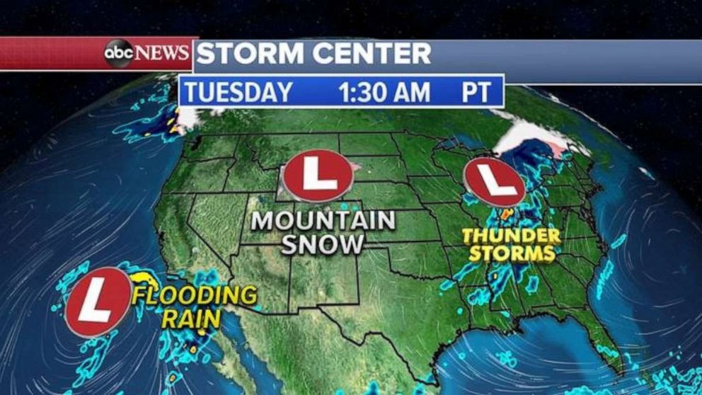
Several storm systems continue to march across the country this morning with a threat for flash flooding in southern California, gusty winds and mountains snow in the Rockies and strong storms and heavy rain for the Midwest and parts of the South.

By tonight and into Wednesday morning, flooding threat with mudslides will continue in southern California and also in Arizona.
In the Plains, strong to severe storms are possible tonight into tomorrow morning from Kansas to Oklahoma and into Arizona where damaging winds and large hail will be the biggest threat.
By Thursday, a very slow moving storm system in the Southwest will continue to bring flash flooding threat from southern California to Arizona.
In the Plains and across the South, heavy rain and strong to severe storms are possible.
Over the next several days, 2 to as much as 4 inches of rain could fall from southern California to Arizona and flash flooding, mud and rock slides are likely.
In the mountains of Southern California, Arizona, Colorado and New Mexico, locally, a foot of snow is possible.

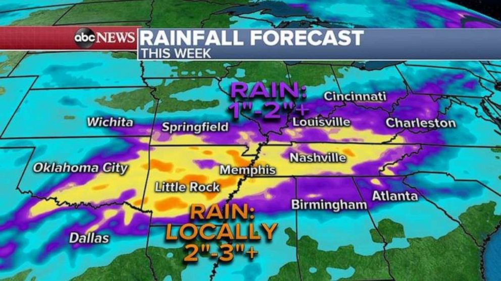
Very heavy rain also possible in the southern Plains and into the Tennessee Valley where locally 2 to as much as 4 inches is possible through the rest of the week.
Elsewhere, it reached 70 degrees yesterday in Portland, Maine, which was enough to break a record high for the day.
New York City reached a whopping 72 degrees making it the warmest day so far this year.
In Philadelphia, the temperature reached 71 degrees also making it the warmest temperatures of the year.
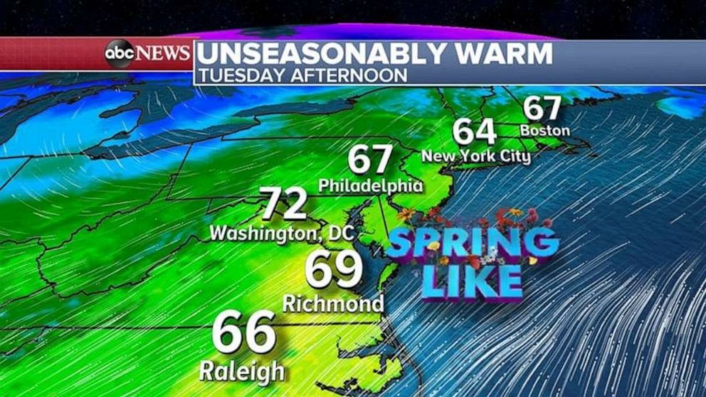
Slightly cooler weather is expected today temperatures will still be in the mid to upper 60s from Philadelphia to New York City and Boston which is about 10 to 20 degrees above normal for this time of year.
Warm weather will also continue in the Mid-Atlantic today where it will be in the 70s today in Washington, D.C.


