'Godzilla' El Nino May Be on the Way
It started as a clever joke that might come to pass.
— -- So, what exactly is a "Godzilla" El Niño?
Actually, it’s just a clever joke by a NASA climatologist: "This definitely has the potential of being the Godzilla El Niño," Bill Patzert of the NASA Jet Propulsion Laboratory in La Cañada Flintridge, California, said Thursday.
What's It Look Like?
"Godzilla" El Niño is not a technical or scientific term, but it's a good way to describe the upcoming El Niño event, because it could likely be one of the strongest since record-keeping began in 1950.
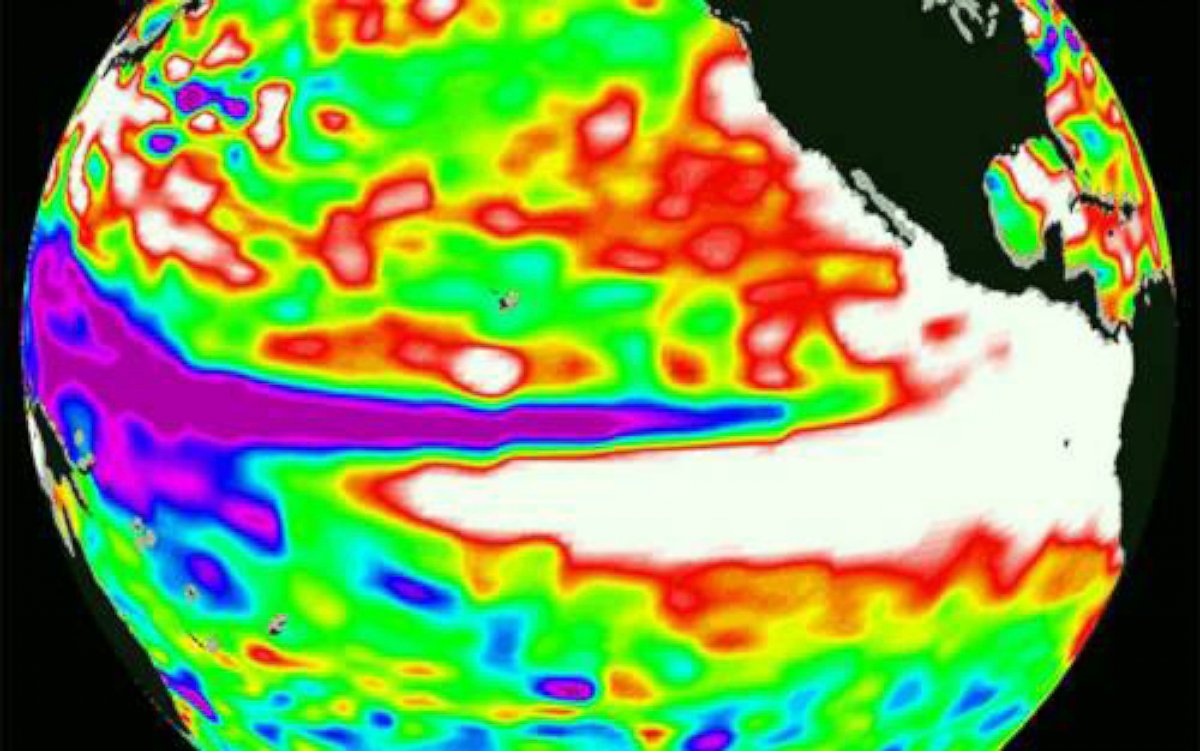
Below are the sea surface height anomalies, which correlate to the ocean temperature. The red and white colors mean above-normal, or very warm, temperatures in that area of the Pacific Ocean. The temperatures are warmer than they were in August of 1997, when the strongest El Niño on record occurred. This is an indication that we could be rivaling the 1997-1998 record El Niño event that caused devastating flooding and mudslides across California.
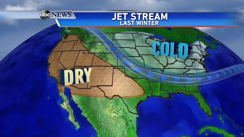
The United States has been stuck in this all-too-familiar pattern: extremely dry out West and below-normal temperatures in the Midwest and Northeast. California is in the midst of a severe four-year record weather drought, with little relief in sight, but things may be changing in the coming months.
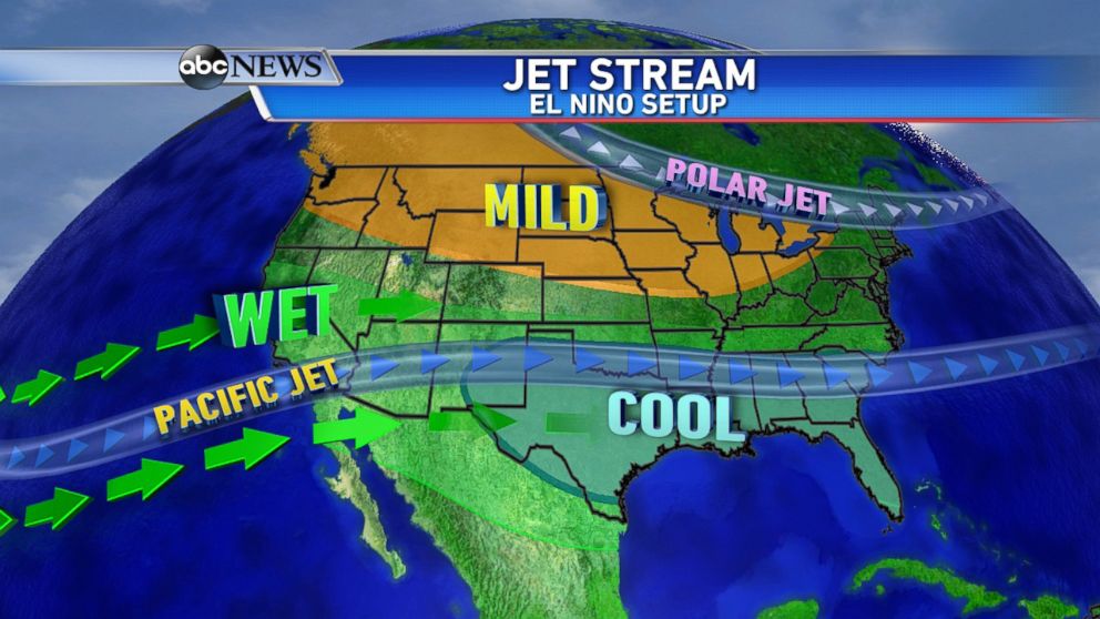
During a typical El Niño event, the jet stream setup illustrates the subtropical (or Pacific) jet stretching from California to Florida, and the polar jet stuck in Canada during the winter months. So, what does that mean for the weather across the country?
Is It All Bad News?
Well, it's great news for the drought-stricken Southwest because wetter-than-normal conditions are likely. Places that have had an unprecedented lack of precipitation for so long will rejoice as drops begin falling from the sky.
But too much of a good thing can also turn bad. Big storms with extreme rain can become dangerous, leading to flash flooding and mudslides, as seen back in 1997-1998.
Will there be enough rain and snow to erase the four-year record-breaking drought in California? Even if they do receive above-average precipitation, it will most likely not be enough. It takes more than one season to break out of such a historic drought; it takes many wet seasons. El Niño would need to be present for the next two to three years to finally fill up all the reservoirs, lakes and rivers in the West, and that is unlikely to happen.
Another concern is "the blob": the ridge that has been sitting off the West Coast for two years now. It will help determine how far north in California rain and mountain snow will fall. Not every El Niño brings heavy rain to northern and central California. That would require breaking out of the blocking ridge in the West.
What About the Rest of Us?
Regarding the rest of the country, El Niño usually brings wetter and cooler weather from Texas and Florida. For the Upper Plains, Midwest and Great Lakes regions, the polar jet stays locked in Canada, allowing warmer-than-normal temperatures to persist for much of the winter. That means less arctic outbreak for cities like Minneapolis and Chicago.
For the East Coast, El Niño usually brings slightly wetter winter to the Mid-Atlantic and cities like Washington. The rest of the Northeast and New England, in a typical El Niño winter, have equal chances of seeing above- or below-normal precipitation and temperature, meaning they are not affected by El Niño as much as other locations across the country.
It's important to note that many of the cold outbreaks in the Northeast originate in the upper Midwest, so if they are milder, that could correlate to a bit milder winter for the Northeast, as well.
Of course, many other factors come into play when predicting the weather and jet stream setup for the upcoming winter, but this "Godzilla" El Niño is not to be ignored.

Trending Reader Picks
ABC News Live