Hurricane Ian before and after images show destruction of Sanibel Island, Fort Myers Beach
Parts of Florida have been left unrecognizable in the wake of Hurricane Ian.
Parts of southwest Florida have been left unrecognizable in the wake of Hurricane Ian.
The Category 4 storm ripped through neighborhoods like Sanibel Island and Fort Myers Beach last Wednesday after making landfall nearby in Cayo Costa, a barrier island off the coast of Fort Myers.
Officials in the region announced within hours of landfall that places like Sanibel Island and Fort Myers Beach had been "decimated" by the storm.
At the time, nearly all of Lee County was without power, and hundreds of people were stranded due to high water, officials from Lee County Emergency Management announced during a press conference Wednesday afternoon.
Before and after images offer a stark perspective on the level of damage some of the hardest-hit areas experienced.

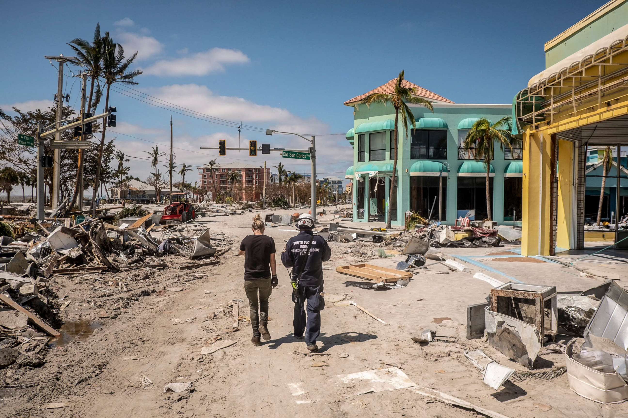
The slow-moving hurricane churned over the same area for so long that it was not until dawn broke on Thursday that officials would fully realize the devastation it left behind.
The storm surge was so intense that homes up to 3 miles from the Gulf of Mexico were inundated. Neighborhoods previously lined with beach homes were reduced to rubble after waters from the Gulf of Mexico were pushed onto shore.
In Fort Myers Beach, homes several blocks behind Estero Boulevard, the roadway that runs parallel to the coast, were destroyed by Ian, satellite images show.


Before and after satellite images show an RV park and boats on San Carlos Boulevard on Fort Myers Beach, much of which were washed away by the surge.
In Punta Gorda, Florida, about 25 miles north of Fort Myers, a line of trees in front of a home near Charlotte Harbor was almost completely stripped of their branches from the dangerously high winds.


Flooding across Lee County continued into Thursday and Friday, with upward of 700 people rescued there alone. The causeway leading to Sanibel Island from Fort Myers, the only road in and out of the island, collapsed in the storm.


More before-and-after satellite images show the neighborhood surrounding the Fort Myers Pier -- with the pier and homes nearby completely obliterated by the storm.
By Monday, the death toll in Florida as a result of Ian had risen to at least 94 people -- a large portion of whom were located in Lee County, according to an ABC News tally that was compiled through several sources, including the state Medical Examiners Commission, and direct contact with the sheriff’s departments in certain counties.
More deaths are expected as search and rescue crews continue to wade through the destruction, local officials said.
Members of the U.S. Coast Guard used boats and helicopters to pluck survivors off the island.


The recovery process is expected to be "very long," Sanibel Island Mayor Holly Smith told ABC News on Friday.
"But right now, [the plan is] getting everybody off that island and to safety. It is not habitable," Smith said.
ABC News' Jill Tatara contributed to this report.
Related Topics

Popular Reads
ABC News Live