Northeast finally cooling off as a new storm moves to the Midwest
A heat wave in the Northeast is finally showing signs of letting up.
Record highs were reported in several cities on Wednesday, including Boston and Providence at 98 and 95 degrees, respectively.
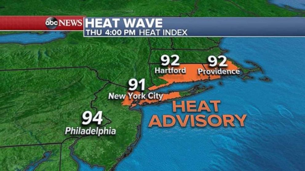
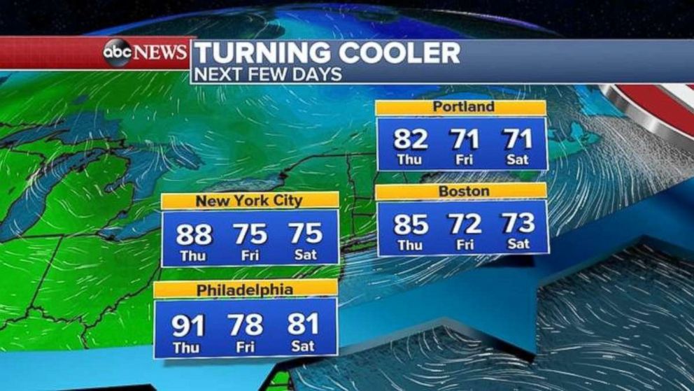
Today should be the last hot and humid day in the Northeast as the heat wave should let up beginning tomorrow. A heat advisory is in effect today throughout much of the New York City and New England areas.
As Northeast temperatures begin dropping later tonight and tomorrow -- with some areas seeing decreases of 20 to 30 degrees -- showers and storms are possible along the Interstate-95 corridor beginning this afternoon.
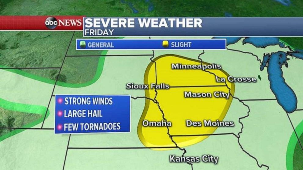
Wisconsin is experiencing record flooding this morning, and a new storm is heading for the Midwest. That system likely will move into the Plains today and the Great Lakes on Friday, as southwestern Wisconsin could get hit hard again.
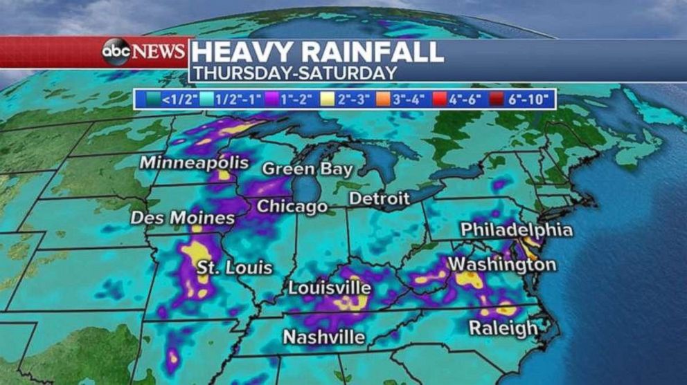
Stretching from the Midwest to the East Coast, many regions are expecting additional rainfall through Saturday. Parts of already-saturated Wisconsin may see 3 more inches, exacerbating flooding concerns. Parts of the Northeast may see similar totals.
Related Topics

Popular Reads

ABC News Live