Powerful cold front brings snow squalls, gusty winds to Midwest and parts of Northeast
It is winter jacket weather across the Northeast and Midwest.
A strong cold front brought snow squalls, gusty winds and some hail to parts of the Midwest on Saturday. Wind gusts close to 60 mph were reported from Iowa to Michigan, including parts of Chicago and Indianapolis.
Several waterspouts were also reported on Lake Erie and a confirmed EF-0 tornado with winds up to 75 mph hit West Seneca, New York. The tornado did damage to a condo complex in the town.
Behind the front, it is quite cold by October standards. Wind chills are in the 20s across the Midwest on Sunday morning, and wind chills in the 30s extend all the way into the southern U.S. from Arkansas to Georgia.
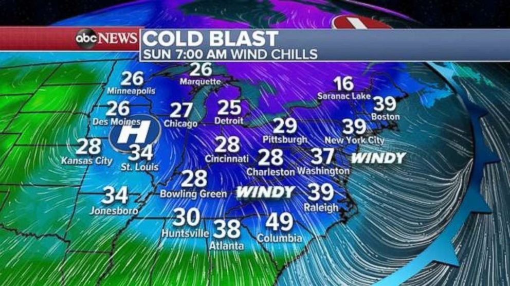
In the Northeast, wind chills in the 30s are expected from Washington, D.C., to Boston. Also, winds are still gusty in the wake of the front across the Carolinas and into portions of the mid-Atlantic. Wind gusts over 30 mph are possible through the morning hours Sunday.
Colder air moving over the Great Lakes is causing some isolated snow squalls to move into parts of the Northeast. While little to no accumulation is likely, these snow squalls could briefly cause low visibility and gusty winds.
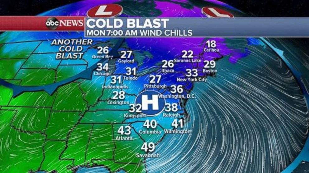
The core of this cold blast will settle into the Northeast for Monday morning, with wind chills in the 20s and low 30s in some areas. The Midwest will recover somewhat Monday morning, but another cold blast is quickly sneaking in.
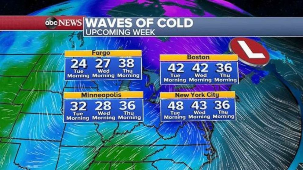
There will be another wave of cold air that will move into the Midwest on Tuesday and Wednesday, and eventually reach the Northeast by Thursday morning.
More rain coming to Texas
Drier weather on Saturday allowed Lake Travis, near Austin, Texas, to begin decreasing in water level. This is the first time the water level is decreasing since near-record flooding earlier this week in the region. Most of Texas will be dry Sunday, with heavy rain confined to the extreme southern Texas coastline near Brownsville.
Some rain will move back into parts of south-central Texas on Monday, but a more widespread shot of rain appears to be in the forecast again for later in the week. Part of the threat for rain comes from Hurricane Willa in the eastern Pacific.
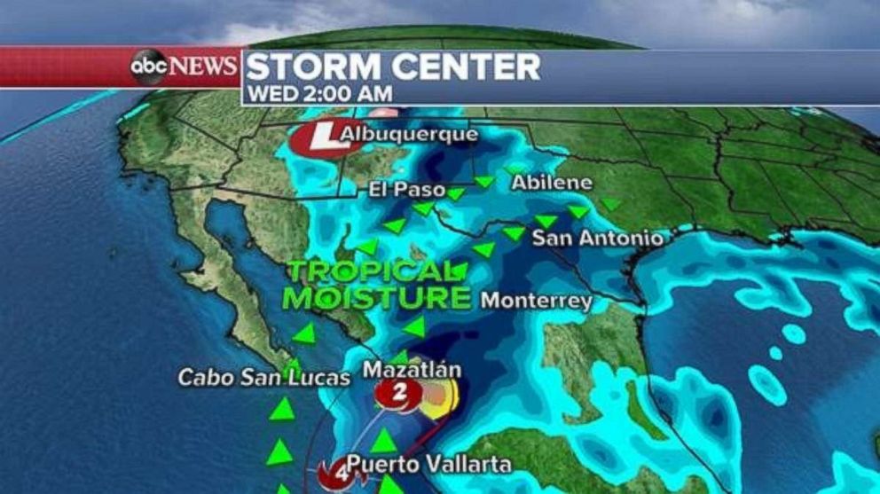
Willa formed into a hurricane in the eastern Pacific early Sunday. Satellite imagery shows a rapidly organizing and strengthening tropical system approximately 240 miles southwest of Manzanillo, Mexico. Hurricane Willa has maximum sustained winds of 85 mph and the storm is moving northwest at 7 mph. It is relatively small, with hurricane-force winds extending only 10 miles from the center.
Hurricane Willa is rapidly intensifying and will become a major hurricane by Monday morning and likely a Category 4 hurricane within the next 48 hours. Willa will come very close to the Mexican coastline as a major Category 4 hurricane. Some wind shear will interact with the storm as it approaches the coast, which could cause the storm to weaken in intensity right before -- or at -- landfall late Tuesday or early Wednesday.
At this point it is unclear the magnitude of the impact in Mexico, however, strong winds and very heavy rain remain likely.
Willa will rapidly weaken over the mountains of Mexico. However, some tropical moisture from Willa will move into much of northern Mexico and begin to interact with a different system in the Southwest.
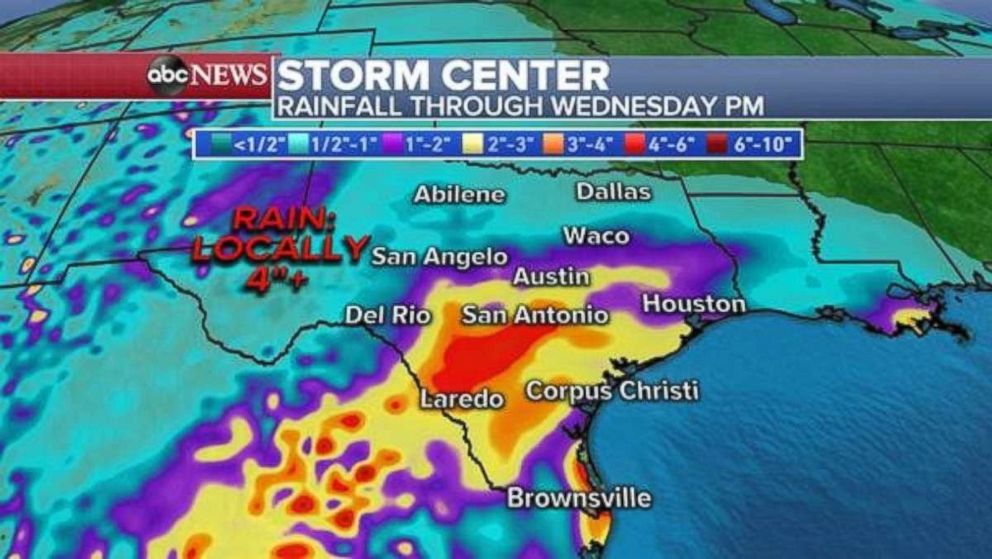
As a result of this interaction, some tropical moisture could spread into parts of Texas by Wednesday, with locally heavy rain and flash flooding possible. Rainfall totals could exceed 4 inches in spots. However, at this time it is too early to determine the specific location of the heaviest rain.


