US sets rain record for 3rd time this year as Gulf prepares for tropical system
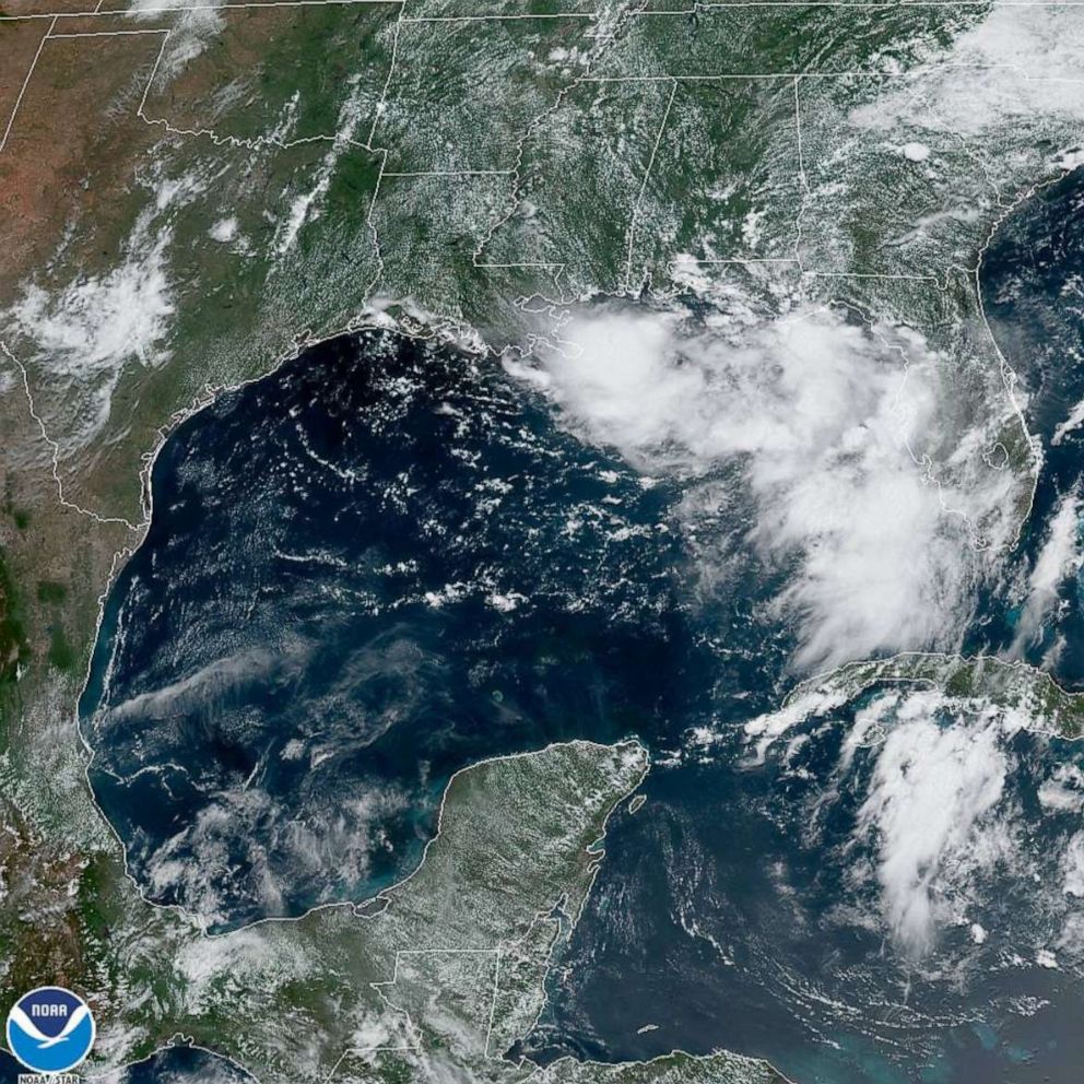
The storm system will hit somewhere between the Florida panhandle and Texas.
The Gulf Coast is bracing for heavy rainfall from a potential tropical storm system as officials revealed that the country has broken the record for the wettest 12-month period for the third time this year.
The news comes as the National Oceanic and Atmospheric Administration announced that there have been six $1 billion weather and climate disasters so far this year. Since 1980, there have been 250 such events -- an average of six a year.
A tropical depression is expected to form in the Gulf by Thursday and will likely hit somewhere between the western Florida panhandle and the northern Texas coast, the National Weather Service announced Tuesday.

The system has the potential to produce heavy rainfall in the affected areas, but it is too soon to determine the magnitude and location of any potential wind or storm surge impacts at this time.
Rainfall in the U.S. has broken records a stunning three times this year, with above- to much-above average participation in the Deep South through the Mississippi and Ohio river valleys as well as the East Coast, according to the NOAA.
The precipitation total for June was 3.3 inches in the contiguous U.S., about .37 inches above the average, according to NOAA. The contiguous U.S. saw 19.05 inches in total precipitation in the past year, 3.74 inches above the average and the wettest such period in the 125-year record.
Flooding persisted along many of the major river systems and their tributaries across the central U.S., including the central and lower Mississippi River, the Missouri River and the Illinois River.

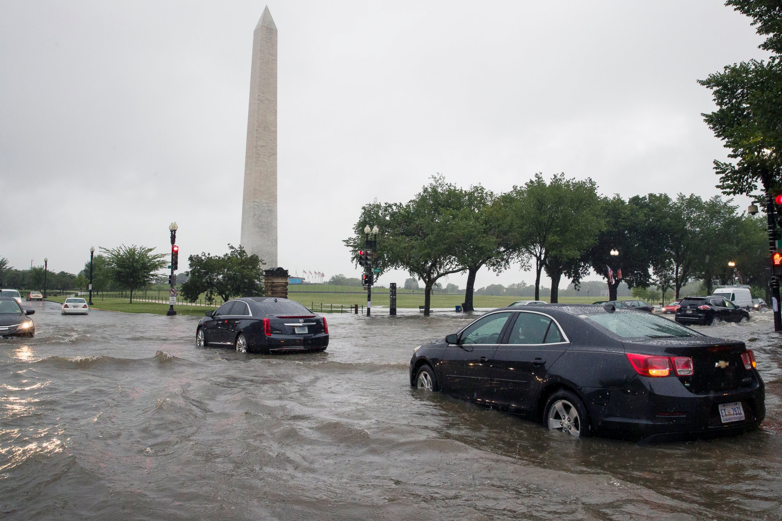
The nation's capital saw more than 3.4 inches of rain on Monday -- a daily record -- with most of it falling in a single hour as nearby regions saw half a foot and flash floods.
More than 100 water rescues were required in and around Washington, D.C., on Monday, including 15 people saved from vehicles trapped by high water.
Flash flooding also was reported Tuesday morning in south-central Nebraska, some parts of which just saw 9 inches of rain. Areas of North Dakota received up to 5 inches of rain overnight, also producing flash flooding.
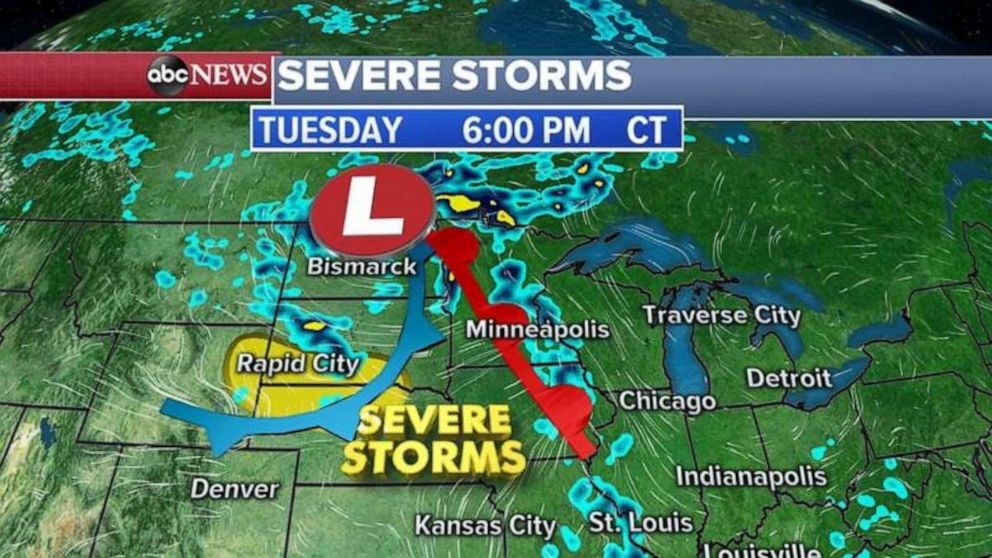
More flooding is possible later on Tuesday as a new system moves through the Plains and western Great Lakes. The most severe storms are likely to be in Wyoming, South Dakota and Nebraska, all of which could see damaging winds, hail or an isolated tornado.
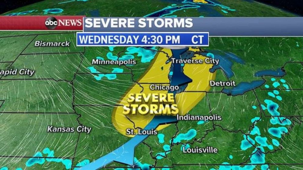
This system on Wednesday is expected to head east and produce severe storms in the Midwest and Great Lakes regions. Damaging winds, hail and an isolated tornado are again the most likely threats.


NOAA also announced Tuesday that above average temperatures in June were observed across 11 states in the U.S.
Alaska experienced its second-warmest June in state history. The average temperature in June was 54 degrees, 4.8 degrees above the long-term mean.

Florida saw its third-warmest June on record.


