Record snow and ice falls in Upper Midwest, new storm to hit California this weekend
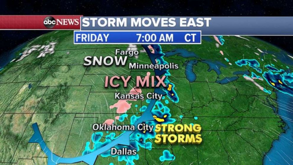
Seven states from Minnesota to Kansas are under ice and snow alerts Friday.
There was record snowfall in the Upper Midwest Thursday. In Grand Forks, North Dakota, almost 10 inches fell and Fargo, North Dakota, received almost 5 inches of snow.
Wyoming saw the largest amount of snowfall, with 21 inches.
Seven states from Minnesota to Kansas are under ice and snow alerts Friday morning.

The cold front associated with the storm system that brought the record snow to the Upper Midwest is moving east and south Friday, with an icy mix from Minneapolis to Kansas City.
Further south, strong storms with lightning and gusty winds are moving through Oklahoma, Texas and Arkansas.

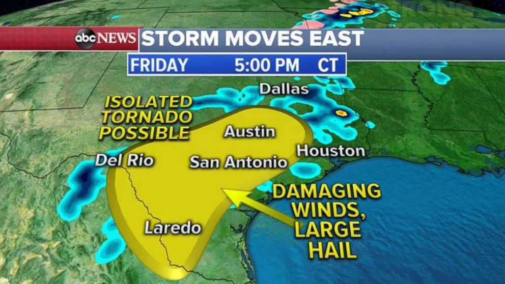
This cold front will reach southeastern Texas Friday afternoon, where severe weather is possible. The biggest threats with these severe thunderstorms will be damaging winds in excess of 60 mph, up to golf-ball size hail and an isolated threat for tornados. Heavy rain could also produce flash flooding.
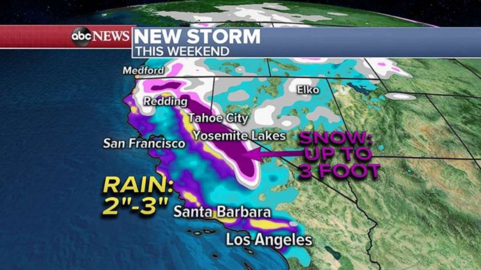
A new storm is also moving into the West Coast this weekend, which will bring heavy rain along the California coast and feet of mountain snow to the Sierra Nevada mountains.
The storm will move into northern California Saturday morning and into southern California by Sunday afternoon and evening.

Some areas in southern California could see up to 3 inches of rain Sunday into Monday, and this could cause flash flooding and even localized mudslides.
In the mountains, up to 3 feet of snow is possible in the Sierra Nevada mountains.


