Severe weather threatens South with tornado threat; New Storm in West could bring feet of snow
Five states are now under snow alerts from Washington to Wyoming.
Today we are watching the South for severe weather today and the West for possible feet of snow.
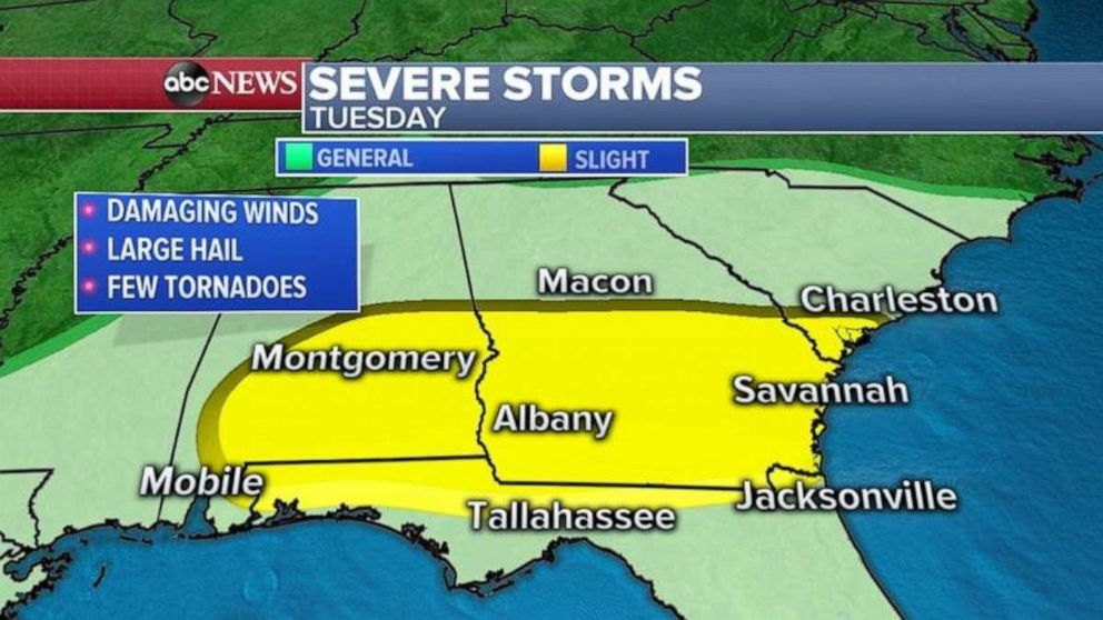
Let’s start with the South where a storm system is moving across the Gulf Coast with severe storms. These storms could produce damaging winds, large hail and a few tornadoes.
Cities that will see severe weather today will be Montgomery, Alabama, Tallahassee and Jacksonville, Florida, Savannah, Georgia, and Charleston, South Carolina.
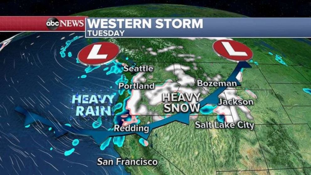
There are a couple of storm systems moving from the West Coast into the northern Plains with heavy snow for the area over the next 48 to 72 hours.
As of this morning, five states are under snow alerts from Washington to Wyoming and these alerts will be expanded into the northern Plains as we move through the morning and afternoon.
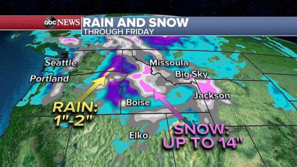
By Wednesday night into Thursday cold air will mix with the storm system bringing heavy snow all the way into the Dakotas.
The heaviest snow over the next few days will be from the Cascades into the Rockies where locally 30 inches of snow is possible.
Half a foot to a foot of snow is possible by Thursday in the northern Plains.
Related Topics

Popular Reads

ABC News Live