Spring Storm Brings Blinding Dust, Heavy Snow Out West
Wild weather across US includes dust, hail, snow and tornadoes.
— -- Dust storms have wreaked havoc in Fresno, Las Vegas, and west of Salt Lake City – the worst of it in Utah where a deadly pileup occurred on I-80. Winds gusted to 80 mph, blinding drivers with dust and knocking over semis.
Salt Lake City went from 76 degrees at 2:00 p.m. to 35 degrees and snowing at 6:00 p.m. on Tuesday. That's a 40 degree temperature drop in just four hours. Winds at the airport were sustained at 50 mph with gusts to 64 mph as the cold front moved through.
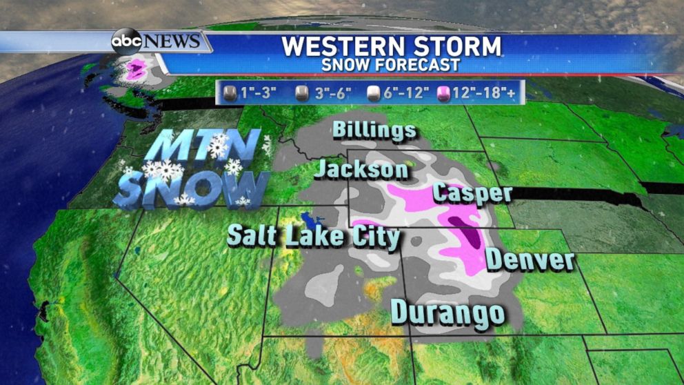
Welcome snow continued in Salt Lake City on Wednesday. At least 5 inches has fallen at Salt Lake International Airport; that’s more than the last three months combined. It’s their least snowy season on record, so far.
The National Weather Service confirms an EF-0 tornado touched down in Eugene, Oregon, yesterday afternoon, packing wind speeds up to 85 mph. An official at Lane Community College witnessed a rain- and hail-wrapped tornado that significantly damaged three vehicles, flipping one of them upside down.
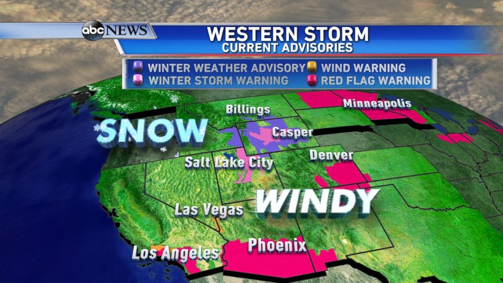
The Los Angeles area is under high wind and red flag warnings. Damaging winds could reach 60 mph at times. Red flag warnings are also still up for many locations across the country for dry and warm conditions in place from the Southwest to Northeast.
The western storms are bringing heavy snow to parts of the Northern and Central Rockies Wednesday through Friday. Snow is falling from Salt Lake City to Billings, Montana, but the heaviest snow is expected in the mountains, and highest elevations where up to two feet is possible.
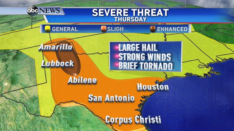
This storm system will continue to track east, helping to create an elevated threat for severe weather in Texas on Thursday. The area of greatest concern is the Texas Panhandle, where an enhanced risk warning has been issued; large hail, strong winds, and isolated tornadoes are possible from Lubbock to Amarillo by Thursday afternoon and evening.
Flash flood watches continue through Tuesday evening from New Orleans to Mobile, Alabama. Rain will not be as widespread, but any isolated thunderstorms could still cause flash flooding since they’ve received so much rain since the weekend. Some places near Mobile, received nearly 10 inches of rain over the past five days.
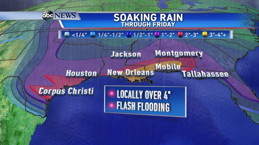
Each day this week the Gulf Coast will continue to stay unsettled, with heavy rain and scattered thunderstorms. Another two to four inches of rain is expected from Texas to Alabama.

Popular Reads

ABC News Live