Storm that drenched the South moving into Northeast for weekend
The storm delivered 4.5 inches of snow in Oklahoma City on Thursday.
There are seven states under flood or snow and ice alerts on Friday morning, including Oklahoma City and Atlanta, as a storm that brought record snowfall targets the Northeast with heavy rain over the weekend.
Record snowfall was reported in Oklahoma City (4.5 inches) and Wichita Falls, Texas (2.5 inches), on Thursday.
On the warm side of the storm, heavy rain fell in parts of southeastern Texas and into the Gulf Coast states Thursday, producing flash flooding.
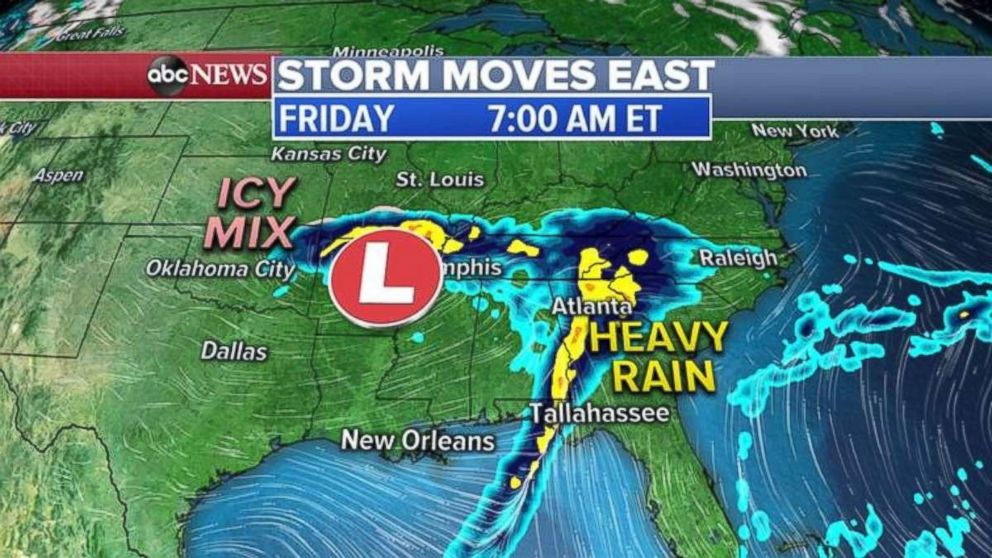
The center of the storm is located in the Mississippi Valley on Friday morning and is spreading heavy rain into Atlanta and parts of the Southeast.
The wintry mix of snow and freezing rain is finally ending in the Southern Plains, but slick roads will remain through Friday morning and possibly the rest of the day and into the night as refreezing occurs.
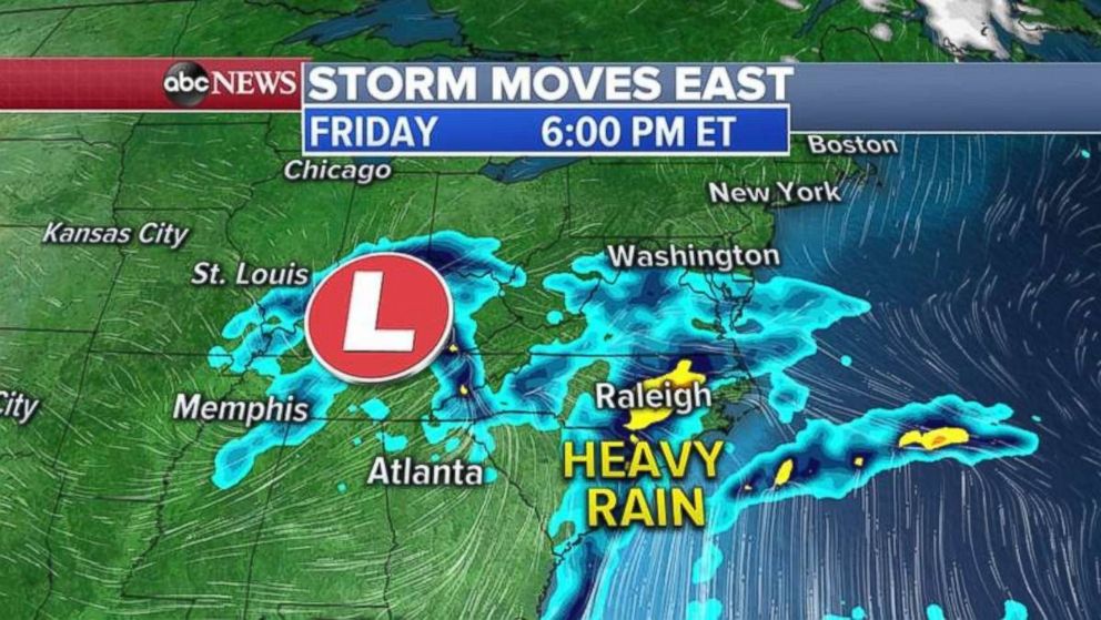
The center of the storm moves into the Ohio Valley by Friday night, bringing heavy rain to the Carolinas.
Rain will begin in Washington, D.C., around 6 p.m. and will get heavier Friday night. Rain will begin in New York City around midnight and get heavy on Saturday morning.
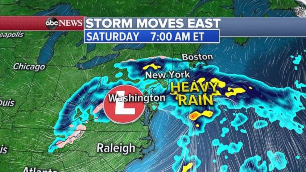
Saturday will be a rainy day in the Northeast, with some areas getting heavy precipitation, but only minor flooding is expected.
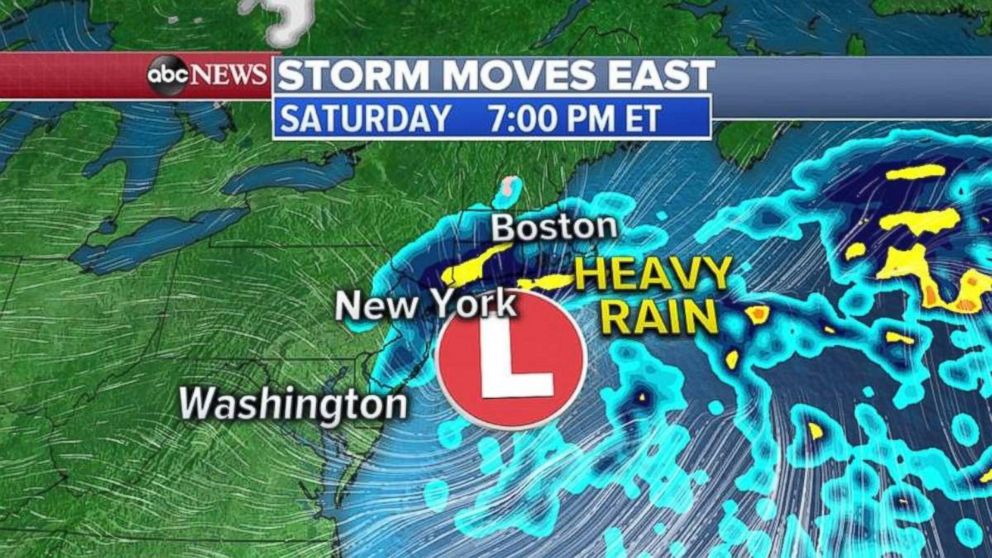
The center of the storm will be located just south of Long Island by Saturday evening and moderate to heavy rain will continue from New York City to southern New England.
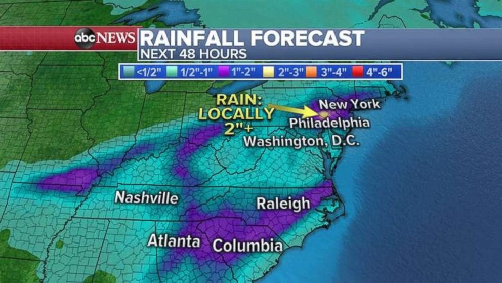
The storm system finally moves away from the East Coast Saturday night and things should dry out for Sunday. Some areas on the East Coast could see 1 to 2 inches of rain, with even more possible locally.


