Storm system bringing snow, ice and thunderstorms from the Heartland to the East Coast
Twelve states are under ice and snow alerts from Kansas to northern New Jersey.
A large storm system in the heartland continues to cause treacherous road conditions for millions with ice, snow and thunderstorms.
Already up to a half a foot of snow fell from Missouri to Michigan causing lots of accidents on the roads.
Up to a half an inch of pure ice accumulated in northern Arkansas yesterday causing trees to fall on power lines there.
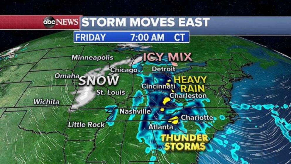
This morning, as this storm lifts north and east, 12 states are under ice and snow alerts from Kansas to northern New Jersey.
Wet snow is falling from Kansas City to Chicago with an icy mix from Michigan to Pennsylvania. Heavy rain is moving through Georgia and up to Ohio.
Friday evening, the storm system moves into the Carolinas with heavy rain and possibly even strong storms and some of these storms could become severe with damaging winds.
By Friday night into Saturday morning, as the storm continues to move further north and east, another round of snow is expected in Chicago and parts of the Great Lakes.
Also Saturday morning, heavy rain with possibly thunderstorms possible for parts of Mid-Atlantic from Virginia to southern New Jersey.
An icy mix will continue from northern New Jersey into Poconos and into western New York state.
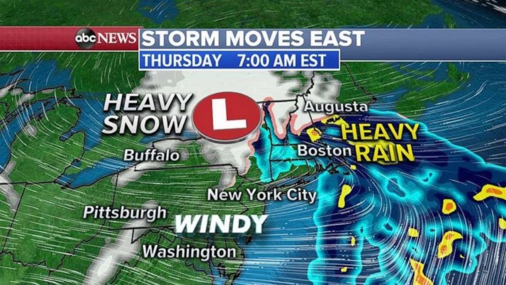
By Saturday late afternoon, an area of heavy rain and gusty winds will move into the I-95 corridor from Philadelphia to New York City with some localized urban street flooding possible.
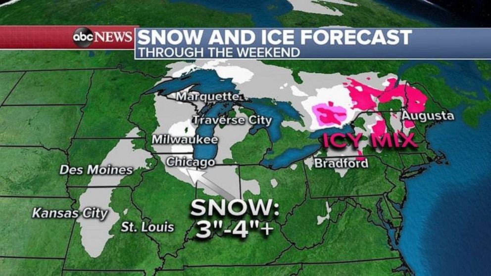
Here is the snow and ice forecast for the Midwest and the Northeast over the next few days. Locally 3 to 4 inches of snow is possible from northern Illinois to southern Wisconsin just outside of Chicago.
In the Northeast, a glaze of ice is possible tonight into Saturday morning from northern New Jersey into Maine.
Related Topics

Popular Reads

ABC News Live