New storm system to travel across South this weekend
It could deliver heavy rain, strong thunderstorms, damaging winds and some snow.
After a relatively quiet Thanksgiving across much of the U.S., the weather pattern is about to turn quite turbulent over the coming days.
A storm system is going to develop this weekend and track across the southern and eastern U.S., possibly creating multiple hazards, including heavy rain, strong thunderstorms, damaging winds and some snow.
The first impacts of the storm are expected on Friday, with areas of heavy rain affecting parts of the western Gulf Coast, from Texas into southern Louisiana. This is forecast to continue for 24 hours.
On Saturday, the storm will start to get more organized with heavy rain, moving onshore to southern Texas and New Orleans, where localized flooding is possible.
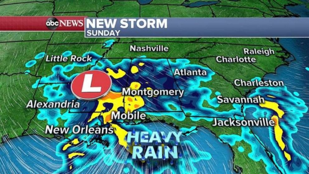
On Sunday, the storm will be moving through the northern Gulf Coast, and heavy rain will spread over much of the South, from Louisiana to Florida. It will then push north, across several southeastern states, bringing heavy rain and the potential for flash flooding.
On Monday, as the storm travels up the eastern U.S., it will be invigorated by a shot of cold air coming in across the Midwest.
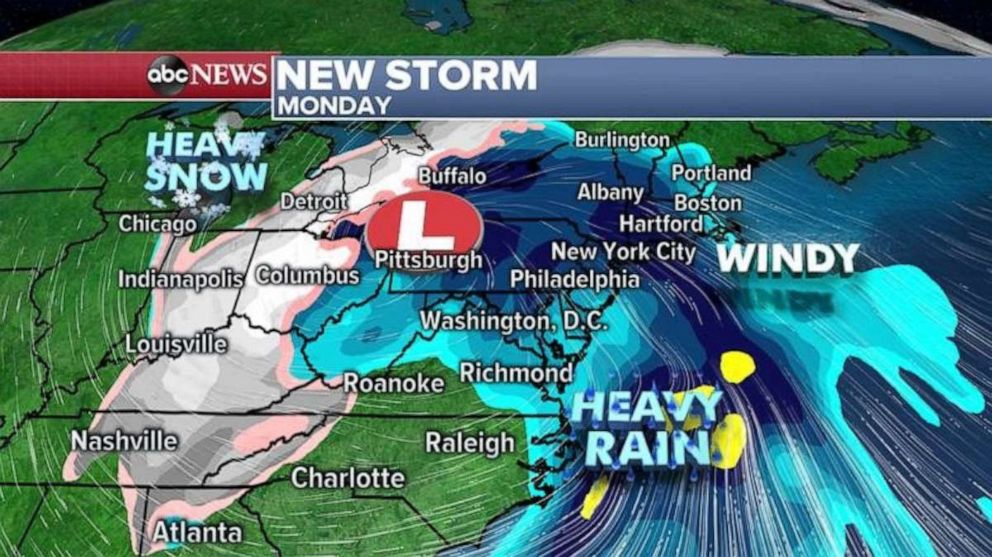
The result on the milder eastern side of the storm will be widespread, with very heavy rainfall likely in the mid-Atlantic. Additionally, some very strong winds will have the potential to mix down from aloft, especially across New England, which could result in some potential for damaging wind gusts, including power outages.
On the colder side of the storm, snow likely will be falling, somewhere from Ohio into Michigan. It's too early to determine the precise location of the heaviest snow.
The main global forecast models are indicating that the storm will be a little slow to move out of the region as it moves into southern Canada on Tuesday and Wednesday, but the storm should weaken during this time period.
The storm should help pull a shot of cold air across much of the central and eastern U.S., with wind chills in the teens expected from Minnesota possibly into parts of Tennessee, Texas and Georgia by Tuesday morning.
The most notable part of this cold blast is how far south the cold air will reach -- it's looking like parts of northern Florida will be seeing low 30s on Tuesday morning.
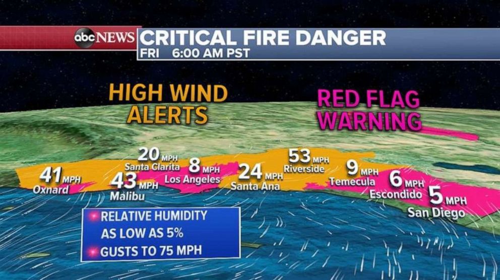
Meanwhile in the Southwest, another day of dry Santa Ana winds is expected on Friday.
A high-wind warning is still in effect across portions of southern California until the afternoon, extending from Ventura to Riverside counties. Wind gusts of over 70 mph have been reported in the mountains.
The gusty winds, combined with dry air, could cause rapid fire spread through the region, possibly causing critical fire conditions today, with red flag warnings in effect across parts of Southern California. The fire threat is strongest on Friday but will linger into Saturday.
Related Topics

Related Stories
ABC News Live