Storms to hit Northwest with strong winds, rain and heavy mountain snow
A series of storms could bring several feet of snow in higher elevations.
— -- A series of storms will affect the Northwest coast this week that will bring heavy rain, strong winds and heavy mountain snow.
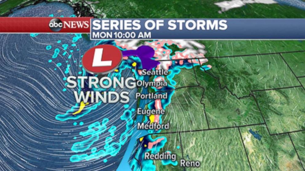
The first storm is bringing heavy rain, some mountain snow and strong winds to parts of the West Coast. The most notable impact will be across parts of the Seattle and Portland metro areas, where strong wind gusts are expected later on Monday. Locally, winds could gust over 50 mph, which could bring tree damage and power outages.
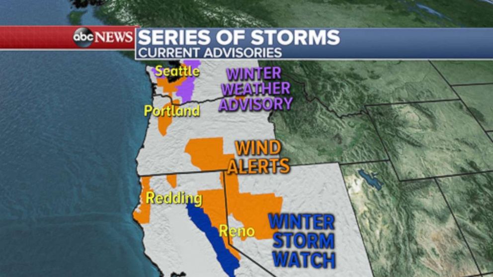
Heavy rain will contribute to some localized flooding through the next few days. Waves off the coast of Washington and Oregon could reach 20-30 feet. Additionally, the system will bring a couple of severe thunderstorms along the Northwest coastline today, which will bring an isolated tornado risk.
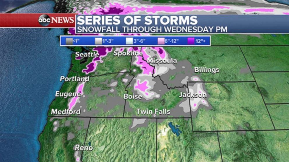
Some of this moisture and mountain snow will make it into Northern California, where locally a half-inch or more of rain is possible through Tuesday. Behind this storm another storm will move into the region on late Tuesday and Wednesday. This next one looks colder and has the chance to bring a more widespread snow event to the higher elevations of the Northwest including the Sierra Nevada, Northern Rockies and Cascades. This period of unsettled weather will bring the possibility of several feet of snow in the mountain passes by the end of this week.
This is the time of the year that the Northwest typically gets several rounds of strong storms.
Wintry mix comes to the Northeast
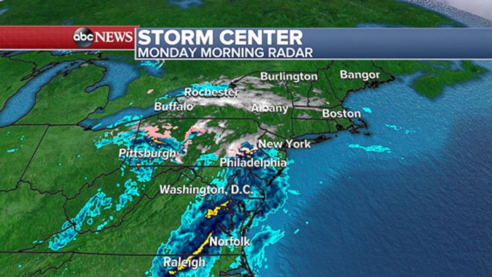
This morning there is a weak disturbance moving through the eastern U.S. A wintry mix and some light snow is currently falling in parts of Pennsylvania, New Jersey and New York. Some of this will move into parts of New England later today.
A winter weather advisory is in effect until 8 a.m. for parts of northwest New Jersey and eastern Pennsylvania. The precipitation is expected to remain light and temperatures will be moderate through the day. Very little, if any, accumulation is likely. The frozen precipitation should stay away from the major urban metro areas of the region. However, it is important to note that these borderline situations can produce slick spots on roadways and subsequently catch drivers off-guard.
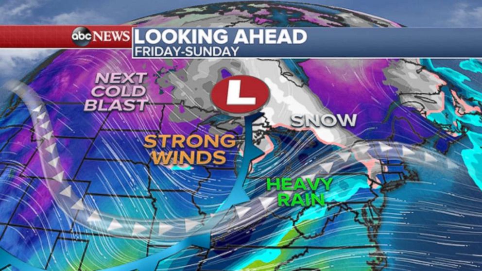
Midwest, Great Lakes and some parts of the Northeast could see snow later this week
There is potential for a more notable storm system later this week that would affect parts of the Midwest, Great Lakes and some parts of the Northeast. Some of the impacts in this region could be strong winds, some snow, heavy rain, and the next blast of colder air. Even though the storm looks moderately potent, there are many uncertainties that remain in the forecast. One of the greatest uncertainties currently will be the track of this system, which will ultimately determine the impact of the sensible weather in the region. The timing of this weather event would be during the late week, potentially Friday through the weekend.
At this point, our most confident forecast is that at least some of this region will be dealing with strong winds and perhaps the first notable lake effect snow of the season. Heavy rain and a subsequent blast of colder air are also possible but it is too early to determine the magnitude or precise location of these impacts.
The weather pattern over the Midwest and Northeast is looking stormy and cold as we head into the week leading up to the Thanksgiving holiday weekend.
Related Topics

Trending Reader Picks
ABC News Live