Tracking Tropical Storm Humberto off the Southeast coast as storms threaten the Midwest and Northeast
The storm is forecast to strengthen, but it should stay offshore.
Tropical Storm Humberto is forecast to strengthen over the next few days but should stay offshore -- preventing significant impacts to the southeastern U.S.
As of Saturday morning the center of Tropical Storm Humberto was about 70 miles east of Great Abaco Island. Humberto has winds of 40 mph and is moving northwest at 7 mph. A tropical storm warning is still in effect for parts of the northwestern Bahamas.
Humberto is expected to continue moving northwest today with a turn north-northwest by Sunday and then a turn northeastward by Monday. Humberto is forecast to strengthen over the next 48 hours and become a Category 1 hurricane by Sunday night.
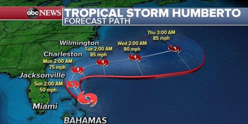
Forecast computer models are showing Humberto bringing periods of heavy tropical rain showers to parts of the Bahamas today. Only a couple of showers look like they will reach the Florida coastline and therefore any notable impacts should be kept to a minimum. Humberto is expected to bring locally 2-4” or more of rain to parts of the Bahamas and 1-2" from Florida to the Carolinas. No significant storm surge is expected in the Bahamas.
As Humberto moves north and eventually turns northeast, some tropical showers may move into parts of Georgia, South Carolina and North Carolina. However, an overwhelming majority of the heavy rain will stay well offshore and therefore rainfall impacts in the southeast U.S. should be kept to a minimum.
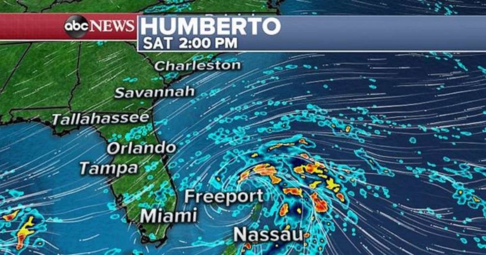
Rough surf and occasionally gusty winds will occur along the Southeast coastline as Humberto moves parallel to the coast.
Meanwhile, there are several other regions being monitored for tropical developments in the Atlantic Basin.
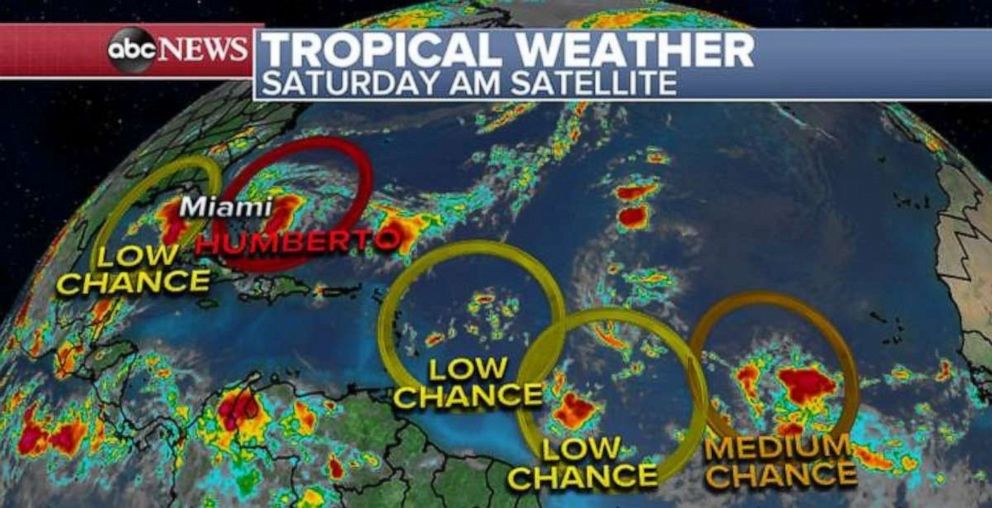
One area over the Gulf Of Mexico will drift westward over the next few days and conditions will become just a little bit more favorable for development next week. There are two different areas well east of the Lesser Antilles that also show some low chance of development next week as those areas slowly move westward.
The most notable tropical wave is about 600 miles southwest of the Cabo Verde Islands. This system will enter favorable conditions for some development in the coming days and will likely become the next depression early next week. It is unclear how this system interacts with the two tropical waves out ahead of it.
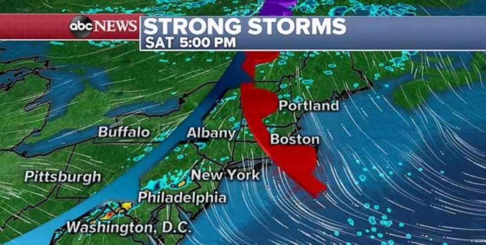
Strong storms are also possible today in parts of the Northeast and Midwest, with gusty winds and heavy rain.
The threat for severe weather is rather marginal today. A frontal system will approach the Northeast later this afternoon and early evening. As it does, it could spark a couple of showers and some thunderstorms. The activity should first fire up from Washington, D.C., to Philadelphia during the early evening hours, and then new activity should develop from New York to Boston during the middle of the night as we head into Sunday. At this time, the widespread severe threat with these storms looks to be rather low.
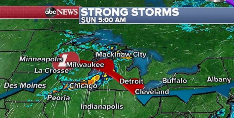
Also overnight into early Sunday, a line of storms should develop in southern Wisconsin and into parts of Illinois and Western Michigan. Once again the severe threat with these storms looks to be rather low, but some gusty winds and heavy rain will be possible.
In the West, temperatures remain 5 to 10 degrees above average across parts of southern Nevada and California as late summer warmth continues to hang on in much of the U.S.
Temperatures will reach into the triple digits today from Vegas to Fresno. There will be an increasing fire danger threat for parts of extreme northeast California and Nevada in the coming days.
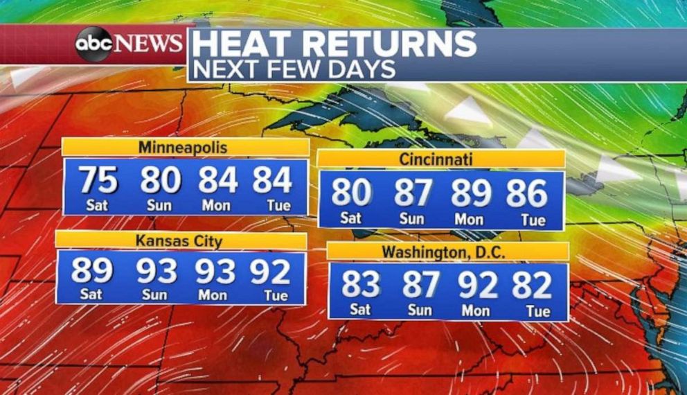
Meanwhile, the heat will make a return to parts of the central and eastern U.S. Minneapolis should reach into the 80s to start the week, and it will be in the 90s in Kansas City, which average a high of 80 degrees this time of the year. Some of the summer warmth with temperatures near 90 will also reach parts of the East from Cincinnati to Washington, D.C., early in the week.


