Warmest air since November expected across parts of US next week
Temperatures will likely soar up to 20 degrees above average.
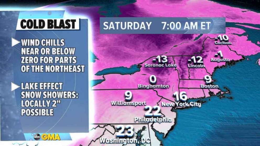
A late winter cold blast is gripping parts of the Northeast Saturday morning.
Wind chills in the Northeast are in the teens and single digits.
In the interior northeast, wind chills are well below zero.
Lake effect snow will be possible Saturday and into Sunday for parts of upstate New York, where 1 to 2 inches of snow will likely accumulate in areas prone to lake effect snow.

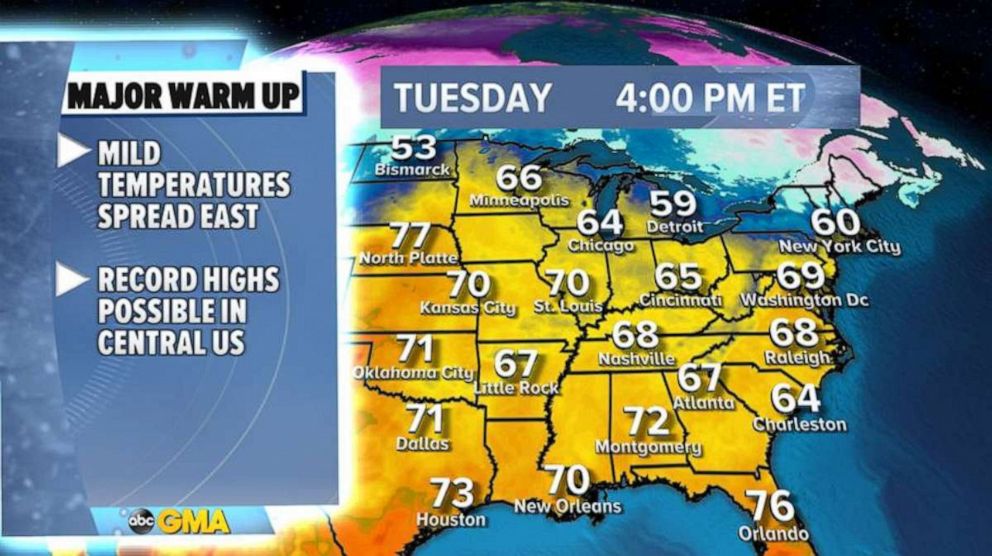
Meanwhile, mild air in the 60s and 70s is building across the Central U.S. Saturday.
Temperatures Saturday afternoon are expected to rise up to 20 degrees above average.

Dry and windy conditions could cause grass fires across the high plains from eastern Colorado to western North Dakota.
Record highs will be possible across parts of the Central U.S. on Monday and Tuesday.
By Tuesday, temperatures into the 60s are likely across major American cities, including Minneapolis, Chicago and New York.

The mild air will stick around at least through the middle of the week.
This will be the warmest air since November from Minneapolis to New York City.

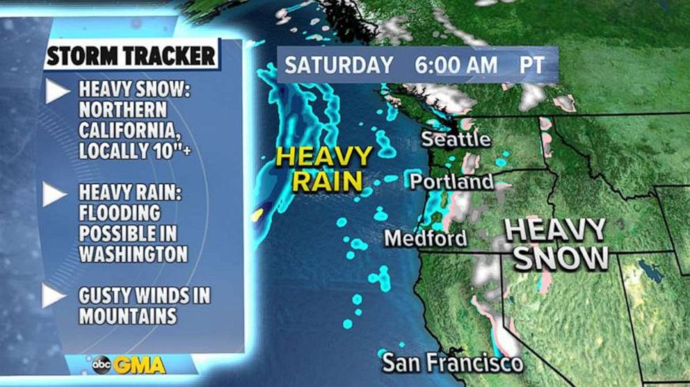
On the West Coast, some unsettled weather will persist through the weekend.
The main impact will be some heavy snow in mountains, especially in Northern California where over 10 inches of snow could fall.
Some flooding may occur across the Oregon and Washington coasts. It will remain rather quiet weather-wise across much of the country until at least the second half of next week.


