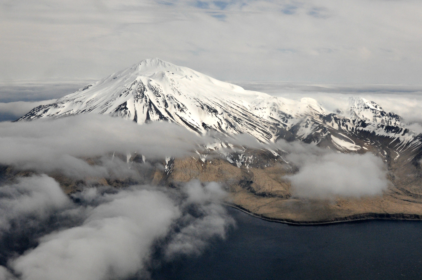
Western Alaska Prepares During Calm Before Typhoon Nuri
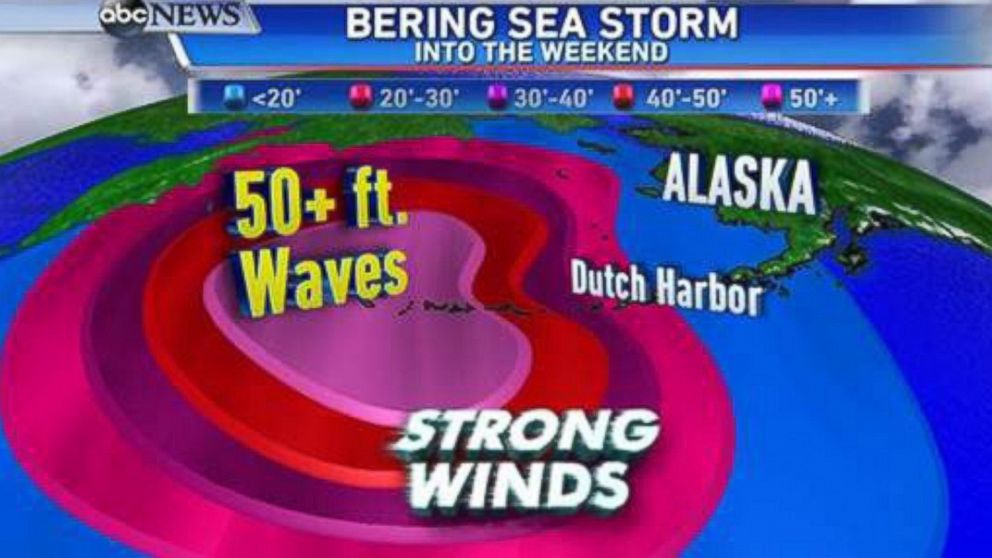
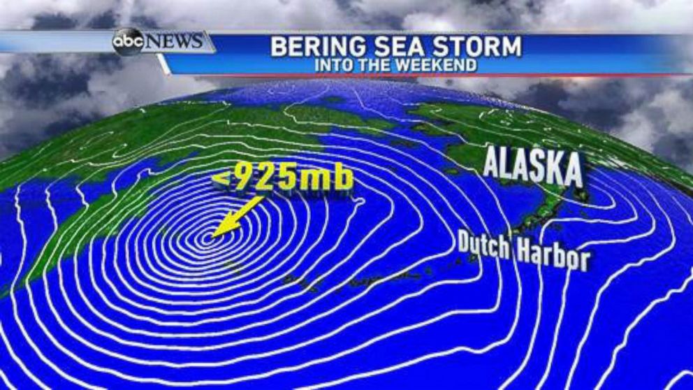
Mariners around the Aleutian Islands brace themselves for 50-foot waves.
— -- Sig Hansen, captain of the fishing vessel Northwestern, featured in the television series "Deadliest Catch," told ABC News that folks in Alaskan waters are bracing themselves for what Typhoon Nuri's remnants may bring, including 50-foot waves.
The harsh weather may hit the Aleutian Island chain in Alaska as early as Friday. Hansen has been fishing King Crab, northeast of Dutch Harbor in the Bering Sea, about 300 miles away.
"Right now, the weather's decent. We've been watching the weather reports, and so that's what's got us kind of skittish," he said. "We've had other reports coming in, which are very strange, like 25-knot winds with 30-plus foot [waves]. It's just very uncommon, so you know something's coming. It's just a warning sign for now. We're just on pins and needles here."
"We're just keeping our fingers crossed that it doesn't push in a more easterly direction, and bring those 70-knot winds this way," he said. "Right now, we're at battle stations. In other words, we need about a 24-hour notice to get our boats, our gear, and get onto shore. You don't want to be out here."
"From what I'm hearing, we haven't been through anything like that before, at least not in my lifetime," he said. "And I don't want to. We've seen 50-foot waves, we've seen 120-knot winds. I've been out in stuff like that. But the difference is, if it's going to hit here with that kind of power, you don't know the frequency of the waves. We don't know how it's going to affect the ocean differently. I don't want to stick around to find out."
Kip Wadlow, U.S. Coast Guard spokesperson in Juneau, Alaska, said emergency crews are standing by with helicopters and a 378-foot cutter. The emergency crews were already ready for duty to assist with the crab fishing season.
"These assets are standing by to provide assistance if called upon. We are working with federal and state tribal partners to keep an eye on the storm," Wadlow said.
Jeremy Zidek, from Alaska's division of homeland security and emergency management, has warned communities about possible weather dangers along western Alaska, including many native tribes and the Alaska Village Council Presidents.
"Because they are small, remote communities, they are in tune with the weather and folks are taking precautions and taking steps to protect people in those communities," Zidek said.
Zidek said emergency services generally don’t warn people to evacuate these small communities, because the distances to travel may cause greater dangers than taking shelter in place.
"This is a normal way we go about handling these storms in Alaska," he said.
In many of these small communities, the local school is the hub.
"People will go up to the school, which is normally built on higher ground with backup systems. In some communities of maybe 120 people can fit in the school and they are a tight-knit community," Zidek said.
Chris Plaisance of seafood company UniSea Inc., said his colleagues in the city of Unalaska, Alaska, near Dutch Harbor are protected by nearby mountains.
"We should not experience winds much more than 40 miles per hour to hit this weekend. It sounds like the islands that are farther west will take the brunt of the storm," he said.
Clarification: Alaska is preparing for remnants of Typhoon Nuri. The system is no longer a typhoon.

Trending Reader Picks
ABC News Live