Western storm brings heavy rain, snow to center of country; East continues thaw
Temperatures will continue to rise in the East as the week ends.
— -- As Southern California continues to dig out from deadly mudslides and flooding, the only good news is that the storm is over and has left the state.
The highest rainfall total in San Bernardino County was 7.69 inches in the last 48 hours, while Ventura County saw as much as 5.9 inches.
The storm is moving west on Wednesday morning. Ahead of the storm, more than a dozen states from Arizona to Wisconsin have wind and snow alerts as the storm moves across the country.
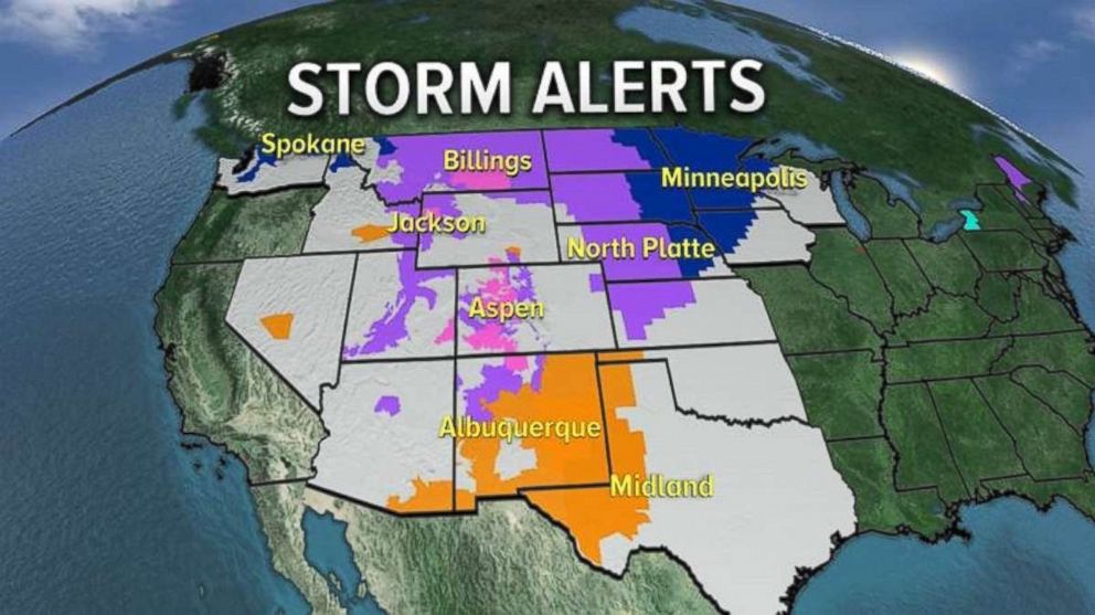
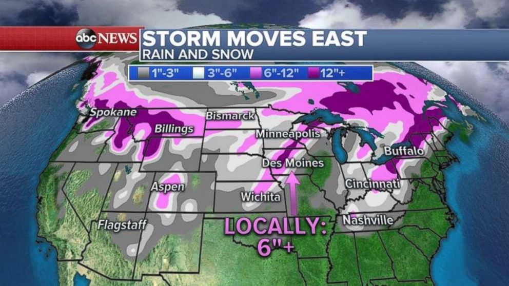
The storm is moving through the Rockies on Wednesday morning, and is expected to strengthen as it moves into the Great Plains.
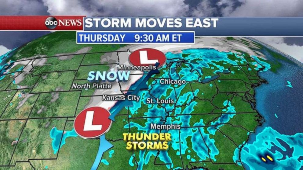
By Thursday, the storm system will move into the Mississippi Valley with snow for the Northern Plains and thunderstorms with lightning and gusty winds for the mid-Mississippi Valley and the Deep South.
The storm system picks up moisture from the Gulf of Mexico and the Atlantic by Friday, bringing heavy rain to the East Coast from the Carolinas to Maine. Some flash flooding is possible.
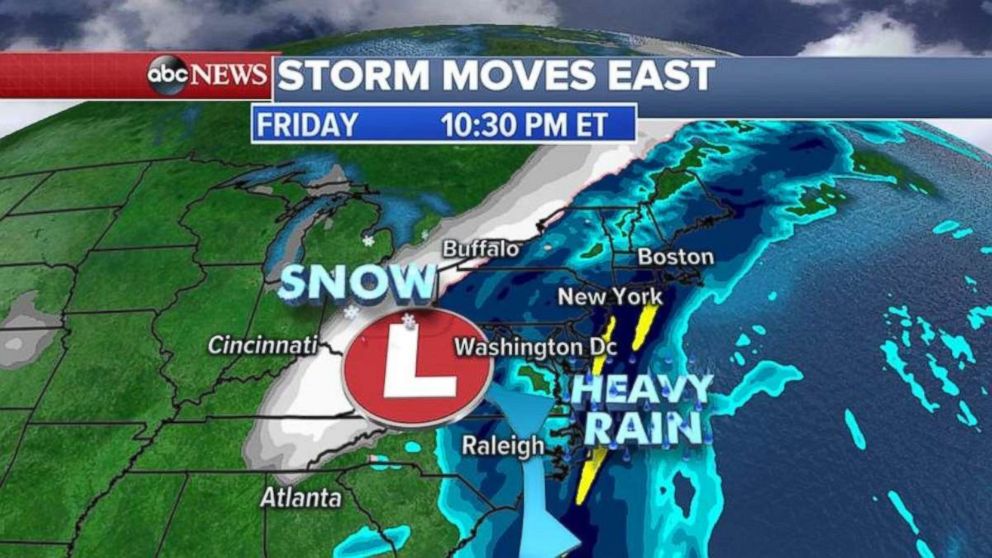
Behind the storm system, much colder air will turn any leftover precipitation into snow. Snowfall totals could surpass half a foot from the Rockies into the Midwest and eventually inland in the Northeast by the weekend.
January thaw continues in East
Snow and ice continues to melt in the Midwest and the Northeast Wednesday as above normal temperatures continue for the regions.
Forecast highs will be near 50 from Chicago to Detroit today, about 15 to 20 degrees above normal.
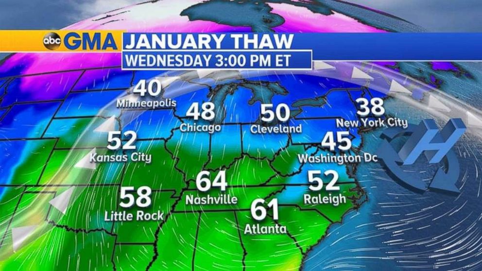
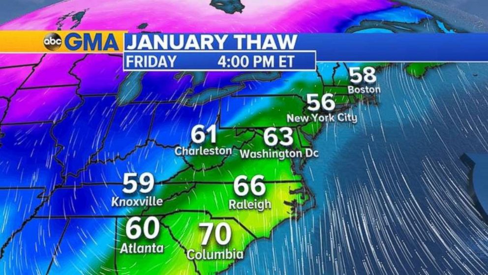
The warmth moves into the Northeast by Friday, accompanied by very heavy rain.
Temperatures in the 50s and even 60s are possible from Washington, D.C. to Boston on Friday. These temperatures are 15 to 20 degrees above normal for January.
