Winter storm watch in place for Northeast as snowstorm arrives Saturday
The region is expecting its first noteworthy snowfall of the season.
— -- The Northeast is about to taste its first snowfall of the season this weekend.
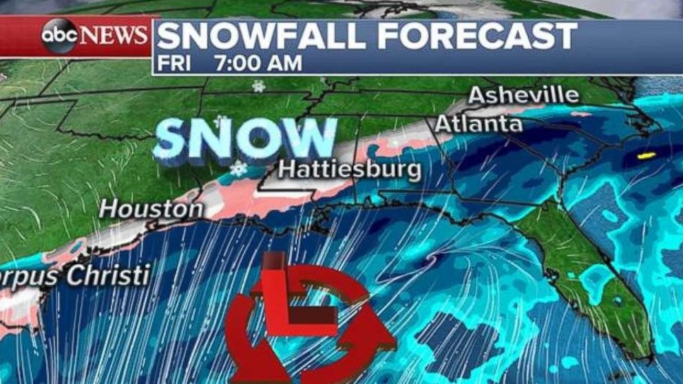
A storm system is developing in the Gulf Coast on Friday morning, and is expected to track northeast into Georgia and the Carolinas by Friday night.
A swath of accumulating snow is expected from Louisiana to Mississippi, Alabama, Georgia and the Carolinas.
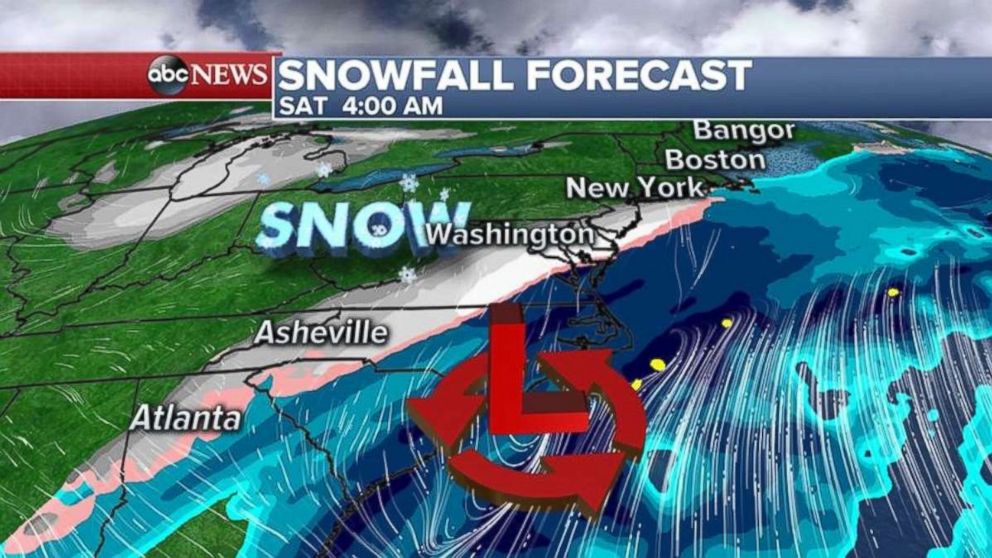
The storm system will move up the East Coast and spread snow from Virginia to New York early Saturday morning.
The heaviest snow should be flying along the I-95 corridor during the late morning on Saturday into the early afternoon as the storm system moves east of New Jersey.
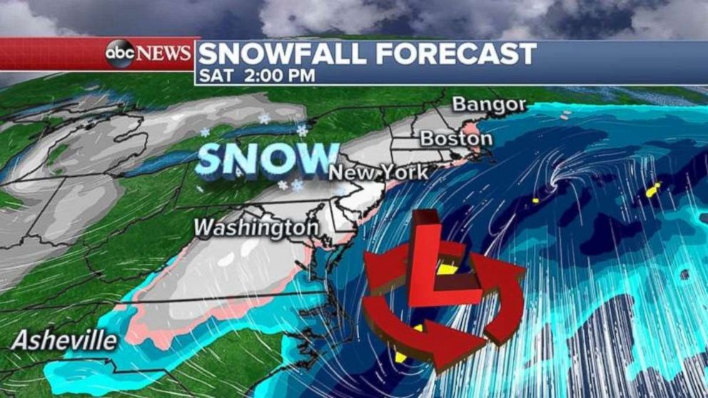
The snow should be moving out of the Northeast Sunday morning.
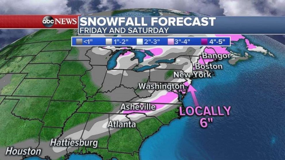
Snow accumulations will be anywhere from 1 to 3 inches from Alabama to Georgia and into the Carolinas.
Up to 6 inches of snow is possible from southern New Jersey to Connecticut and eastern Massachusetts. Philadelphia should see a couple of inches, while New York City receives 2 to 4 inches and Boston sees 4 to 6 inches.
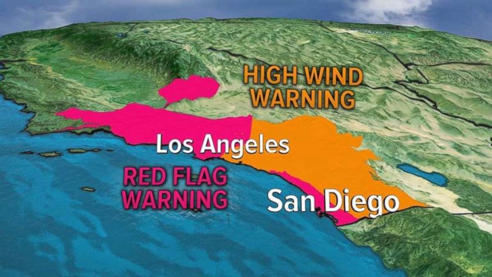
Santa Ana winds continue
Winds gusted to over 50 mph in San Diego County yesterday, spreading two new wildfires. Winds gusted to 88 mph in the mountains of San Diego County.
The National Weather Service has extended red flag warnings for Southern California through Sunday as the dry, gusty Santa Ana winds will continue.
Relative humidity is expected to be as low as 5 percent in Southern California.
This morning, the winds are a little lighter, but the region could still see gusts near 30 mph in spots.
Gusty off-shore winds are expected to continue Saturday at 20 to 30 mph with local gusts near 60 mph in the mountains.
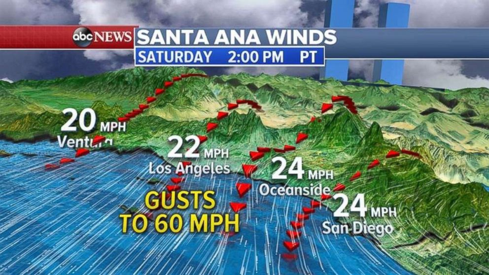
Santa Ana winds will continue to gust on Sunday near 25 mph along the coast with higher gusts near 60 mph in the mountains.
Related Topics

Related Stories
ABC News Live