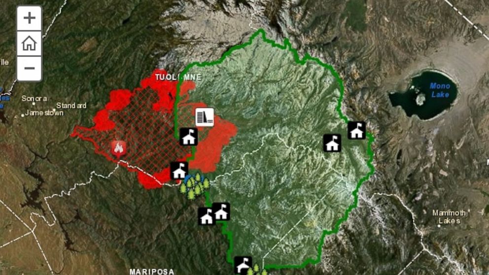
INFOGRAPHIC: Tracking the Yosemite Wildfire
ByABC News
August 30, 2013, 12:40 PM

ESRI
Aug. 30, 2013— -- The sixth largest wildfire in California’s recorded history continues to burn around Yosemite National Park.More than 200,000 acres have already been destroyed since the fire began two weeks ago, California fire officials say.
Where did the fire come from and what's being threatened by its path? Check out this interactive map created by ESRI, a Fusion Investigative partner.


