Deep freeze with subzero temps hits Northeast and Midwest as West Coast braces for heavy rain
The West Coast is also bracing for a storm that will bring heavy rain.
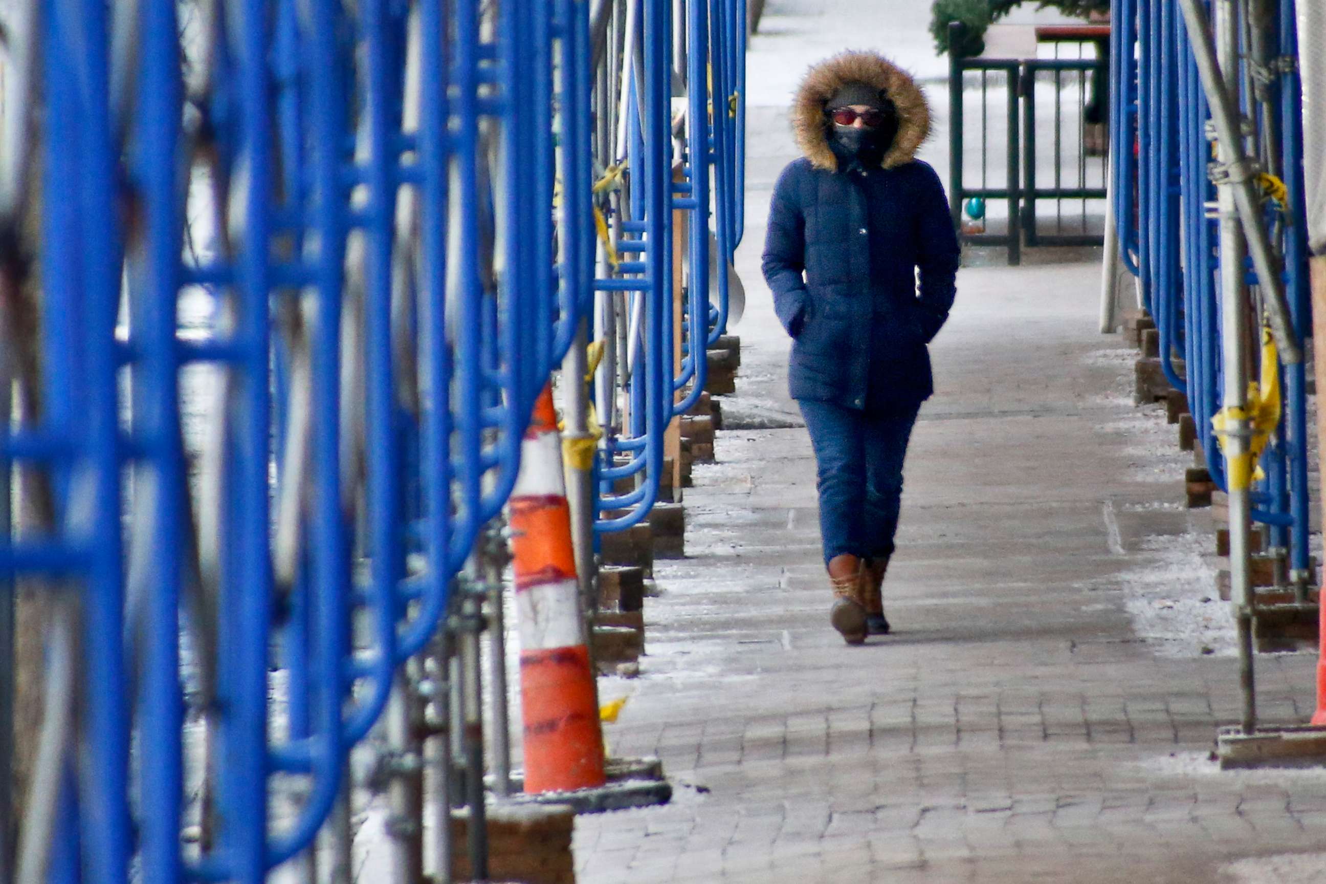
— -- The unrelenting freezing temperatures in the Northeast and Midwest aren't letting up today.
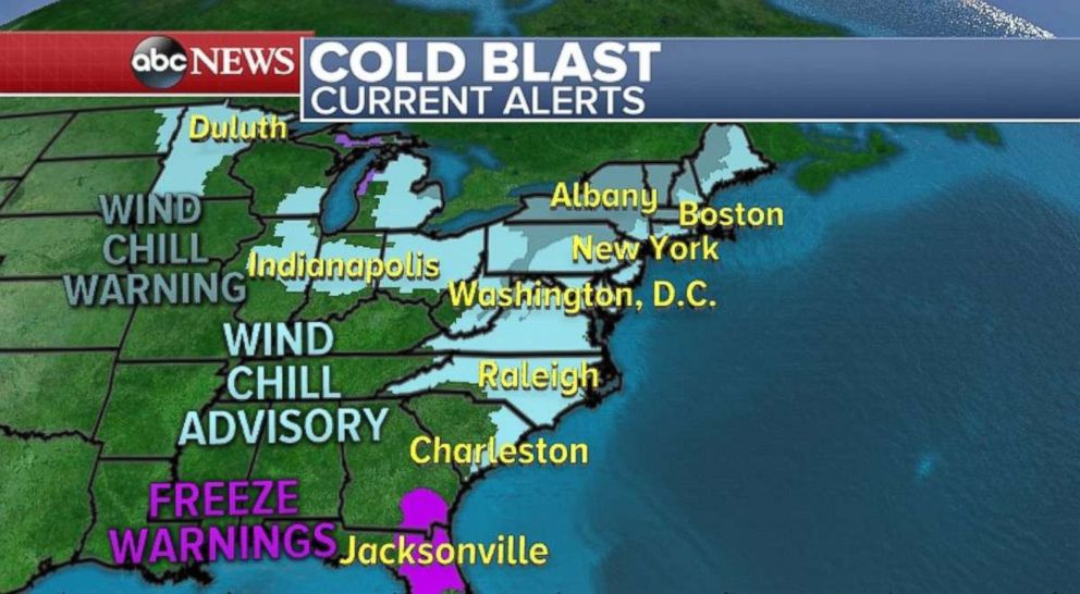
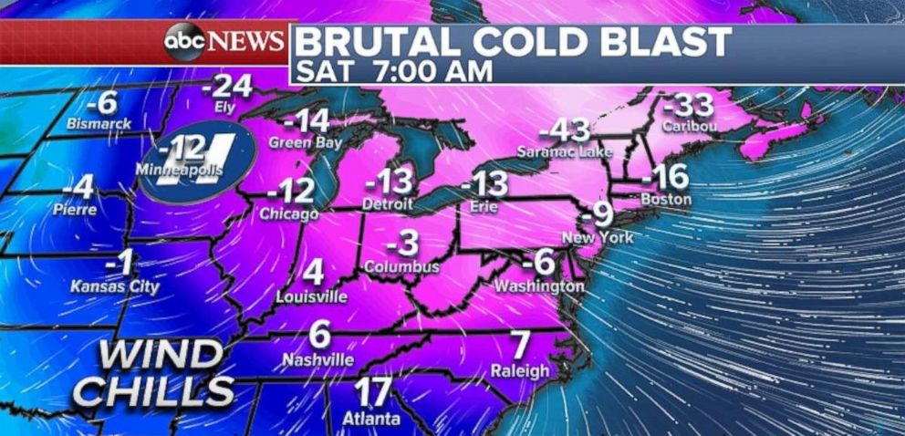
A brutal shot of cold air is dominating the weather over the eastern half of the country, prompting a slew of wind chill advisories and warnings for parts of the Midwest and a large portion of the East Coast, from Virginia to Vermont.
Wind chills this morning were forecast to fall to minus 16 degrees in Boston; minus 9 degrees in New York City; minus 12 degrees in Chicago; 17 degrees in Atlanta; and 7 degrees in Raleigh, North Carolina.
Aside from being uncomfortable and disruptive, the low wind chills in the Northeast can be life-threatening, with frostbite possible in as little as 10 minutes of exposure.
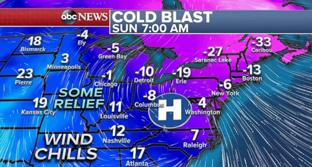
On Sunday, the Midwest will begin to see some relief with less severe wind chills. The Northeast, however, will continue to remain quite cold with dangerous wind chills below zero.
The wind chill is expected to be minus 6 degrees in New York City on Sunday morning, and minus 13 degrees in Boston, while it will likely warm up to minus 1 degree in Chicago and 19 degrees in Kansas City.
Sunday is set to be New York City's 13th straight day below freezing
New Yorkers may already have forgotten what above-freezing temperatures feel like: The last time the metropolitan area was above freezing was Christmas Day. Sunday is forecast to be the 13th straight day below freezing, which would tie for the third-longest stretch ever of temperatures below 32 degrees in New York City and would be the longest stretch since January 1961.
A record in Raleigh
Even in Raleigh, North Carolina, the cold blast is breaking a record. If Raleigh does not warm to above freezing by Saturday evening it will have a new record for number of consecutive hours below freezing. The old record, from January 1982, is 159 hours.
Relief is coming next week
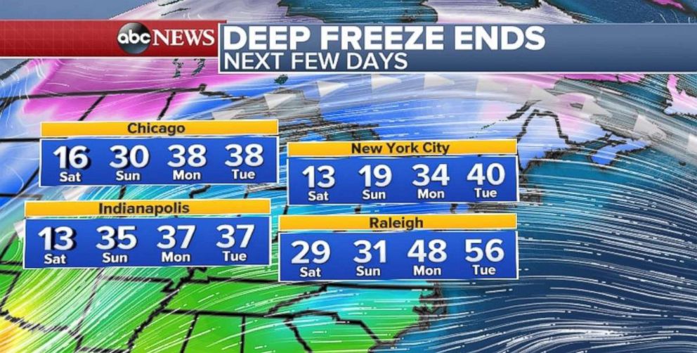
But a pattern change is lurking over the next few days: Relatively milder air will slowly expand eastward and temperatures are expected to finally rise above freezing in much of the Midwest and Northeast, including Chicago, New York City, Indianapolis and Raleigh. In fact, it will be nearly 30 degrees warmer in parts of these regions by Tuesday.
At the end of the upcoming week, there are higher probabilities for above-average temperatures for the Northeast.
Looking ahead toward the latter part of the month, the long-term forecast suggests a January thaw will be coming for much of the country.
Rain heading to the West Coast
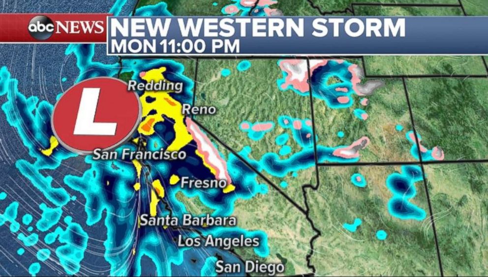
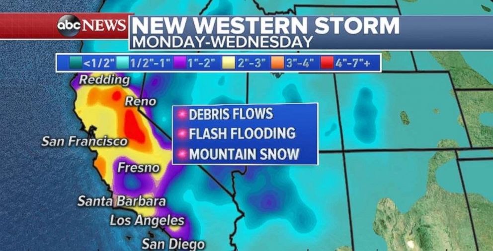
As for the West Coast, there is growing concern over a new storm that is heading towards California from Monday through Wednesday. This could be a potentially dangerous situation with heavy rain. There's also a concern that the storm could cause debris flows in recent burn areas in Southern California.
A weak disturbance will continue to move through parts of the West today. Another storm will develop over the Pacific Northwest and impact the region on Sunday.
The next significant weather concern comes from a storm system developing in the Pacific. The storm will carry a good deal of precipitation towards all of California form Monday to Wednesday.
The primary concern is the onslaught of rain that is coming for the lower elevations and hillsides. A potentially dangerous situation will develop across the burn areas of the Thomas, Creek and La Tuna burn areas in Southern California. Locally, 2 to 4 inches of rain will be likely with high hourly rainfall rates.
This storm will bring a good amount of mountain snow, which will hamper travel in the mountain passes.
Central US forecast
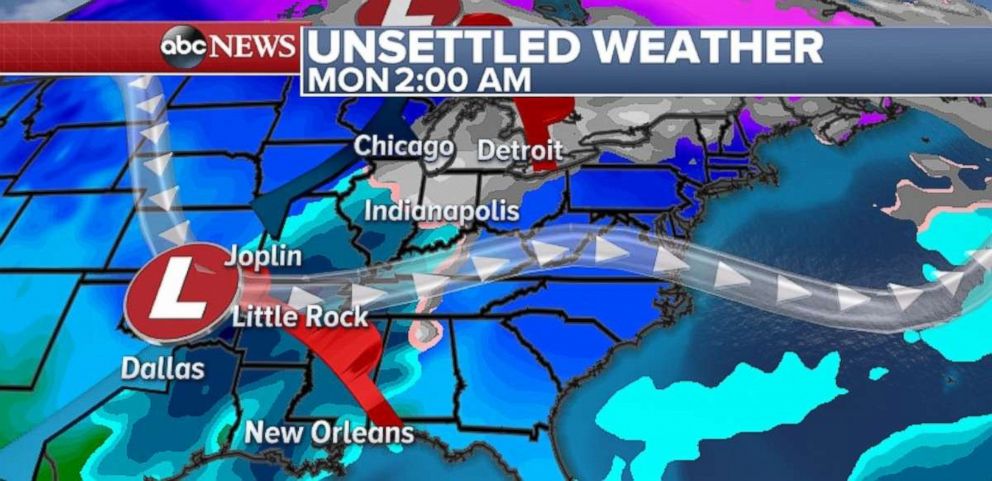
As for the central United States, out ahead of a weak system developing in the region, there is a chance for some freezing drizzle across much of Missouri and western Illinois on Sunday.
As the system develops late Sunday into Monday, some light snow will track towards the Great Lakes Region.
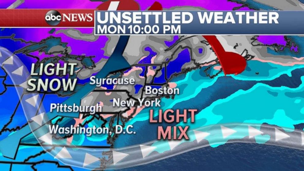
By Monday, the precipitation will move to the Northeast with light snow and a light wintry mix possible.
At this time, no accumulation appears to be significant for the central U.S. However, light wintry precipitation can hamper travel locally.
Related Topics

Popular Reads
ABC News Live