Hurricane Outlook for 2016 Atlantic Season
Meteorologists are expecting a near-normal hurricane season.

— -- U.S. meteorologists are predicting more tropical activity this year compared to recent years but expect the summer hurricane season to be near-normal levels.
The National Oceanic and Atmospheric Administration (NOAA) said there is a 70 percent likelihood that there will be 10 to 16 named storms this season (winds of 39 mph or higher), of which four to eight could become hurricanes (winds of 74 mph or higher). In a "normal" year, there are 12 named storms, six hurricanes and two to three major hurricanes, NOAA said.
This is one of the toughest hurricane season outlooks ever made due to the abundance of atmospheric variables, said Gerry Bell, lead seasonal hurricane forecaster with NOAA's Climate Prediction Center.
The most influential variable would be the AMO (Atlantic Multi-Decadal Oscillation). This pattern is characterized by cooling and warming of water temperatures in the Atlantic and intensity of the monsoon season over West Africa. If the Atlantic water temperature is warmer than normal and the monsoon season in West Africa is active, this pattern tends to produce more tropical systems in the Atlantic Basin. If the reverse happens, it tends to yield toward below-normal hurricane season. These patterns can last over 20 years.
Another important variable this upcoming hurricane season is the fading El Nino and forming La Nina. El Nino tends to suppress tropical activity in the Atlantic and La Nina does the opposite. This year, there is a 70 percent chance that La Nina will form by the end of this summer and early fall. Coincidentally, August, September and October happen to be the average peak of hurricane season, with 90 percent to 95 percent of tropical storms forming during this period.
Finally, even if a tropical system forms in the Atlantic Basin, small scale atmospheric conditions and patterns have to be just right for it to make landfall in the United States. Last time a major hurricane (winds 111 mph, Category 3 or higher) made landfall in the United States was in 2005. During 2003, 2004, and 2005 seasons, there was a persistent area of high pressure over the Southeastern U.S. pushing any formed storms in the western Atlantic toward the US's East and Gulf Coasts. But in the recent years, we had a persistent area of low pressure pushing storms away from the U.S. These small scale, short term patterns can be only forecasted a couple of weeks in advance, making the entire hurricane season forecast that much more difficult.
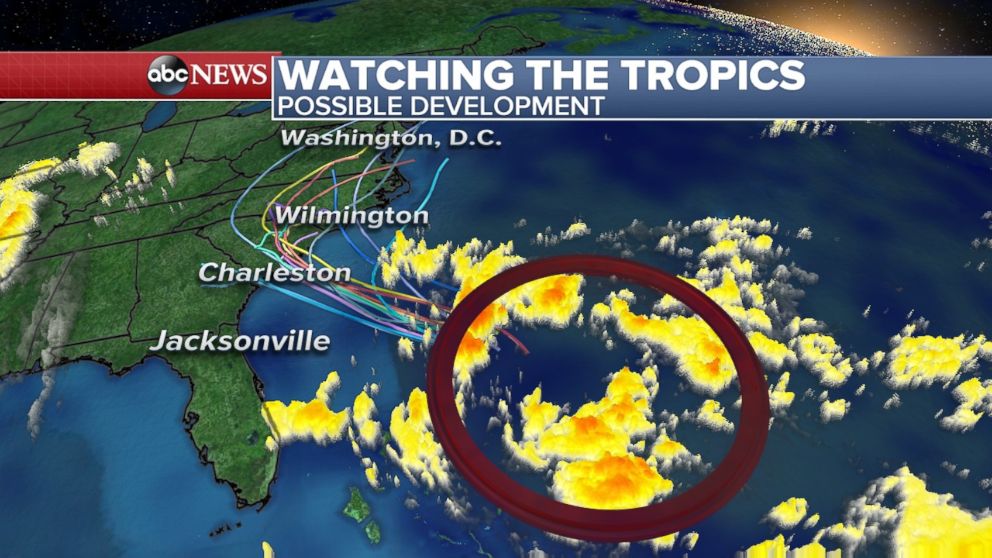
Hurricane season doesn’t officially start until June 1, but we are already tracking a tropical system that could affect parts of the Eastern U.S. It is likely to become the named storm “Bonnie” over the next 24 hours, if not sooner. Even though this system is forming before the official start to the Atlantic Hurricane season, it does not mean that this has never happened before or that is unusual. NOAA officials are warning anyone that lives or is traveling to Georgia or the Carolinas this Memorial Day weekend to monitor the forecast for updates.

Top Stories
ABC News Live