Midwest, Northeast brace for more snow as major storm heads for West Coast
April snow continues for the Midwest and Northeast as a storm forms out West.
Stormy and cold weather will continue for the Midwest and Northeast through the weekend, with more snow expected.
Record lows were reported on Wednesday in Omaha (13 degrees), Kansas City (17 degrees) and Sioux City (7 degrees).
An active jet stream is moving from west to east, with cold air in place to the north, creating a perfect setup for even more snow.
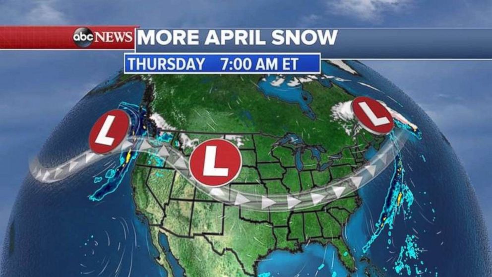
Two storm systems are expected to dump snow from the Midwest into the Northeast, with severe weather again possible in the Southern Plains.
The first storm, beginning today and continuing into tomorrow, will be moving from the Midwest into the Northeast with mixed snow and rain. Areas from the Great Lakes into the Northeast could see a few inches.
Meanwhile, the second system will be developing in the Southern Plains, potentially packing damaging winds, hail and tornadoes on Friday.
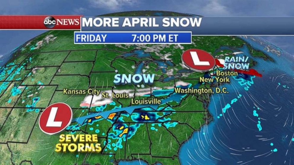
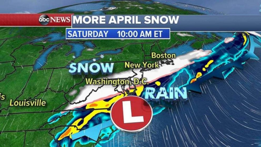
In anticipation of the second storm moving east, a winter storm watch already has been issued for the Ohio Valley for Friday night into Saturday. That region could see as much as 6 inches of snow.
This system will swing east and could bring accumulating snow to the mid-Atlantic and Northeast regions.
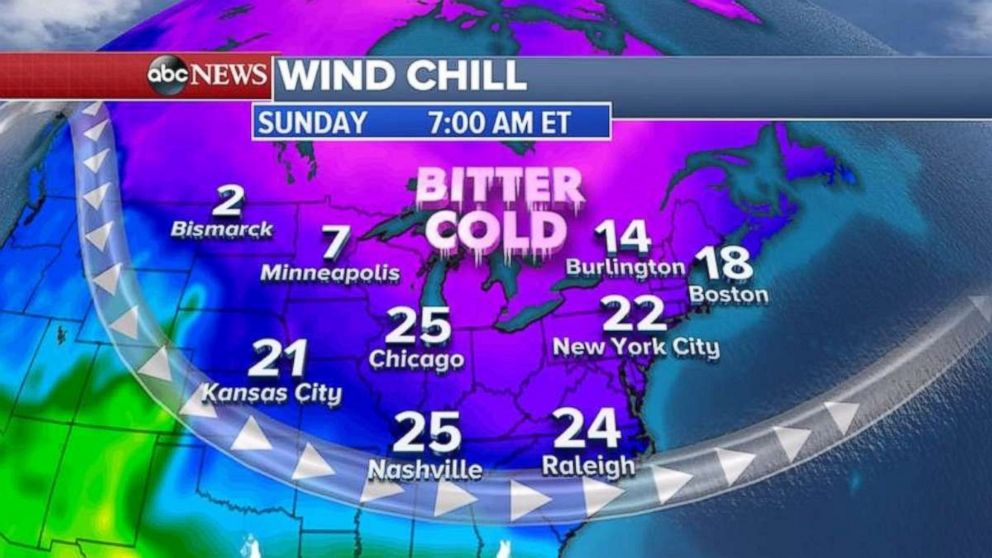
Following the storm will be more bitterly cold air, dropping Sunday-morning wind chills from the Midwest into the Northeast into the teens or single digits.
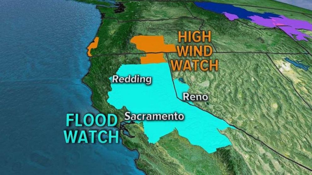
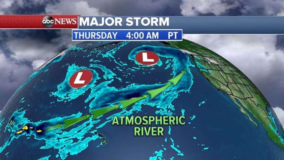
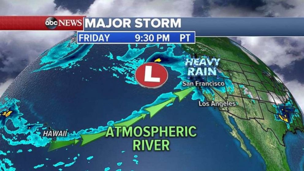
A one-two punch heading for the West Coast has extended itself all the way from Hawaii. Consequently, flood and wind watches have been issued up and down the West Coast, particularly for Central and Northern California.
This morning, two storms are riding the Pacific Jet and ready to smash the West Coast.
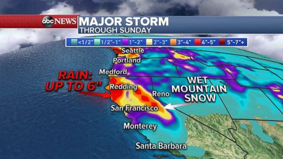
California, Oregon and Washington can expect significant rainfall today and into tomorrow, with the heaviest precipitation in the central and northern parts of California. This will continue into Saturday.
Rainfall could reach half a foot in certain parts of California, with as much as 3 inches in the Bay Area. Higher elevations could see some snow.
Related Topics

Popular Reads
ABC News Live