Severe weather, flash flooding threaten millions in central US
Heavy rain will move through the central U.S. on Tuesday.
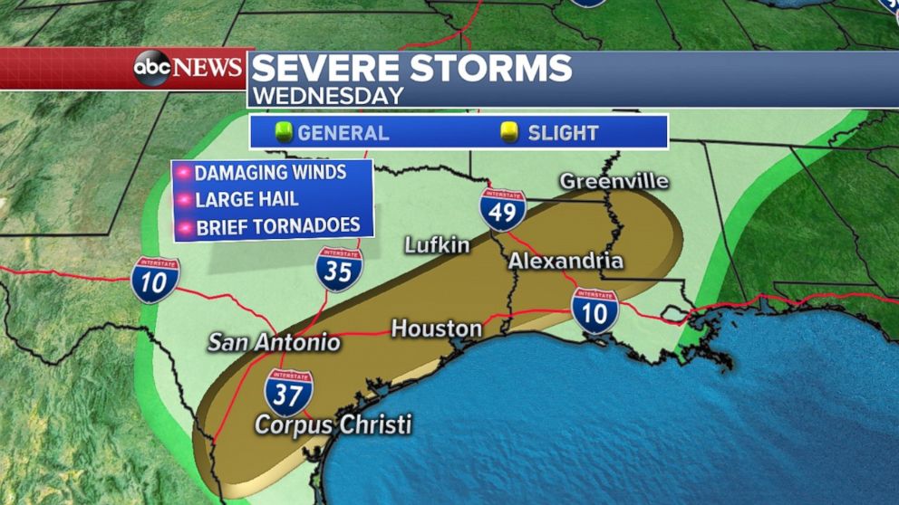
Over 20 million Americans from Texas to Alabama are at risk for severe weather through Thursday as a storm system moves through the central U.S. over the next few days bringing several rounds of heavy rain.
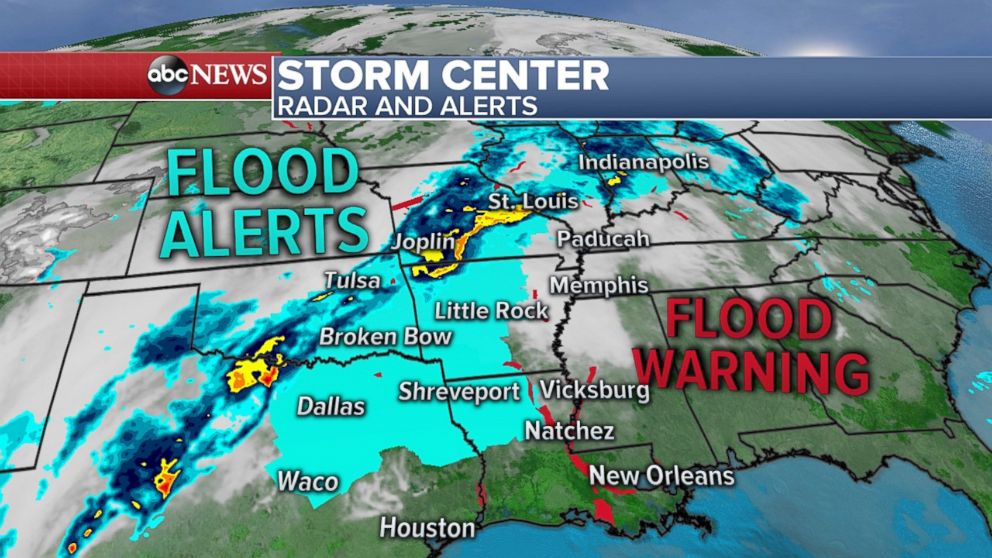
An additional 20 million Americans are at risk for flooding from Texas to Indiana, where flash flood watches have already been issued.
There were nearly 25 reports of large hail -- 2 inches in diameter -- on Monday across parts of western and central Texas on Monday. Today, the risk of severe threat weather slides toward the major Texas cities in the I-35 corridor: San Antonio, Austin, Waco and Dallas. Damaging winds and large hail are the main threat.
And now it is looking like the severe weather risk will return to parts of the Deep South on Thursday, with the potential for strong to severe storms in parts of Mississippi and Alabama.
Thunderstorms and heavy rain will develop ahead of the core of this storm system. The storms are expected to become widespread and slow moving over the next few days across the Mississippi River Valley and into parts of the Midwest. Due to the slow-moving nature of the storms, rainfall will be intense and potentially long in duration making flash flooding a serious concern.
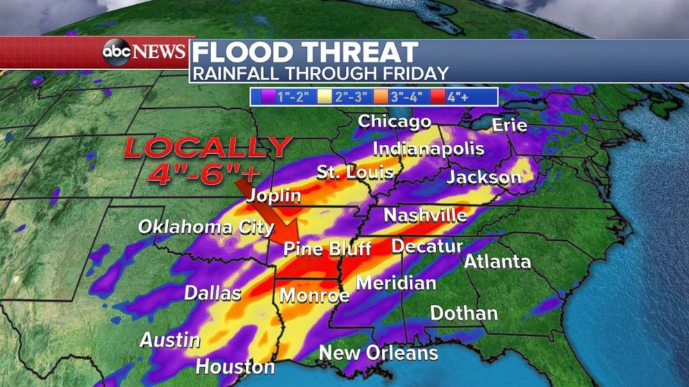
The greatest risk for excessive rainfall Tuesday will be in northeast Texas and much of Arkansas. Tomorrow, the threat nudges slightly south and east into northern Louisiana, southern Arkansas and western Mississippi. Locally, 4 to 6 inches of rain is expected in parts of this region.
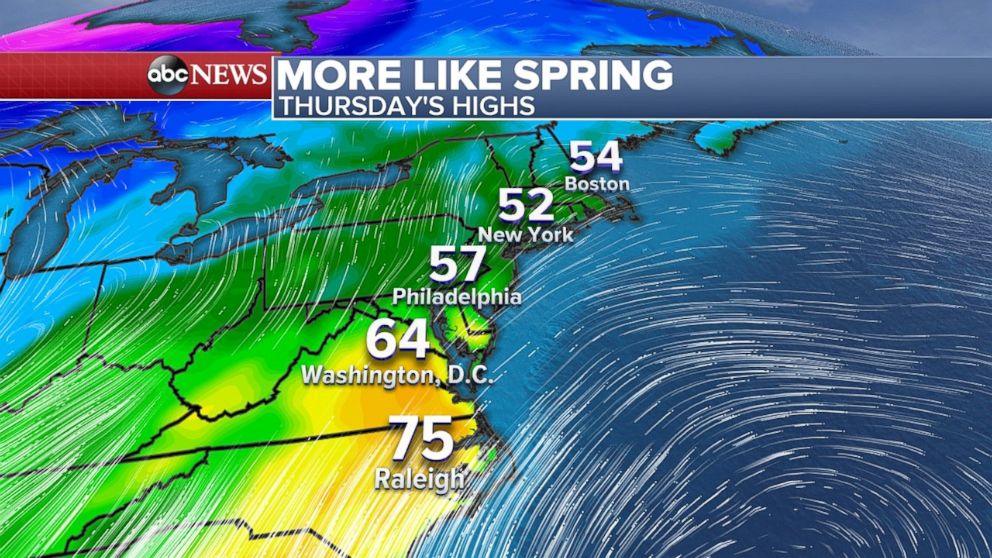
Signs of spring in the East
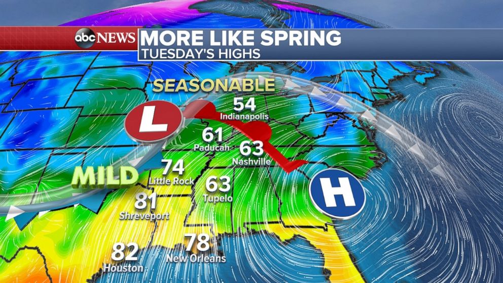
Temperatures on Tuesday are expected to be nearly 10 degrees above average in eastern Texas and Louisiana.
By Thursday, some of this mild air makes it to the Northeast. There is some indication, that the core of the mild air will struggle to make it all the way to New England. Nevertheless, more seasonable temperatures will arrive at the end of the week for the Northeast.
The beginning of April is looking a little cooler than average for much of the country. The highest likelihood of below-average temperatures will be in the Northern Plains and upper Midwest.
Related Topics

Popular Reads
ABC News Live