Widespread severe weather expected from Texas to Virginia
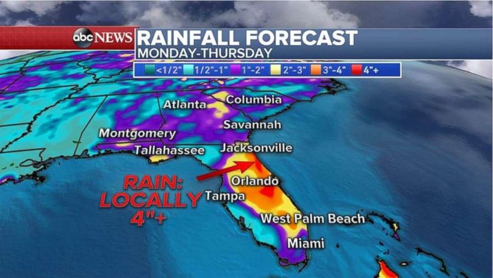
Florida is expecting heavy rain this week too.
Severe weather this weekend brought more than 100 damaging storm reports from western Texas to the mid-Atlantic. Storms are expected to continue in the eastern U.S. for the next few days.
Winds of more than 60 mph produced damage in Pennsylvania Sunday, uprooting trees and destroying some buildings. Meanwhile, hail the size of baseballs covered the ground in Texas Panhandle. Earlier this morning, an EF-0 tornado, with winds up to 80 mph tore through Palm Beach County, Florida.
A stormy pattern from the Great Plains to the Northeast will continue for the next couple of days as a stalled frontal boundary remains in place. Several atmospheric impulses will move along this frontal boundary over the next two days increasing the chance for severe thunderstorms.
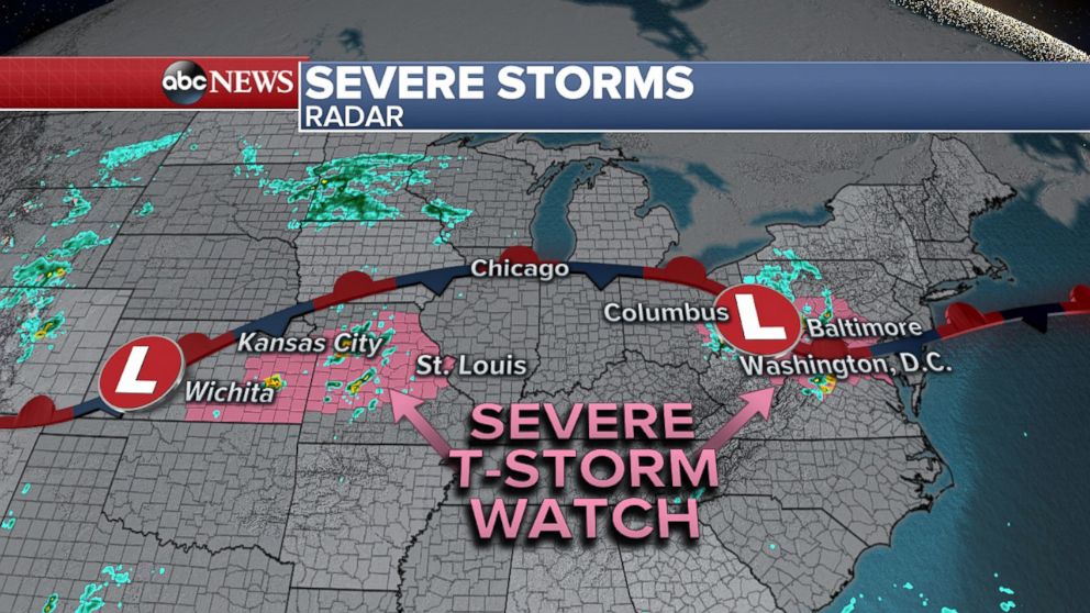
A severe thunderstorm watch has been issued for parts of the Mid-Atlantic, including Washington, D.C., and Baltimore through 9 p.m. EDT. Strong to severe storms will quickly evolve into a squall line that will progress east, then southeast, across the Central Appalachians toward the Chesapeake Bay. Widespread damaging wind gusts of up to 75 mph will be the primary hazard with this line of storms. Isolated large hail or a brief tornado is also possible, but the threat is lower. A severe thunderstorm watch has also been issued for parts of Kansas and Missouri, including Wichita, Kansas City and St. Louis through 10 p.m. CDT. Primary threats will be scattered storms capable of severe wind gusts and large hail.
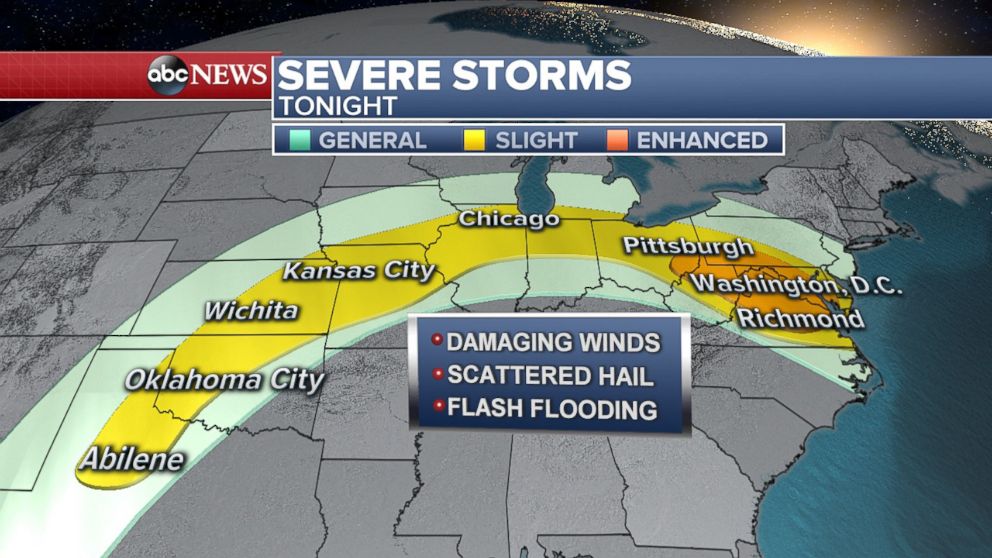
Forty-eight million Americans are in the severe storm zone tonight from Texas to Virginia, including cities such as D.C., Baltimore, Chicago and Kansas City. Severe storms are possible today across this area. A few strong winds gusts, isolated large hail and flash flooding are all possible. The tornado threat is pretty low, but can’t be ruled out any time there is a severe weather threat.
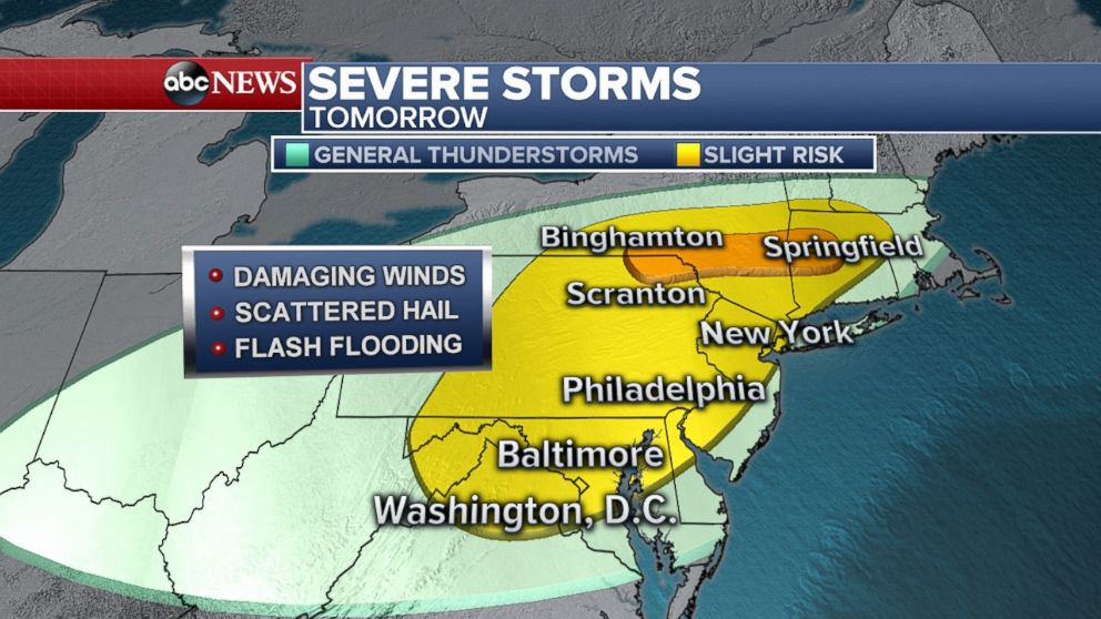
On Tuesday, more severe storms are expected for the Northeast. This includes Washington, D.C., Baltimore, Philadelphia, New York City and into Southern New England in the afternoon and evening. Again, the main threat with these storms will be damaging wind gusts, with the highest probability of widespread wind damage in the Hudson Valley and southern New England, where an enhanced risk has been issued for Tuesday.
Watching the tropics
Even though the official start to the Atlantic hurricane season is not until June 1, the National Oceanic and Atmospheric Administration's National Hurricane Center is monitoring a disturbance in the eastern Gulf of Mexico for possible development into subtropical or tropical cyclone over the next several days.
An area of low pressure developed southwest of the Florida Panhandle on Monday morning, bringing heavy rain to the central and southern parts of the state. Gusty winds, localized flash flooding and lightning are expected today in the state.
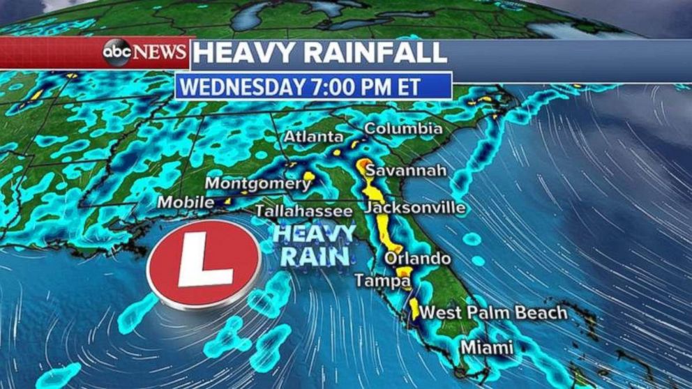
Over the next several days, this low pressure will slowly drift north through the eastern Gulf of Mexico and continue to bring heavy rain to Florida, as well as most of the Southeast by Tuesday and Wednesday.
A wide area of 2 to 4 inches of rain is forecast through Thursday for most of eastern Florida with localized areas getting more than 4 inches of rain. Flash flooding is possible.
