At least 100 million Americans under weather alerts as major winter blast to get worse
Arctic air is causing several storms to move across the country this week.
The winter blast that is occurring across much of the country is going to get worse before it gets better.
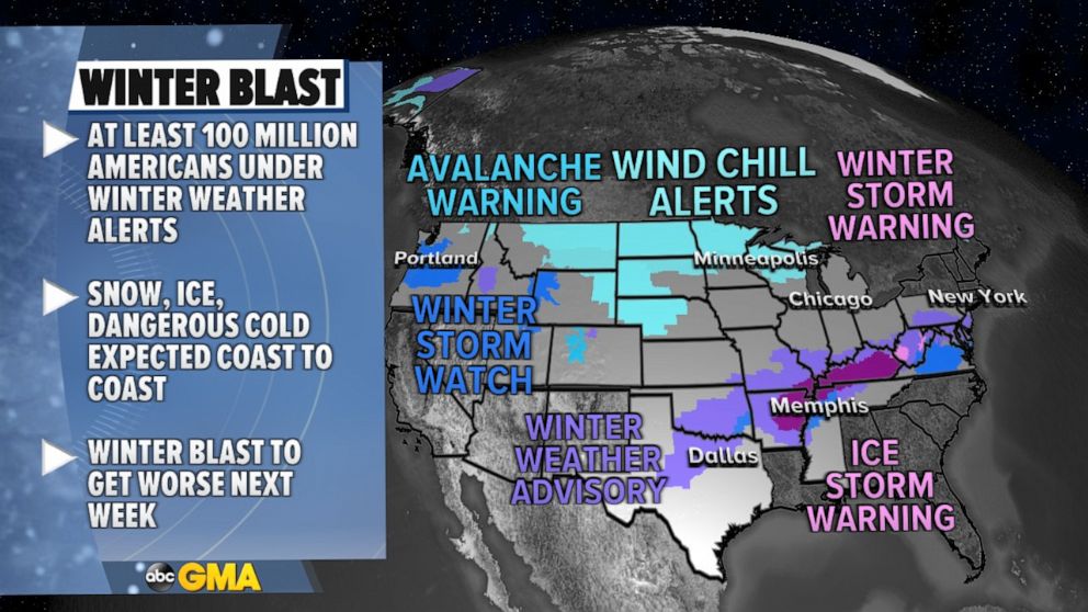
On Wednesday, winter weather alerts stretch nearly coast to coast, affecting at least 100 Million Americans, due to several major weather concerns.

Arctic Air is locked in place over much of the Midwest and Chicago will see its sixth straight day below freezing, with at least another full week or more of the same weather expected.
The Arctic air has pushed the jet stream pretty far south and is causing several storms expected to move across the country in the coming week.
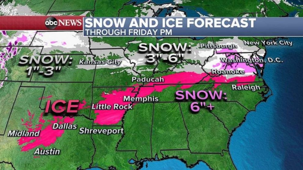
A major concern is an ice storm that will develop from Texas to mid-Atlantic over the next few days with rounds of freezing rain and snow hitting the region through Friday.
Ice accumulation will cause power outages and dangerous travel for the next few days as well.
As the precipitation becomes all snow in the mid-Atlantic, it will accumulate locally over 6 inches of snow, especially in the higher elevations from Virginia to Pennsylvania with the heaviest and most organized snow for the mid-Atlantic coming on Friday.

There could be, locally, over a half inch of ice -- especially in Arkansas, Tennessee and Kentucky -- and this could have major impacts on the region through the end of the week.
Additionally, a winter storm will hit Oregon and Washington on Thursday and Friday, including Portland and Tacoma.
Locally, up to 1 to 8 inches of snow is possible, including Freezing rain which could have major impacts in those metro areas.

A look ahead at the computer models shows this Arctic blast is going to get much worse this weekend and early next week.
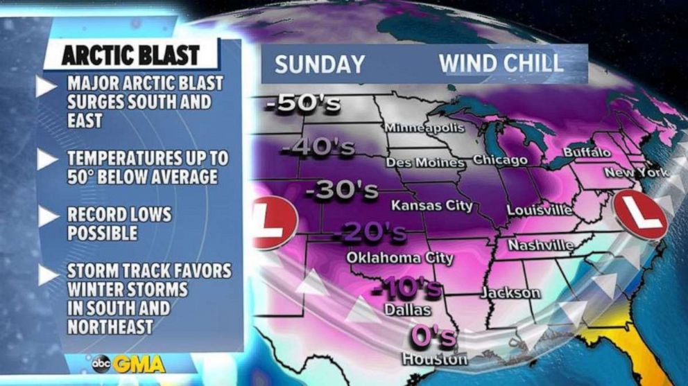
Computer guidance suggests the bitter cold will make a surge into the southern U.S. and expand eastward, especially Sunday and Monday.
This will likely result in widespread record lows in the central U.S., where temperatures at times could be 50 degrees below average.
This will force the jet stream to become quite amplified and still favor storms to track along the southern U.S. and then up the East Coast.
Simply put, the recipe for more impactful weather, mainly in the form of snow and ice will remain across much of the U.S. through the next week.


