20 million Americans at risk for severe weather on Father's Day
The severe storms are possible from Texas to the Northeast.
The combination of two different frontal boundaries caused severe weather and flash flooding in parts of the Plains and Midwest on Saturday. There were over 130 reports of severe weather, including 17 reported tornadoes and numerous reports of straight-line winds of 70 to 80 mph across parts of Texas and Oklahoma.
Conditions will not be much better for a large portion of the country, stretching from Texas to the Northeast, this Father's Day.
The severe storms were still rolling across parts of Oklahoma, Texas and southern Kansas and Missouri on Sunday morning. Flash flooding remains a concern through the morning hours with rainfall rates exceeding 2 inches per hour in spots. Flash flooding is also a concern along the Interstate 70 corridor from central Illinois to Ohio.
Severe storms are expected Sunday in parts of Texas, and as well as from a cold front moving toward the Northeast and Mid-Atlantic.
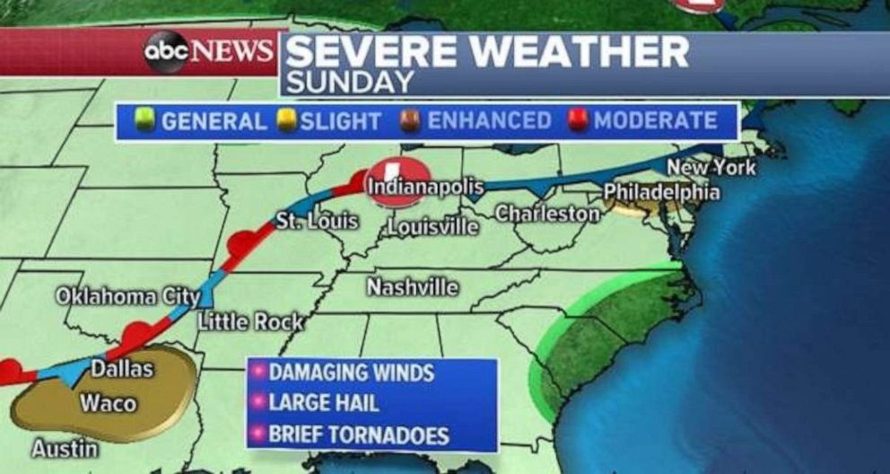
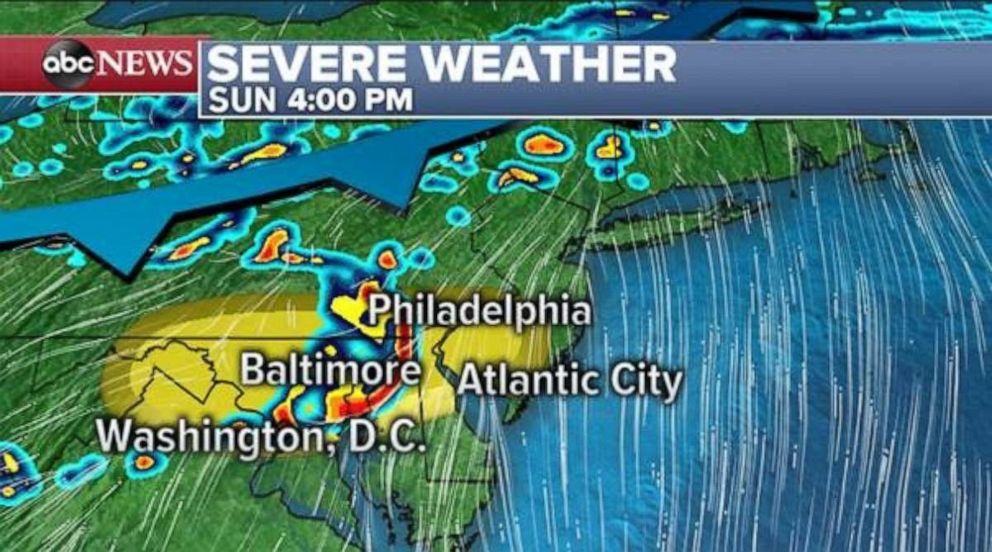
While numerous storms will fire along the combination of these frontal systems, there are two areas of severe weather to watch. One will be a segment of storms approaching Philadelphia, Baltimore, and Washington, D.C., Sunday afternoon. This line of storms likely will bring damaging winds and large hail. A brief tornado is also possible. The line will decrease in intensity as it approaches the Atlantic Ocean, but severe weather impacts could reach into parts of southern New Jersey and northern Delaware.
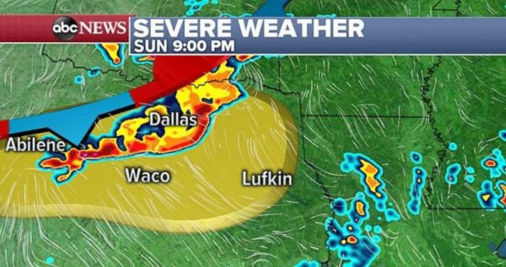
The other region of concern will be across heavily populated parts of Texas. A line of intense storms will likely reach the Dallas and Waco metropolitan areas late Sunday night and bring damaging winds, large hail and brief tornadoes. Intense rainfall rates will likely also bring flash flooding.
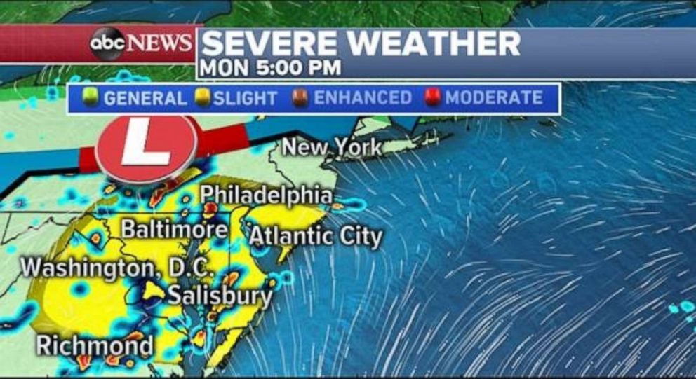
While storms are possible in the Northeast overnight Sunday into Monday, the atmosphere will also destabilize during the day Monday in parts of the Mid-Atlantic from Richmond, Virginia, to Philadelphia.
As a result, numerous severe storms will pop up across the region again Monday afternoon, with more damaging wind gusts and large hail. Brief tornadoes are also possible. The Delaware-Maryland-Virginia peninsula and southern New Jersey tend to be a hot spot for spin-ups.
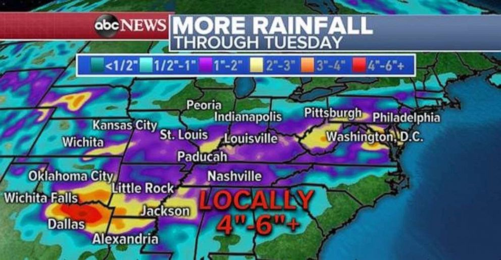
Heavy rain is expected through Tuesday from Texas to Pennsylvania, with locally over 4 inches of rain expected and flash flooding in spots -- especially parts of hard-hit Oklahoma and Arkansas.
Related Topics

Popular Reads
ABC News Live