Apocalyptic views from above the deadly California wildfires
Shortwave infrared imagery makes it possible to see though the smoke.
DroneBase/Reuters
October 12, 2017, 3:35 PM
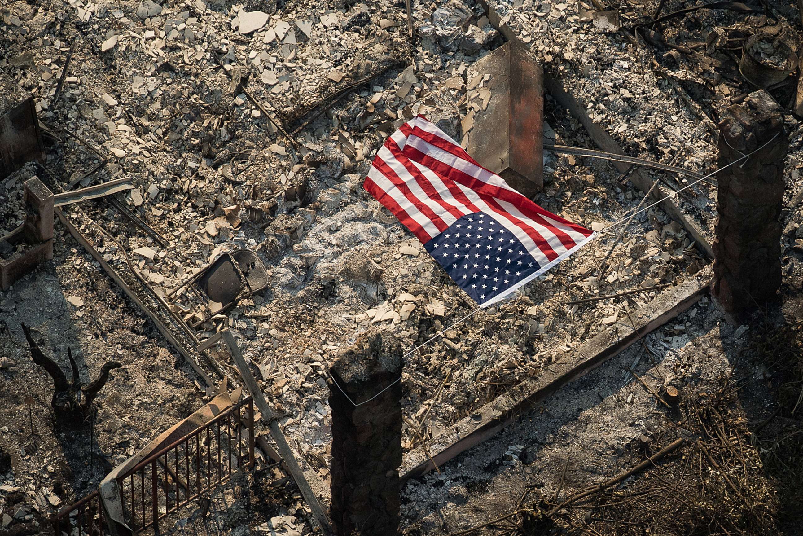
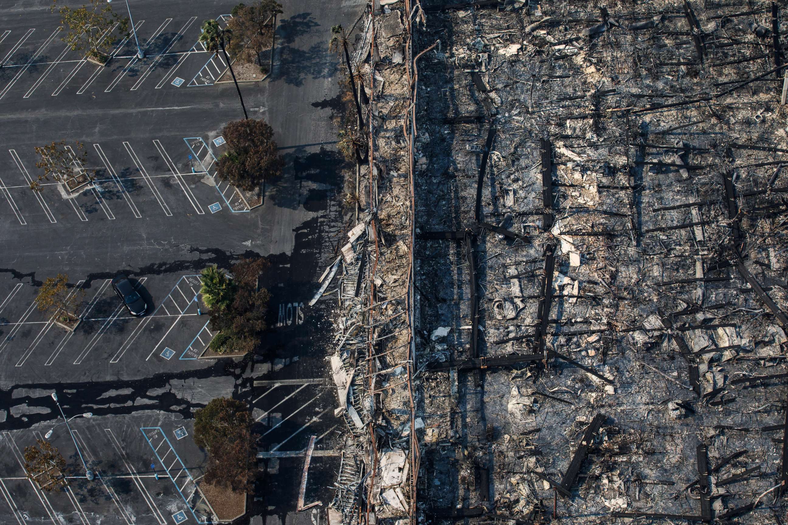
— -- Firefighters are battling at least 22 wildfires across California today. The blazes have consumed more than 180,000 acres of land so far, killing at least 31 people and destroying thousands of homes.
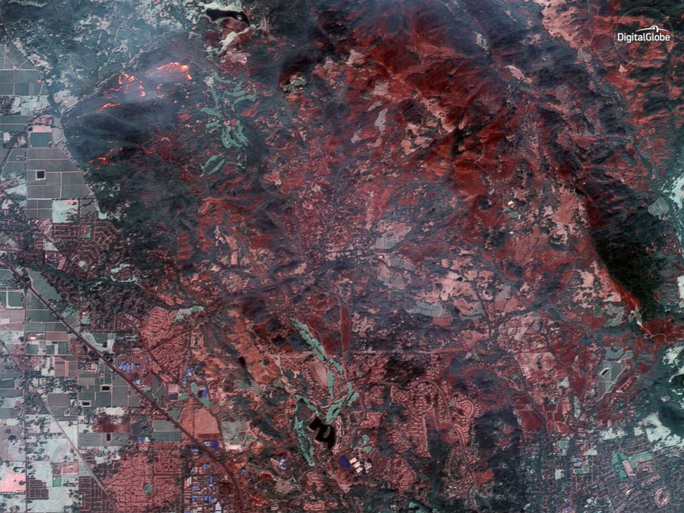
Digital Globe via AP
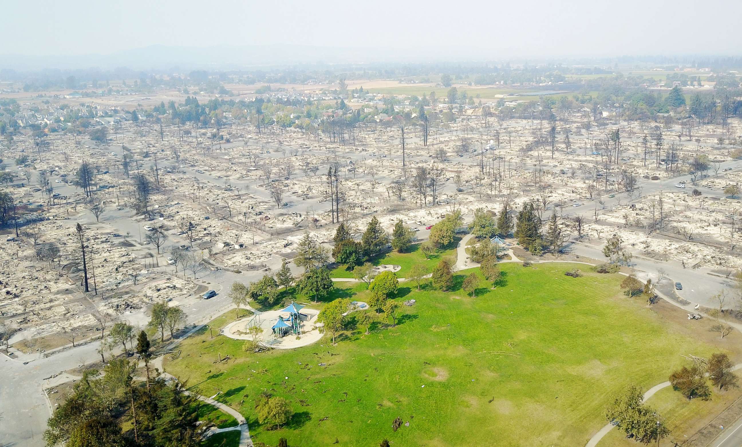
The satellite image above results from shortwave infrared technology to show the extent of damage in Santa Rosa, California, which is among the areas hardest hit by the fires in Southern California. The shortwave infrared imagery makes it possibly to see though smoke and identify active fires.
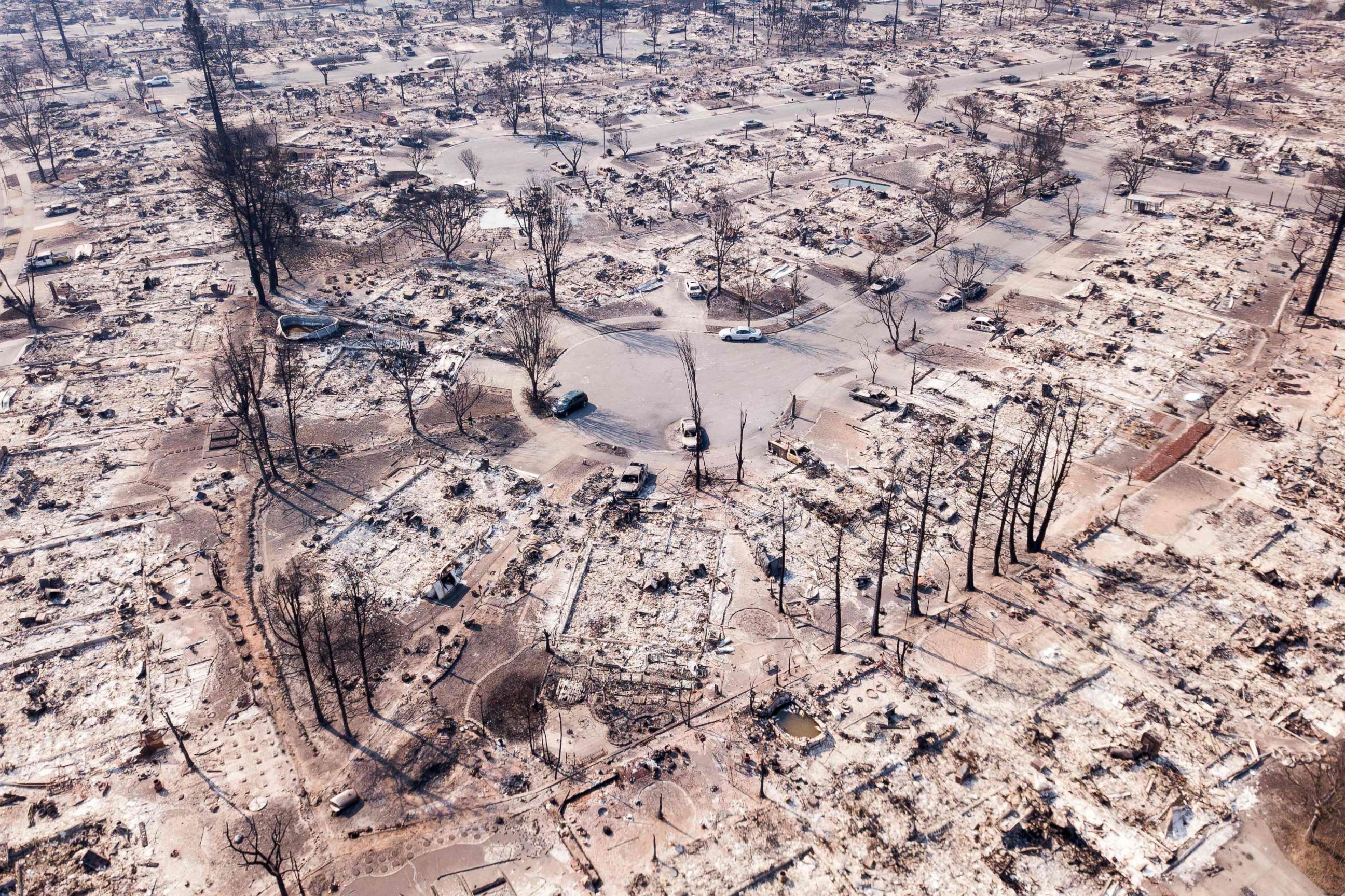
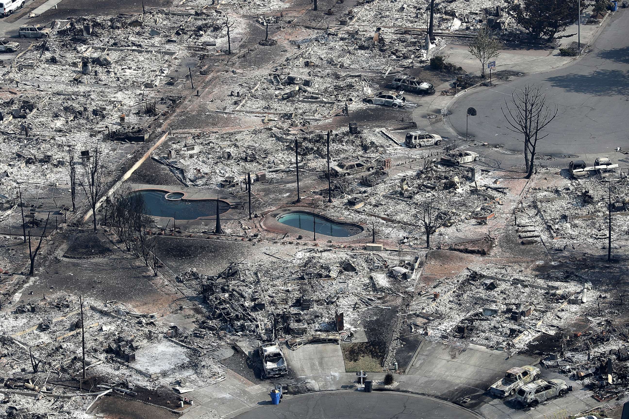
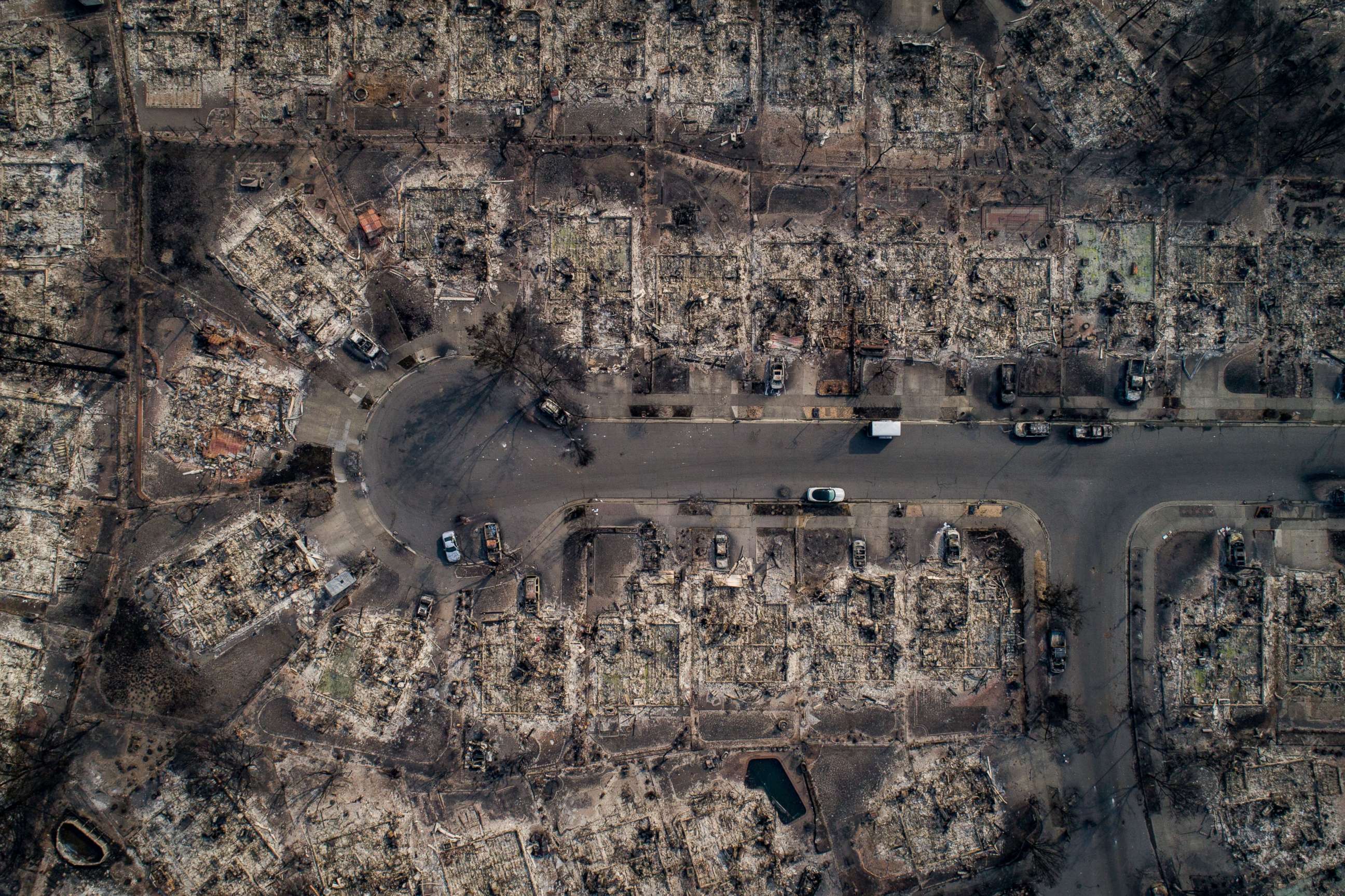
Dramatic aerials of the aftermath also show the widespread devastation across Santa Rosa.
Elijah Nouvelage/AFP/Getty Images
Justin Sullivan/Getty Images
Josh Haner/The New York Times via Redux
Noah Berger/San Francisco Chronicle/Polaris
Marcus Yam/Los Angeles Times/Polaris
DroneBase/Reuters

Popular Reads
ABC News Live