Arctic air locked in over Midwest as several snow storms move from Midwest to the East
Wind chills are in the teens and single digits in much of the Northeast.
A quick moving storm brought heavy snow to the Northeast on Sunday as the snow came down at rates up to 2 inches per hour in some spots.
Fourteen inches of snow was reported in Pascoag, Rhode Island, and 12 inches of snow was reported in Norfolk, Massachusetts.
Parts of New Jersey, and New York reported up to 9 inches of snow and some spots in Connecticut and Pennsylvania reported over 10 inches of snow while Central Park in New York City reported 4.5 inches.
In the Midwest, polar air continued to grip nearly the entire region on Sunday morning as parts of northern Minnesota and North Dakota reported wind chills below -50 degrees and Chicago reported a wind chill of -24 degrees on Sunday morning.
On Monday, wind chills are not as bad but it is still absolutely frigid across much of the Midwest.
It feels like the -20’s in Minneapolis this morning while in Chicago, it is feeling like 5 degrees.
Elsewhere, wind chills are in the teens and single digits as well in much of the Northeast.
The Arctic air is locking into place over the Midwest, with no real significant warm up in sight.

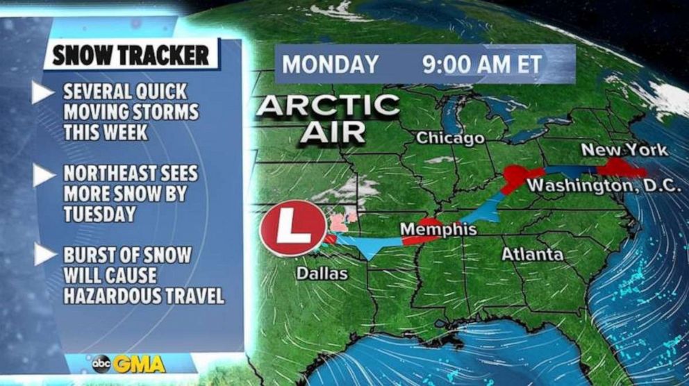
Additionally, at the southern edge of the Arctic air is a stalled frontal boundary that is going to cause numerous weather concerns through the week.
A quick moving storm will develop today in the central U.S. as it races towards the East Coast and, as it arrives near the Northeast by Tuesday, it will be just organized enough to bring a thump of snow to major northeast cities.
The burst of snow will arrive in the morning hours of Tuesday and the snow should have no problem accumulating and although accumulations should be limited to a couple of inches, it will likely cause hazardous travel.
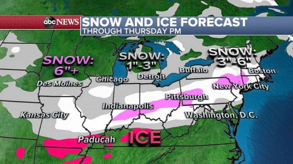
Another system will arrive in the Midwest by Wednesday and this one will bring snow from Kansas City to Chicago as well as a wintry mix from Oklahoma to Kentucky.
Once again accumulations should be rather light but likely just enough to cause impacts on roadways in the region.

On Thursday morning, this latest round of snow and ice will arrive in the Northeast -- once again for the morning hours meaning dangerous road conditions are expected.
Through Thursday, the combination of these systems should bring a wide swath of 3 to 6 inches of snow from Missouri to New England with a few locations likely to exceed 6 inches.
This snowfall forecast is from both systems so many people could see 2 to 3 inches by tomorrow and another 2 to 3 inches by Thursday -- just enough to cause treacherous roads.
Believe it or not, this pattern doesn’t seem to change too much over the upcoming weekend and there will likely be more opportunities for snow in these regions.
While there is some indication a more organized storm could be an issue later this upcoming weekend, there is not nearly enough agreement with the forecast models to place the magnitude or scope of potential upcoming snow.

However, one thing that does seem certain is the cold air is that really locked in place.
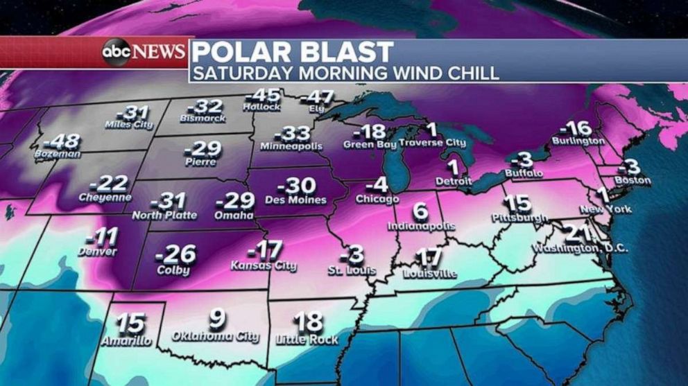
Saturday’s wind chill is looking pretty similar to today’s and this weekend’s wind chill with some of the Arctic air reaching further south and further east.


