Cold blast reaches East Coast and Central US, Santa Ana winds forecast to recede in California
A powerful storm is officially out of the Northeast .
A powerful storm that brought wind gusts above 60 mph to much of the Northeast -- as well as flash flooding to parts of New York -- is officially out of the region and headed into the Northern Atlantic.
Daylight on Friday revealed significant storm damage in Pennsylvania and parts of Northern New Jersey. The National Weather Service has determined that straight lined winds, with winds up to 110 mph, were responsible for damage in Pennsylvania's Bucks County.
Additionally, the National Weather Service determined that an EF2 Tornado hit Delaware County, Pennsylvania, with winds up to 120 mph, and was on the ground for 0.5 miles. The NWS also will be heading today to Madison, New Jersey, in Morris County, to evaluate the storm damage in that area. Results are expected Saturday afternoon.
The cold front also brought a dramatic drop in temperatures to Northeast. After some areas saw temperatures in the 70s on Thursday, Friday’s highs were only in the 50s. In some cases the temperature drop was close to 30 degrees.
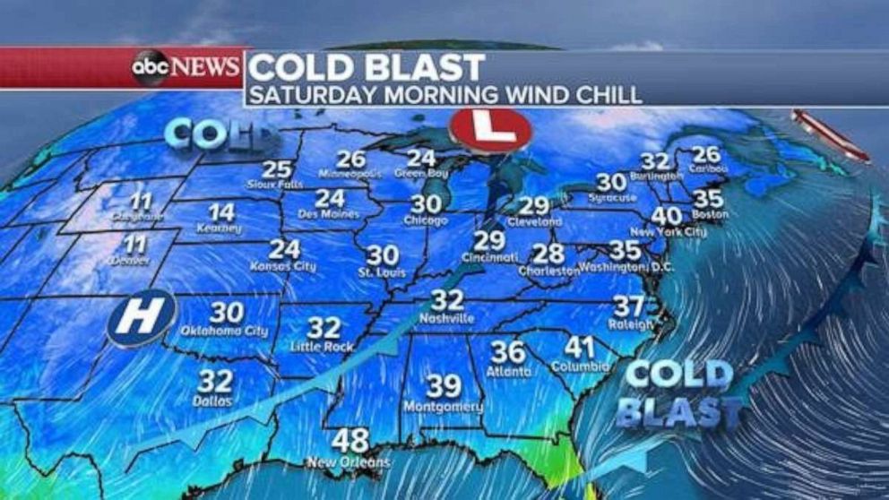
Two waves of cold air are spilling into the East this weekend. Wind chills this morning across the East Coast are in the 30s, while wind chills in the Midwest and parts of the High Plains are in the teens and 20s. It is officially starting to feel like winter as we get closer and closer to meteorological winter.
The second wave of cold air will move eastward this weekend and eventually reach the East Coast. Wind chills on Sunday morning will be just a little cooler than they were on Saturday.
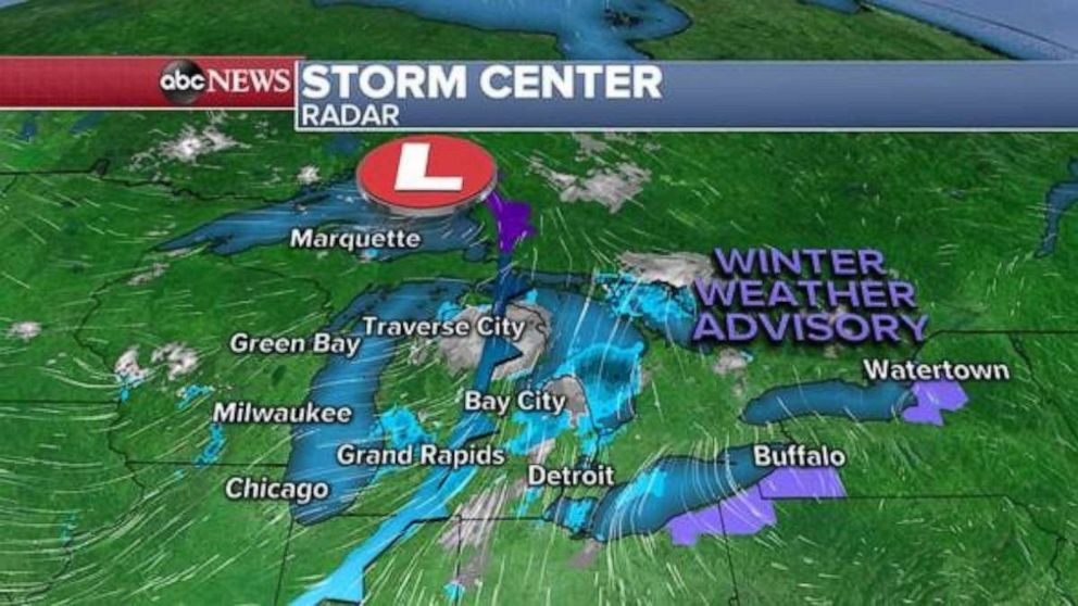
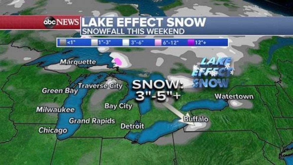
That second wave of cold air is also ushering in some precipitation to parts of the Great Lakes. Currently, rain and snow showers are spread out across Michigan this morning. Once this system moves eastward, cold winds will be oriented so they flow over parts of the relatively warm Great Lakes. As a result, lake effect snow will develop in parts of the region, especially from Northeast Ohio to Western New York.
Another disturbance arrives on Sunday night across this region, bringing another batch of snow and rain showers.
Around 3-5 inches of snow will be possible in parts of New York state that classically prone to lake effect snow. It's important to remember that lake effect snow bands can come abruptly, be very intense causing whiteout conditions, and have wind gusts over 35 mph. This can be very hazardous on roadways for drivers.
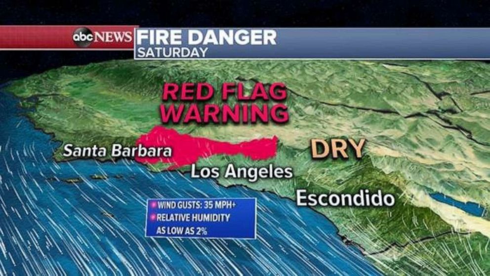
Meanwhile, in California, the Santa Ana winds keep losing strength Saturday morning -- but wind gusts over 35 mph will remain possible for much of the day. The air is still very dry with relative humidity as low as 2%. Therefore, red flag warnings have been extended until Saturday evening in parts of Southern California.
The good news is that relief is on the way Sunday, when winds will turn onshore and bring much-needed relief.
Related Topics

Popular Reads
ABC News Live