As cold settles in Northeast, Halloween forecast for much of country looks pleasant
The cold air comes after a storm system brought snow to parts of the Northeast.
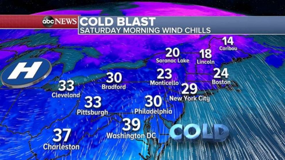
A cold blast has now settled in on the Northeast Saturday morning. Wind chills are into the 20s for parts of southern New England, and into the 30s for parts of the Mid-Atlantic.
This frigid air comes after a storm system brought some snow to parts of the Northeast, especially New England on Friday. Boston recorded 3.5 inches of snow, making it the city's biggest October snowstorm on record.

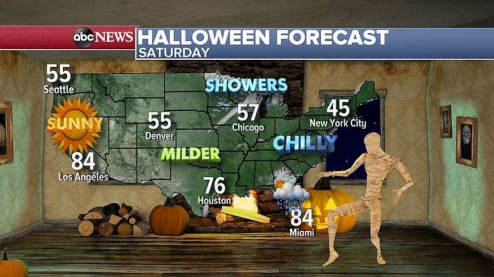
For Halloween, most of the nation is rather quiet. Besides a cold day in the Northeast, most of the country will not see highly impactful weather.

For those who are trying to have some spooky social distant fun, the weather will be in their favor.
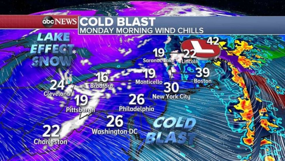
A quick-moving, low impact storm system will move from southern Canada and across parts of the Great Lakes this weekend. The result is another wave of cold air that arrives into the Northeast by Monday morning.
Wind chills with this cold blast could be in the teens and 20s across the Appalachians and Adirondacks. Some of those very cold wind chills could approach the suburbs of the major Northeast cities as well.

Additionally, there will likely be some lake effect snow, and snow squalls with the cold air moving over the relatively warm great lakes. Some areas of the interior Northeast could see 1-2 inches in these squalls.
Looking ahead, a pattern change will bring milder weather back to the Northeast by second half of the upcoming week.
Meanwhile, a tropical wave in the Caribbean Sea continues to have high chances for tropical development this weekend and early next week. Therefore, a tropical depression is likely to develop this weekend as the system moves westward.
The spaghetti model plot indicates a good amount of guidance that this system will move towards the west and ultimately end up near Central America. However, it is too early to rule out some dramatic model shifts that ultimately will determine locations for impacts and storm intensity. In fact, the overnight GFS model, which has been doing well with tropical cyclone forecasting this year, indicated a dramatic turn northward with this system.
If this system were able to obtain its name, it would be Eta, and it would be the 28th named storm of the season. This would tie 2005 for the most named storms in a single Atlantic Hurricane Season.
After a turbulent week of weather, there is actually some good news in the weather for a few days.


