Eta floods Florida after making landfall as strong tropical storm, Subtropical Storm Theta forms in Atlantic
Nearly a foot and a half of rain fell north of Miami.
Tropical Storm Eta has caused major flooding in Florida after making landfall late Sunday night.
The system hit as a strong tropical storm in the Florida Keys around 11 p.m. with wind speeds of 65 mph and slowly moved through the region, drenching South Florida and causing flash flooding in large cities such as Miami and Fort Lauderdale

Nearly a foot and a half of rain fell in eastern portions of Broward County, north of Miami. More than 14 inches of rain fell near Hollywood, and parts of the Miami metro area received more than 6 inches of rain, according to the National Weather Service.
Eta has broken a record as the 12th named storm to make landfall in the continental U.S. in a single season. The previous record was nine named storms in 1916.
In addition, the last time a named storm made landfall in Florida in the month of November was Tropical Storm Mitch in 1998.
Eta made landfall in Central America on Tuesday as a Category 4 hurricane. Nearly 60 people died after torrential rain flooded homes from Panama to Guatemala, even spurring a mudslide in Honduras that killed several people.

The system later weakened after passing over high-altitude mountains but then strengthened back into a tropical storm as it headed toward the U.S.
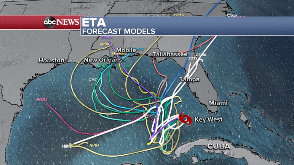
Eta is now moving away from Florida, but flood watches are continuing for the southern half of Florida from Fort Myers down to Miami, and an additional few inches of rain are possible over the next few days as the storm meanders in the eastern Gulf of Mexico.
Monday night, Eta sustained winds of 50 mph and began moving southwest at 9 mph. The center is now about 90 miles north-northwest from the western tip of Cuba as it churns over the southeastern Gulf of Mexico.
The storm will continue to slow down and meander over the southeastern Gulf of Mexico over the next 24-36 hours and then begin a very slow, multi-day northward crawl up the eastern Gulf of Mexico through the rest of the week. It could strengthen a bit through Tuesday night, and then weaken significantly during the second half of the week. It will likely slow into a tropical depression by Saturday.

The storm is expected to meet up with a cold front moving from the West and will bring heavy rain from North Florida to the mid-Atlantic states.
Also on Monday night, Subtropical Storm Theta formed over the open northeast Atlantic. It is not immediately threatening to land; however, it is the 29th named storm of the 2020 Atlantic hurricane season and sets a new record for most named storms in a single season.
Related Topics

Popular Reads
ABC News Live