Tropical Storm Eta kills at least 13 in Central America, may restrengthen approaching Florida
Eta made landfall as a Category 4 hurricane.
At least 13 people in Central America have died after Tropical Storm Eta made landfall as a Category 4 hurricane.
Heavy rains have caused landslides, and overflowed rivers and ravines, in Nicaragua, Guatemala, Honduras, El Salvador and Costa Rica. Thousands of people have been evacuated, and more than 100,000 are without electricity.
The slow-moving storm made landfall in Nicaragua with 140 mph winds on Wednesday afternoon.
Eta continues to produce deadly floods in Central America, with some areas seeing up to 40 inches of rain.
Eta appeared to be weakening on Thursday. The surface circulation has been broken up by high mountains.
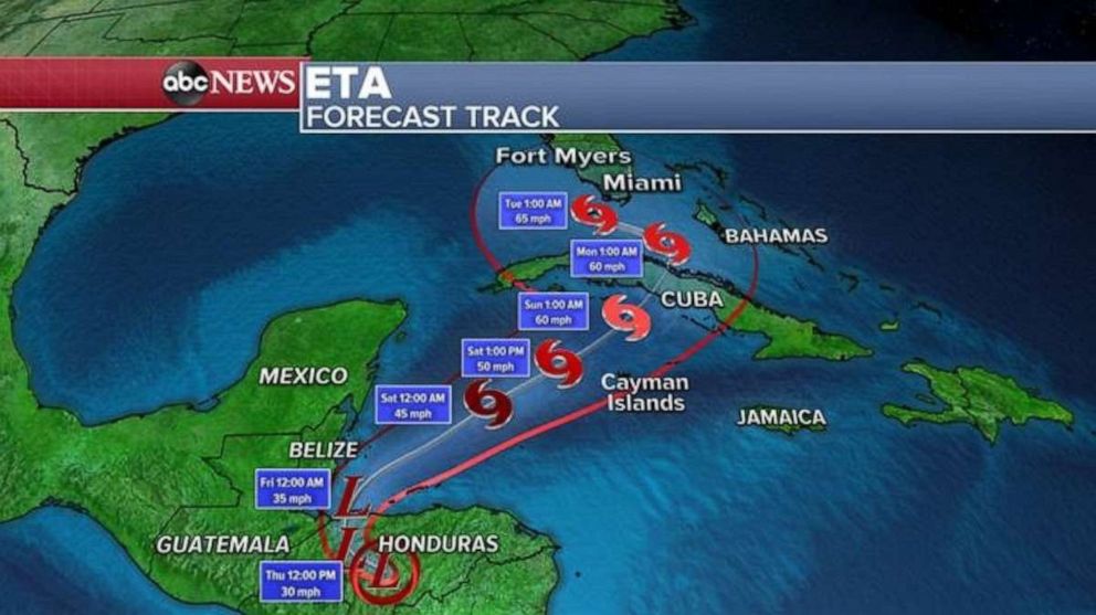
The National Hurricane Center and most computer models, however, believe that the remnants of Eta have a chance of re-emerging in the northern Caribbean Sea and strengthening back to a tropical storm by Saturday.

On Sunday, the strengthened Eta is forecast to cross Cuba, and it could move into the Florida straits by early next week as a tropical storm with winds of 65 mph.
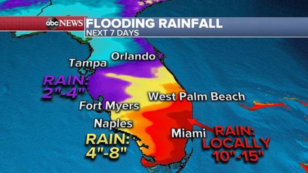
Heavy rain likely will spread into southern Florida well ahead of Eta this weekend, which could cause flooding, especially in urban sections of Miami-Dade County.
Several weather models show the system not coming back, instead just drifting south into the Atlantic Ocean.
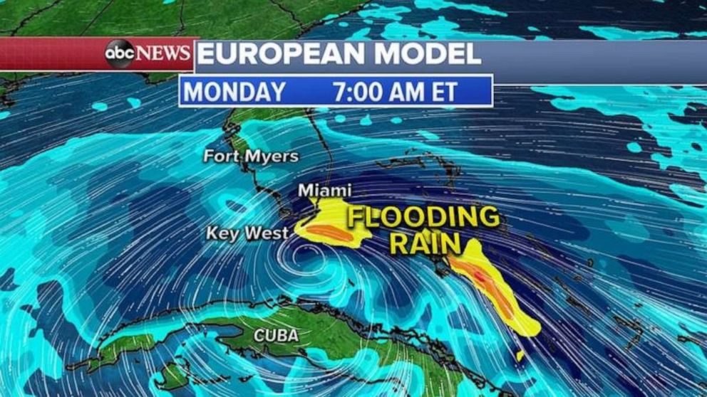
A European model shows the newly developed Eta just south of Florida Keys by Monday morning, with heavy rain hitting Miami-Dade County. The National Weather Service in Miami said heavy rain likely will begin well ahead of Eta, on Thursday, as tropical moisture moves north.
Some areas in southern Florida and parts of the East Coast could see 10 to 15 inches of rain as Florida's west coast could get 4 to 8 inches.
ABC News' Martinez Guzman and Christine Theodorou contributed to this report.
Related Topics

Popular Reads
ABC News Live