Fast-moving nor'easter bringing heavy rain, gusty winds to Northeast
The storm will be cleared out by Sunday.
A storm is developing along the East Coast and will bring widespread heavy rain, strong wind gusts, coastal flooding and possible snow to parts of the Northeast on Saturday.
A deepening low pressure located near the Delaware-Maryland-Virginia peninsula will move toward New England over the next 24 hours.
An observation site in Belmar, New Jersey, saw a gust of 62 mph Saturday morning, while Manasquan, New Jersey, saw a gust of 58 mph. Some parts of Cape May and Atlantic counties in southern New Jersey have reported over 1 inch of rain so far.
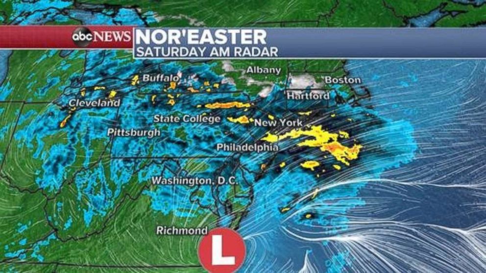
Flash flood watches, high wind warnings and wind advisories have been posted for parts of the Northeast coastline.
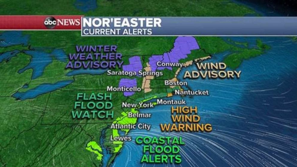
Due to the onshore winds, coastal flooding could be a concern for parts of the region, especially along the Jersey shore. Winter weather advisories have been posted further inland for parts of the higher elevations in the interior Northeast. Some light snow is possible, especially in the predawn hours Saturday morning.
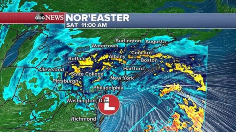
Heavy rain and gusty winds are expected to impact nearly the entire Northeast on Saturday morning. Winds along the Jersey shore and Delaware coast will gust over 40 mph in spots. In New York and Philadelphia, winds gusts over 30 mph are likely. Some of these gusty winds, especially on Long Island and the Jersey shore, could down trees and power lines and make power outages possible.
The bulk of the precipitation will have moved into northern New England and southern Canada by early Saturday evening. However, as the storm deepens in intensity, it will bring widespread gusty winds to all of New England. Wind gusts could exceed 40 mph Saturday evening from Connecticut to Maine and especially into Vermont and New Hampshire. The gusty winds could down power lines and trees.
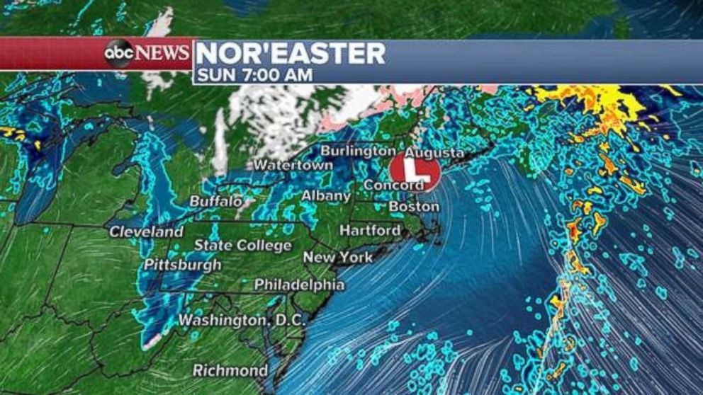
The nor’easter is moving pretty fast and will be out of the Northeast by Sunday morning. Rainfall totals will likely be 1 to 2 inches for most of the Northeast, with some areas seeing locally higher rainfall.
Meanwhile, a new disturbance is developing in the upper Midwest and will bring rain to parts of the region by Sunday. Some of the rain could be heavy at times, especially in Wisconsin.
This disturbance will move very quickly through the Ohio Valley on Sunday afternoon and will bring another shot of rain and some gusty winds to the Northeast by Monday. However, this storm is looking much less intense and impacts will be less widespread.
What is a Nor'easter storm?
Rain, snow head toward Northwest
A new storm is developing in the northern Pacific this weekend and will bring a shot of rain and some mountain snow to parts of the Northwest by Sunday.
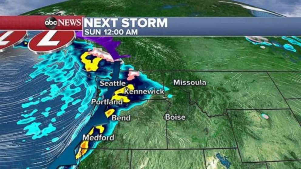
In the wake of this storm, the pattern will remain unsettled for several days in the Northwest with rounds of rain expected from Seattle to Portland. Through Wednesday, rainfall totals over 3 inches will be possible.
Some of the higher elevations of the Cascades and northern Rockies could see some snow accumulation from the unsettled weather.


