Florida wildfire forces mandatory evacuations near Naples
A tropical threat is also possible off the coast of Florida.
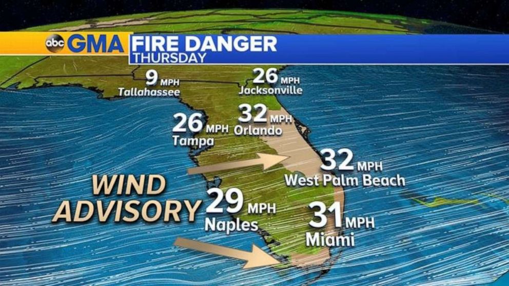
Wind gusts up to 30 mph and temperatures in the 90s helped spread a wildfire east of Naples, Florida, Thursday, which prompted mandatory evacuations in the area.
The fire is at least 4,000 acres and is 0% contained.

Collier County issued a mandatory evacuation "due to the fast moving wildfire" just after midnight Thursday. Fire officials there said winds would continue to contribute to "significant fire movement."
More gusty winds are in the forecast for southern and central Florida Thursday, where wind gusts could reach 35 mph. A wind advisory has been issued for parts of the area.
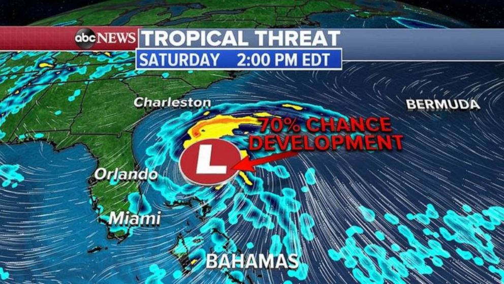
The wildfire isn't the only weather Floridians should pay attention to; an area of low pressure is trying to form near the Sunshine State in the next few days.
This could become the first named storm system of the 2020 Hurricane season, which would be named Arthur. If it forms, it will develop Friday night into Saturday morning north of Bahamas.

The threat for Florida will be more gusty winds and some heavy rain, especially for the southern part of the state, where some areas could see 4-plus inches of rain in the next few days. Some of the rain could make its way to the fire zone east of Napes in the next 48 hours.
Outside of Florida, a strong storm system is moving east and with it, severe weather is expected Thursday from Oklahoma to Ohio. The biggest threat will be damaging winds, large hail and the possibility of a few tornadoes. Cities in the path of severe weather are Kansas City, Missouri, St. Louis, Chicago, Indianapolis and Detroit.
The severe weather moves into the Northeast Friday, where damaging winds will be the primary threat for New York City, Connecticut, parts of Pennsylvania, upstate New York and southern New England.
Related Topics

Popular Reads
ABC News Live