Hanna officially becomes a Category 1 hurricane
Hanna is expected to make landfall in southern Texas as a hurricane on Saturday.
Hurricane Hanna has formed in the Gulf of Mexico as a Category 1 hurricane with sustained winds of 75 mph around the eye wall.
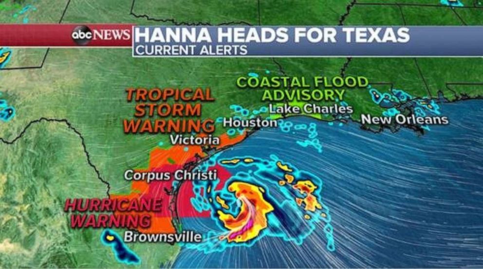
Hanna is strengthening and the National Hurricane Center says it is expected to make landfall in southern Texas on Saturday evening.
Conditions along the southwestern Gulf coast, in particular southern Texas, are expected to deteriorate through Saturday.

The main threats will be dangerous tides and a storm surge along with extreme rainfall.
Tropical Storm Warnings, Hurricane Warnings, Storm Surge Warnings and several Flood Alerts are in place this morning along the southern Texas coastline.
Flood alerts are in place from the Mexico/Texas border to southwestern Louisiana as Hanna is expected to bring over 12 inches of rain locally to parts of southern Texas through the end of the weekend.
Meanwhile, Hurricane Douglas remains a Category 3 hurricane as of 3 a.m. EST with sustained winds of 115 mph and is moving WNW at 20 mph toward Hawaii.
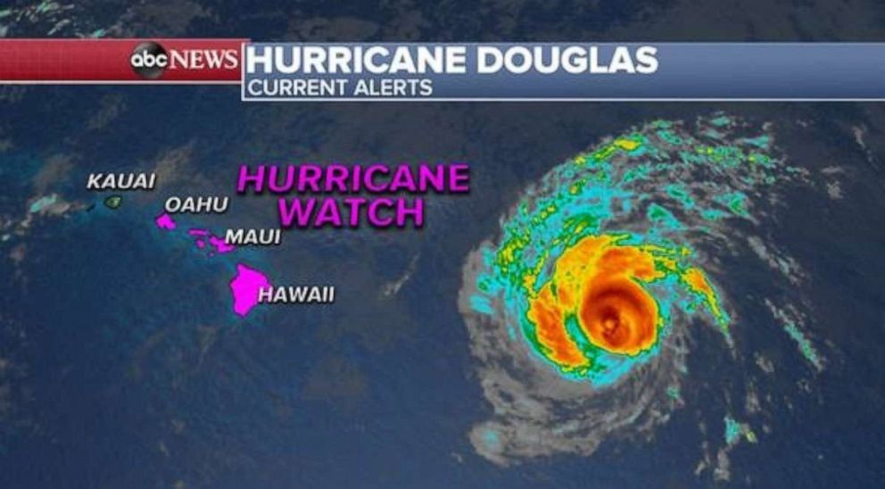
Douglas is expected to pass dangerously close or pass over the Hawaiian Islands Saturday night into early Monday morning.
Douglas will bring a triple threat of damaging winds, flooding rain and dangerous surf, especially along eastern shores.
A Hurricane Watch is in effect this morning from Oahu to the big island of Hawaii.
Elsewhere, Gonzalo remains a Tropical Storm as of 3 a.m. EST with sustained winds of 40 mph and is moving west at 17 mph.
The storm is weakening as it heads south of the Windward islands and may lose its tropical storm status on Saturday, thus becoming a tropical depression.
However, the storm is expected to bring dangerous surf and torrential rains to the southern Caribbean islands Saturday through Sunday night when it will reach Aruba.
Heat alerts are in place this morning for 10 states from the Pacific Northwest to the Midwest.
Today’s heat index values are expected to hit the triple digits in parts of the Midwest.
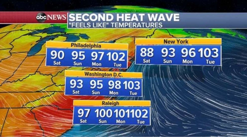
Meanwhile, a new potential heat wave is building across the eastern U.S. as Heat Index Values are expected to be near or above 90 degrees from the Carolinas to New York City today through the middle of next week.
Some spots will even see Heat Index Values soar into the triple digits for the second week in a row.
This is a developing story. Please check back for updates.
Related Topics

Popular Reads
ABC News Live