Heavy rain brings flash flooding threat for Midwest, Northeast
There were 114 damaging storm reports in the country on Tuesday.
Heavy rain has fallen over much of the eastern half of the country the last few days, a pattern that will continue on Wednesday.
Since the weekend, 5 to 10 inches of rain has prompted widespread flooding issues over an area stretching from the Central Plains through the Ohio River Valley.
There were also 114 damaging storm reports Tuesday from west Texas through the Northeast, including three reported tornadoes in Kansas and Texas.
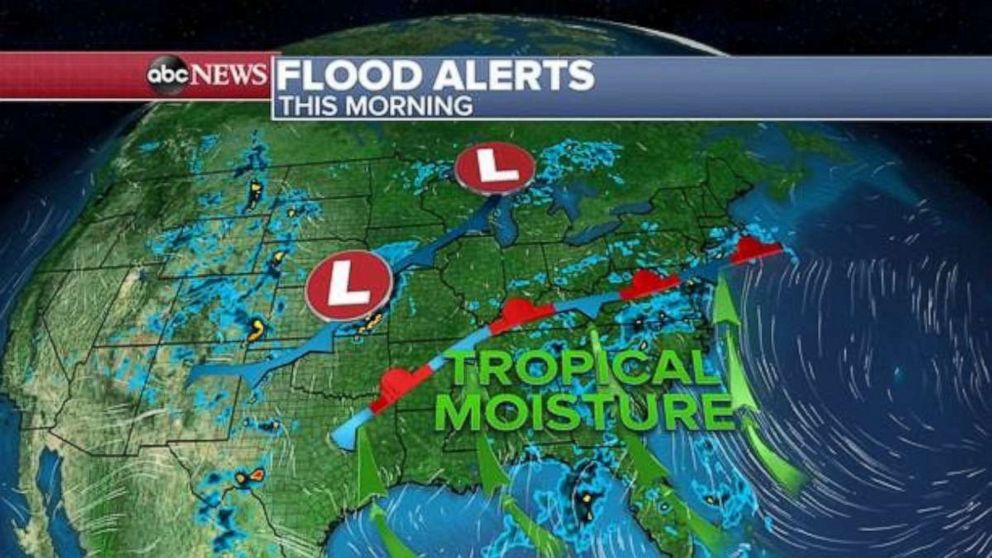
The stationary front remains in place over the eastern U.S. prompting a continuing risk for widespread rains from the southern Gulf states through the Northeast.
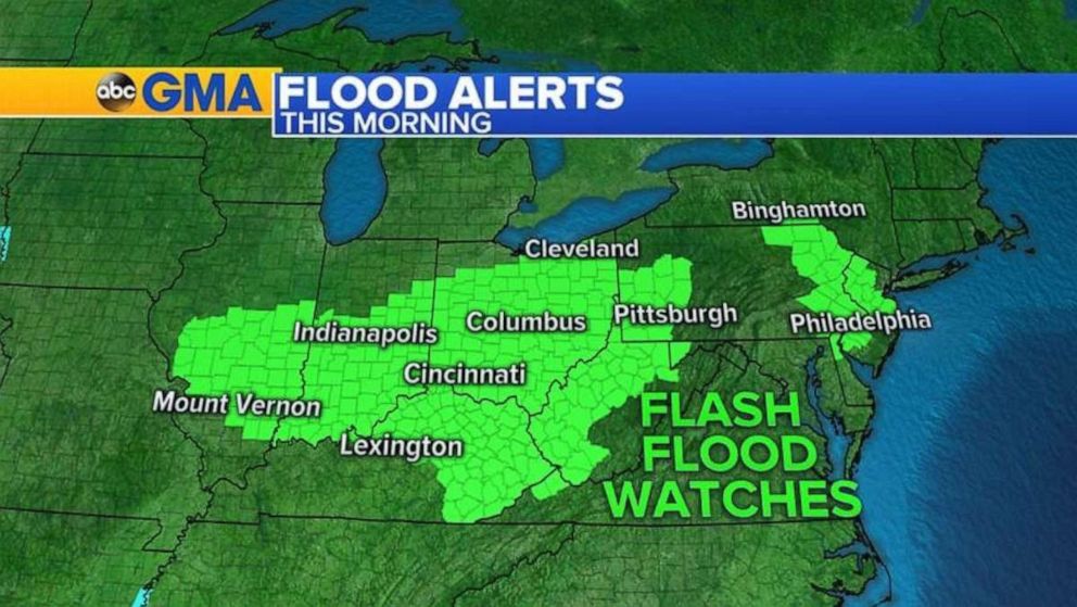
Flash flood watches remain in effect for a large portion of the Ohio River Valley and into the Mid-Atlantic region with more rain expected.
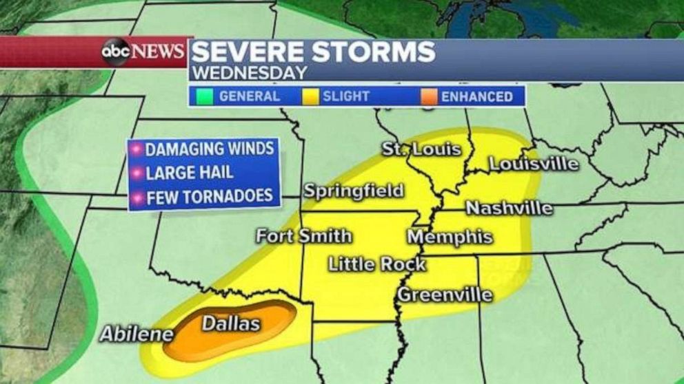
A new storm system moving east will bring a threat for severe storms to Dallas; Little Rock, Arkansas; Memphis, Tennessee; Louisville, Kentucky; and St. Louis. The threat includes tornadoes, damaging winds and huge hail.
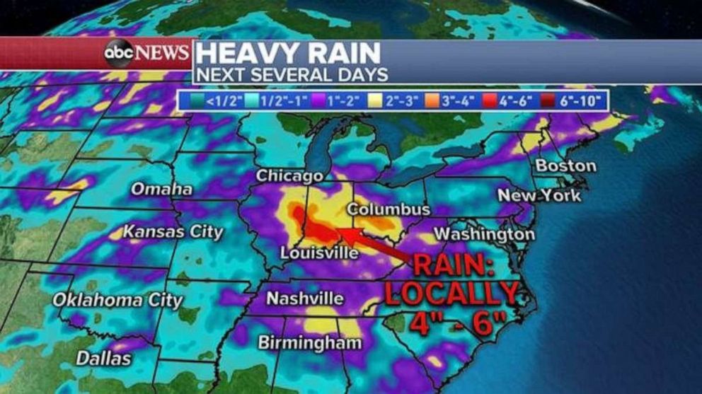
At least another 4 inches of rain is expected through the start of the weekend over some of the same areas already under flash flood watches.
Related Topics

Popular Reads

ABC News Live