Heavy Rain, Flooding Threaten Texas and Gulf Coast States
Some areas of the Lone Star State set record rainfall totals.
— -- Remnants of Hurricane Patricia, combined with a powerful storm system, dumped heavy rain and caused significant flash flooding across parts of eastern Texas and the central Gulf on Sunday with more rounds of heavy rain expected into Sunday night.
Flash flood watches remained in effect across parts of Texas, Louisiana, Mississippi, Alabama, and the western Florida Panhandle on Sunday evening. Windy conditions along the coast prompted wind advisories to be issued with gusts over 50 mph reported along parts of the Texas and Louisiana coast.
This developing coastal storm will continue to bring strong wind gusts and coastal flooding to much of the Gulf Coast region Sunday night.
The focus of the heaviest rain shifted east of Houston by Sunday afternoon and began to bring heavy downpours over Louisiana and the central Gulf Coast. The heavy rain is forecast to remain over this region through Sunday night and into Monday morning.
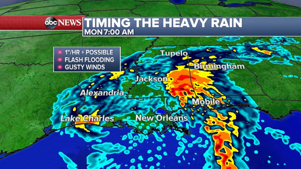
Rainfall rates of more than an inch per hour are possible along with some travel disruption for the Monday morning commute.
Houston Mayor Annise Parker warned about flooding Saturday.
"There will be localized flooding in Houston, primarily street flooding," she said.
A voluntary evacuation was issued by Galveston County Judge Mark Henry Saturday for Bolivar Peninsula, northeast of Galveston Island, as that area was expected to receive as much as 12 inches of rain. Brittany Rainville, a spokeswoman for the county, said officials believed many residents in the peninsula would probably not follow that order since they are accustomed to flooding and usually wait it out.
Parts of Texas accumulated huge amounts of rainfall in recent days. More than 20 inches had been reported in Corsicana since Thursday, with a majority of it falling within 24 hours.
Water levels in the Buffalo Bayou rose high enough in Houston Sunday morning to almost completely submerge a gazebo in someone's yard.
Houston broke a daily rainfall record Saturday with 5.54 inches, surpassing the previous total of 2.13 inches in that city. Nearby Brownsville set a record total of rain with 2.76 inches; the previous record was 1.75 inches.
In Weslaco, Texas, west of Brownsville, more than half a foot of rain fell on Saturday, quickly flooding roadways and trapping cars.
There was also a waterspout reported Saturday off the coast of Galveston and two reported tornadoes in Brazoria County. Some minor wind damage was reported south of San Antonio in Jim Wells and Duval Counties.
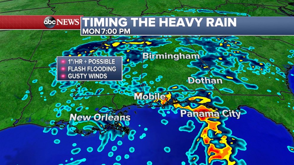
The heavy rain will start to become more scattered throughout Monday, focusing mainly over the Florida Panhandle, and parts of Alabama and Georgia.
Later in the week, some of the moisture from this system will spread northward and bring rounds of rain to parts of the Midwest and Northeast. By this time however, widespread flash flooding will no longer be a concern.
The Associated Press contributed to this report.
