Heavy rain, thunderstorms bring risk of flash flooding along East Coast
Several clusters of thunderstorms are threatening the East on Saturday.
Several clusters of thunderstorms are threatening the eastern U.S. on Saturday with rain expected much of the day, and the possibility for severe weather.
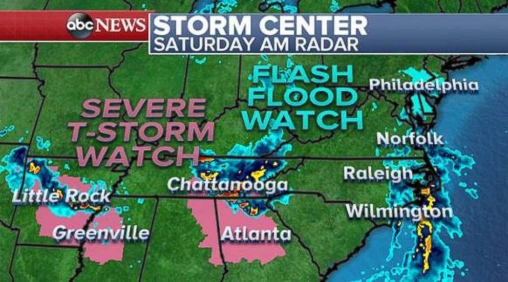
One cluster is over Arkansas early Saturday and moving toward Mississippi, while another is over eastern Tennessee and moving toward Georgia. Parts of the south are under a severe thunderstorm watch through the morning as damaging winds and large hail serving as the main threats.
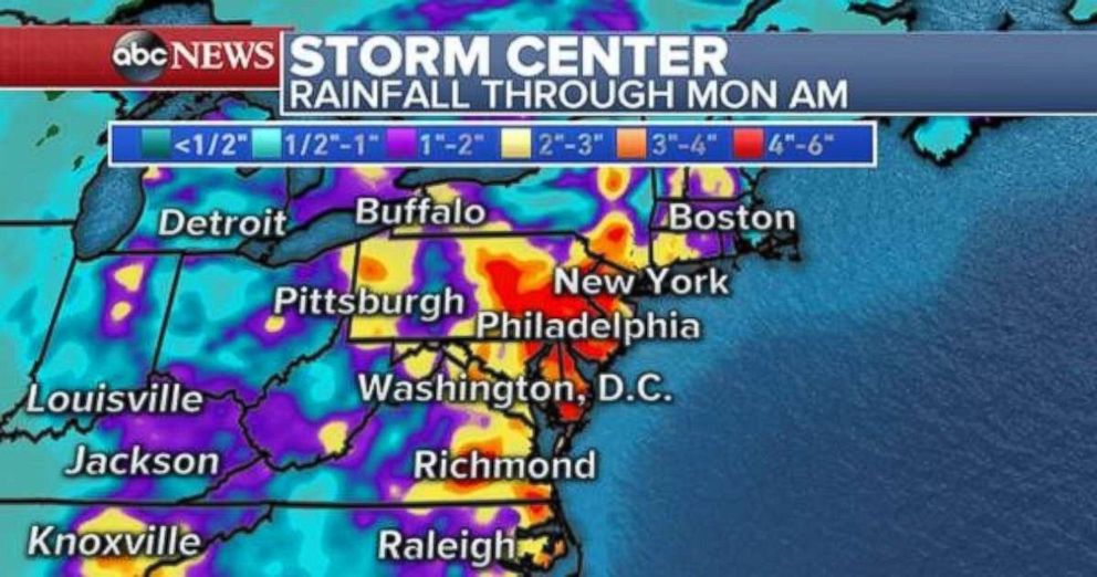
Along the coastline, a disturbance is developing and pushing an onslaught of thunderstorms and rain up the East Coast toward the mid-Atlantic and Northeast. A flash flood watch has been issued for parts of the greater Philadelphia region, including much of New Jersey.
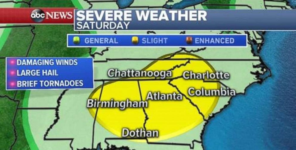
There is a slight risk for severe weather across much of the Southeast on Saturday, including Atlanta; Birmingham, Alabama; and Charlotte, North Carolina. Damaging winds, large hail and tornadoes are possible.
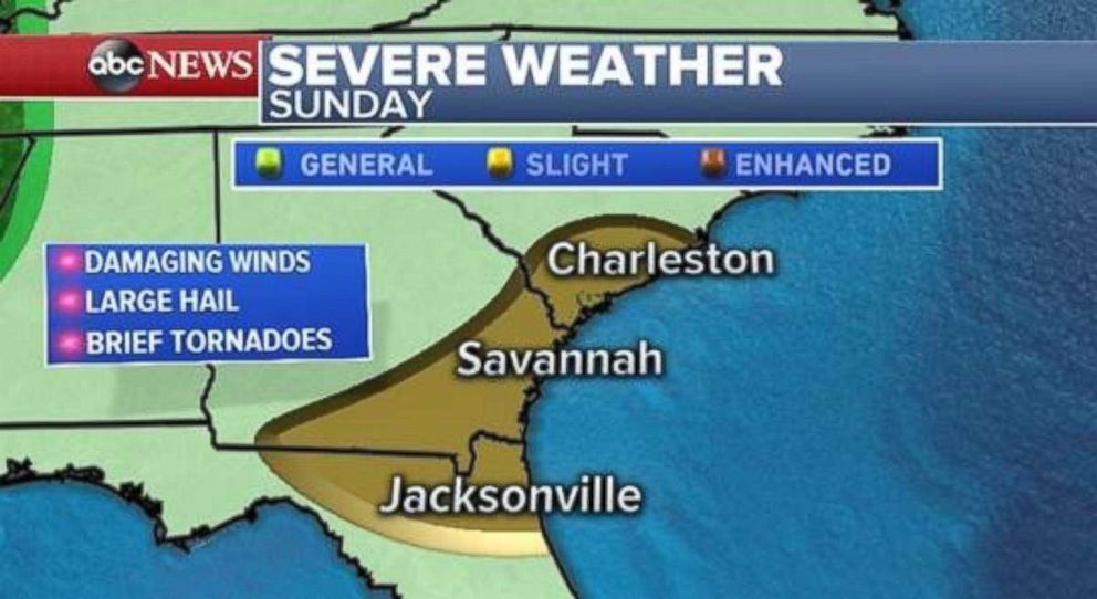
On Sunday, this threat slides slightly southeast, with the possibility for severe thunderstorms from Jacksonville, Florida, to Charleston, South Carolina.
Meanwhile, two systems interacting in the eastern U.S. will force rain toward the mid-Atlantic and Northeast late Saturday. Heavy rain will last into early Sunday for parts of the mid-Atlantic, especially Delaware, Pennsylvania and New Jersey. After the initial rain, numerous scattered thunderstorms will persist in the region on Sunday.
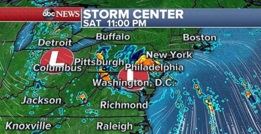
It looks increasingly likely that widespread rainfall totals over 3 inches will fall across parts of Delaware, New Jersey and Pennsylvania overnight Saturday into Sunday. The rain could cause flash flooding, while winds will increase as the storm approaches on Saturday night, with locally high wind gusts over 30 mph along the shoreline from Delaware to Long Island.
Locally strong thunderstorms with heavy downpours are possible from North Carolina to New Hampshire the entire weekend and isolated flash flooding will remain a concern.
Dangerous heat wave
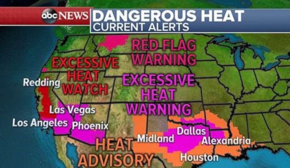
A record-breaking, dangerous heat wave is gripping the southern U.S. and concern is growing for major heat in the Southwest next week. Heat alerts have been issued from western Florida all the way to California.
Waco, Texas, hit 109 degrees on Friday, tying the record high for the entire month of July. Dallas hit 107 degrees, a new record for the date. Arkadelphia, Arkansas, had a heat index topping 120 degrees on Friday. Oklahoma City hit 109 degrees on Friday, tying the record from 2012.
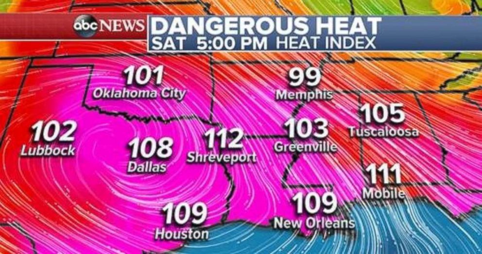
On Saturday, the heat index will once again jump well past 100 degrees across much of Texas and Oklahoma all the way to Alabama. Heat-index values could exceed 110 degrees in Dallas and Shreveport, Louisiana, today.
Today will be the last day of peak heat, but triple-digit heat will persist into Monday for parts of this region.
Meanwhile, in the Southwest, the heat is going to build. A major heat wave is coming to parts of the region with temperatures in Phoenix; Palm Springs, California; and Las Vegas soaring past 110 degrees for consecutive days next week.
Temperatures in Death Valley, California, will head past 120 degrees by Tuesday and Wednesday. The heat will also grip Southern and Central California with widespread triple-digit heat from Burbank all the way to Redding.
In addition to the heat coming to the Southwest, the fire season continues across the entire western U.S.
The Substation Fire in Oregon is now over 70,000 acres, and remains the nation's top wildfire priority. The fire is 15 percent contained.


