Hurricane Lane, a Category 5 storm, threatening Hawaii
Also, more wet weather is in the offing for the East Coast.
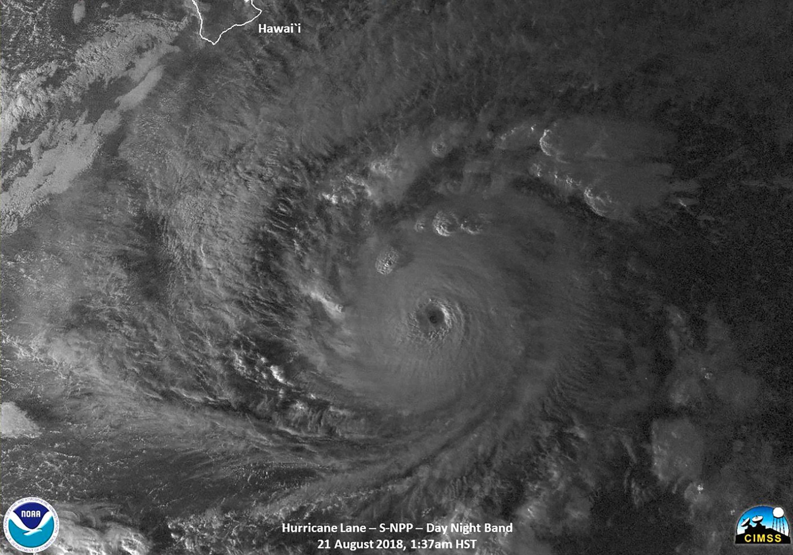
Hurricane Lane is a powerful Category 5 storm with maximum sustained winds of 160 mph, and much stronger gusts, as of Tuesday night.
The forecast takes the hurricane toward the islands of Hawaii.
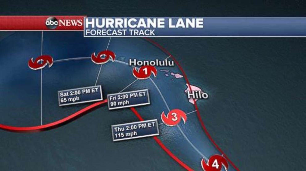
Hurricane Lane is expected to approach the Big Island on Thursday as a major Category 3 storm. Once the system reaches cooler waters near Hawaii, it will weaken and approach Honolulu on Friday as a Category 1 hurricane.
As of Tuesday night, the hurricane was moving west-northwest at 9 mph, making a northwest curve toward the Hawaiian Islands.
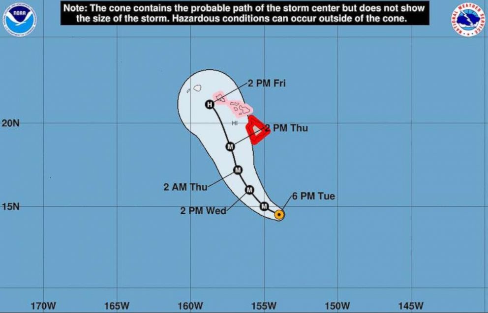
Hurricane conditions are possible in Hawaii later this week. Hurricane warnings were issued for Hawaii County, while watches are in effect for Maui County and Oahu.
Gov. David Inge announced on Tuesday night that all public schools on the Big Island and Maui will be closed starting Wednesday until further notice.

Flash flooding moves east
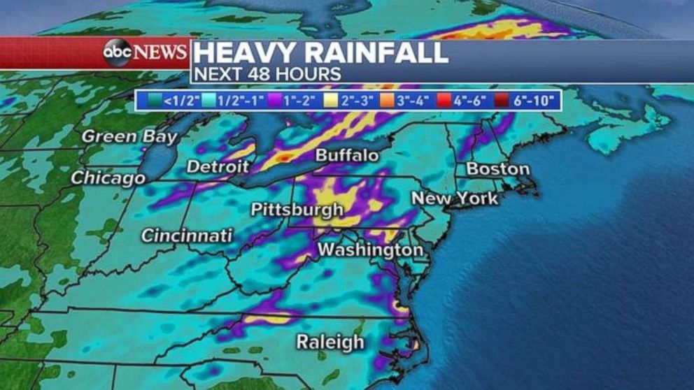
A storm system responsible for three tornadoes from Arkansas to Iowa and an all-time rainfall record in the state of Wisconsin is now moving east into the Mid-Atlantic and the Northeast.
Flood watches continued for the Great Lakes Tuesday morning.
As the storm system moves east, severe storms will break out from western New York to eastern Ohio and western Pennsylvania and down to all of West Virginia, western Virginia and parts of Maryland.
Major cities included in the risk area are Rochester, New York; Pittsburgh; Washington, D.C.; Charleston, West Virginia; and Roanoke, Virginia.
The biggest threat with these storms will be damaging winds, flash flooding and maybe an isolated tornado.
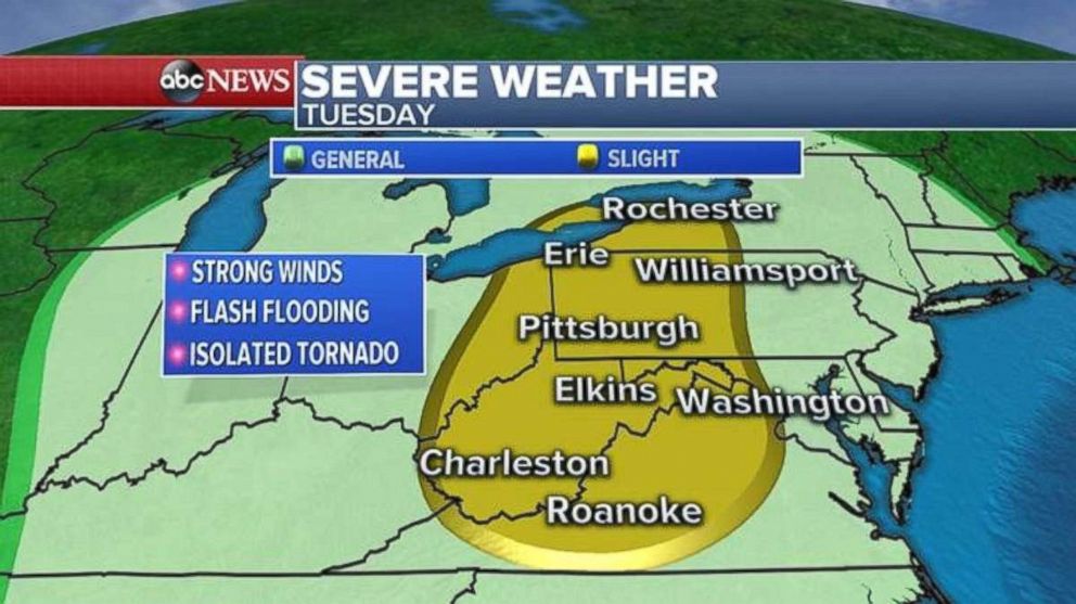
More than 3 inches of rain is possible locally for parts of Pennsylvania and the Mid-Atlantic.
Related Topics

Popular Reads

ABC News Live