Lake effect snow winds down in New York as severe weather and flooding threatens southern US
There is a strong signal for yet another heavy rain event in the South.
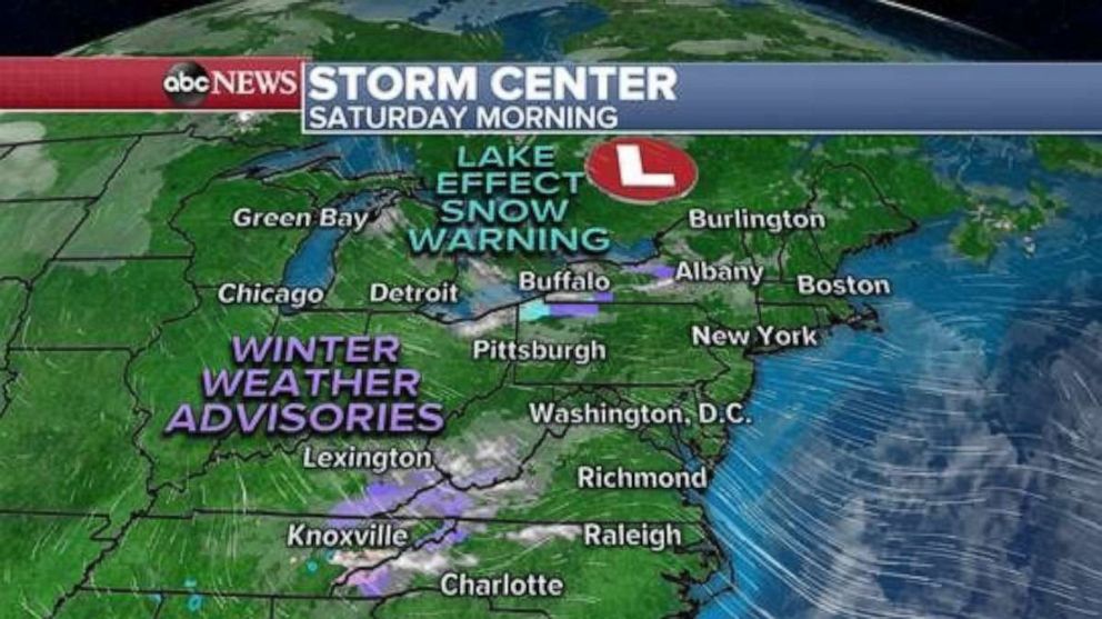
Lake effect snow will begin to taper off later Saturday, but additional accumulation will be possible in parts of New York and northwest Pennsylvania, where locally 3 to 8 additional inches of snow are possible.
There are still some winter weather advisories and some lake effect snow warnings for parts of the greater Jamestown, Syracuse and Watertown, New York, regions for Saturday.
There are also some winter weather advisories posted for the southern Appalachians for snow that is moving through the mountain range. Only a couple of inches of snow is expected there.
The lake effect snow is being driven by cold air moving over the Great Lakes.

Parts of the Midwest and East Coast are dealing with that blast of cold air. Wind chills Saturday morning from Chicago to Detroit to Syracuse, New York, are in the single digits. In the Northeast, wind chills are in the teens and 20's from Washington D.C. to New York City and Boston.
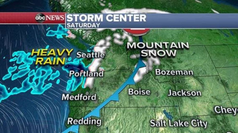
Meanwhile in the West, attention turns to a frontal system that is moving inland Saturday. Heavy rain will move into the West Coast of Washington and Oregon as snow moves into the Cascades and northern Rockies.

Then on Sunday, snow will move throughout Idaho, Utah, Nevada, California and Wyoming. Locally, heavy snow could make driving conditions difficult in the mountain passes.
A significant cooldown will make it all the way to Los Angeles this weekend, where rain showers and possible thunderstorms will impact the area. Additionally, up to 2 inches of snow is possible in the Los Angeles mountains.

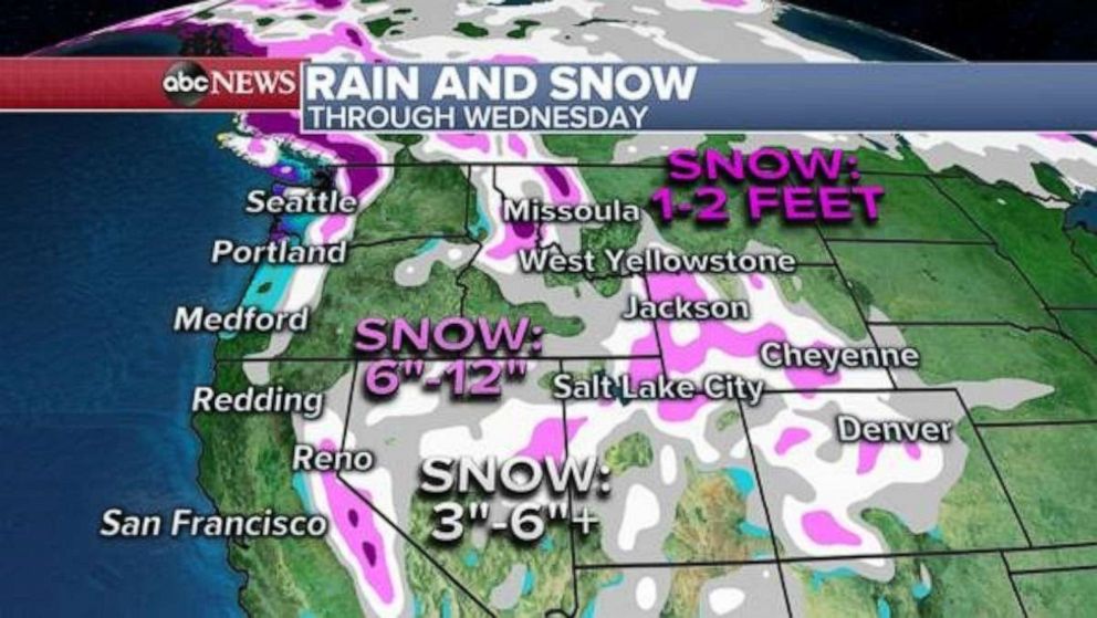
Through midweek, 1 to 2 feet of snow will be possible locally in the highest elevations of the Cascades, northern Rockies and Sierra mountains. Six to 12 inches of snow will be possible through Wednesday in some of the ranges from California to Wyoming and into Colorado.
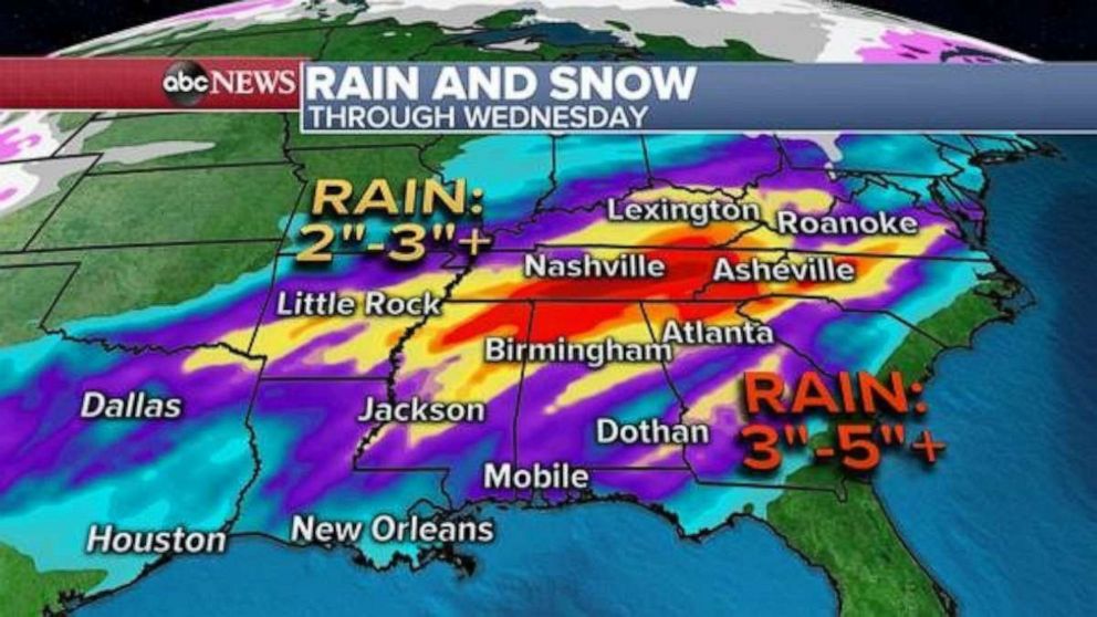
As this entire system moves east by Monday and into the rest of the week, a part of it will redevelop and bring the next concerning weather event. Heavy rain is in the forecast for parts of the Midwest and into the deep south.
There remains uncertainty of exactly where the heaviest rain bands will be. There are drastic geographical differences between the major forecasting models Saturday morning.
However, there is a strong signal for yet another heavy rain event in parts of the Tennessee Valley and Southern U.S. next week, which has already experienced flooding this month. A reminder, places like Birmingham, Alabama, are 11.71 inches above its year-to-date rainfall average, more than double its average for the time period. Atlanta's accumulation is 9.72 inches above its average.

If the heaviest rain tracks close to some of this region, flooding could quickly become a concern in the upcoming week.
Additionally, it looks as though severe weather will likely move into parts of the South beginning on Tuesday.


